National Road Rt 40

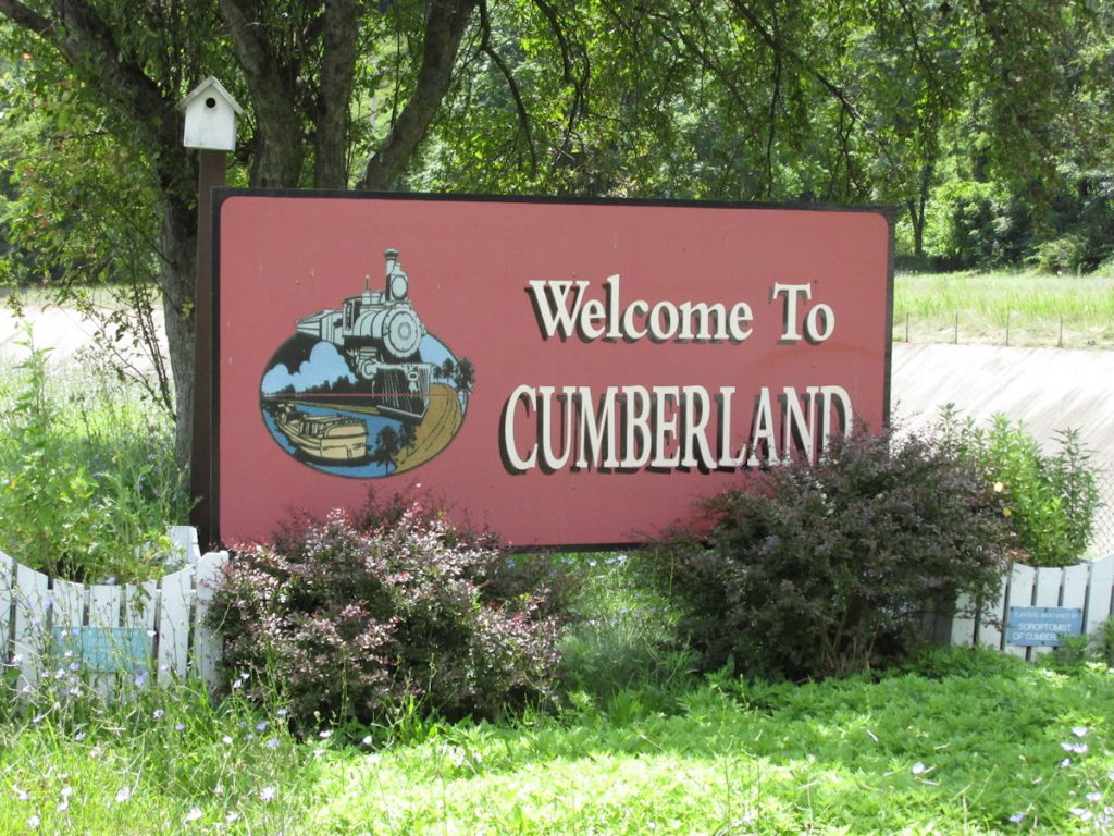
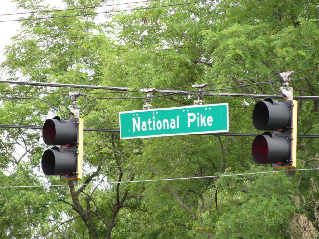
Rt 40 Cumberland, Maryland

to Vandalia, Illinois

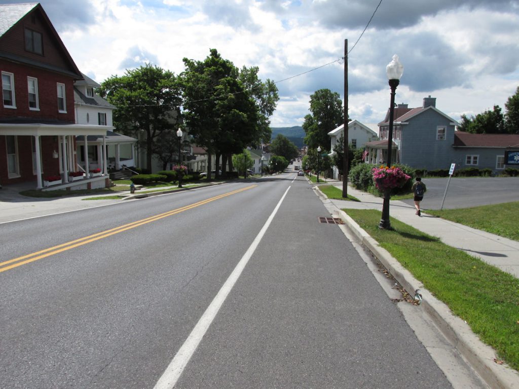
Part 1: Cumberland MD to Washington PA

July 2014

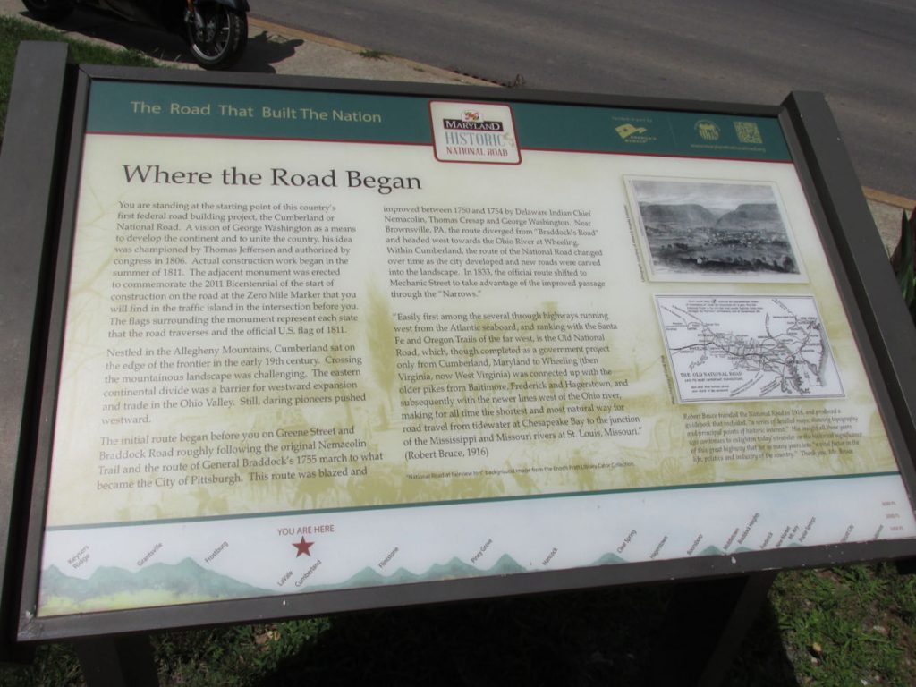
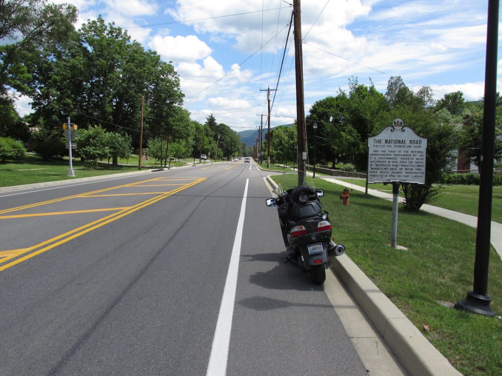
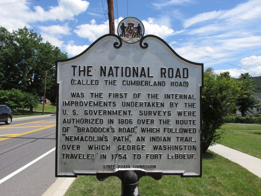
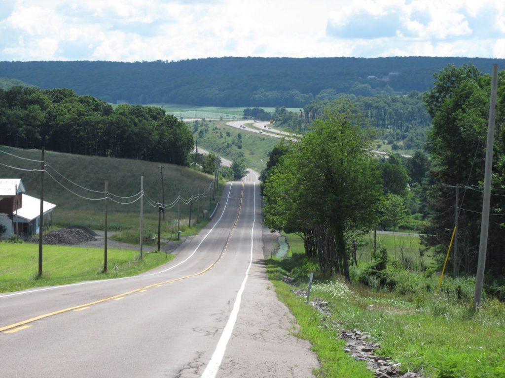
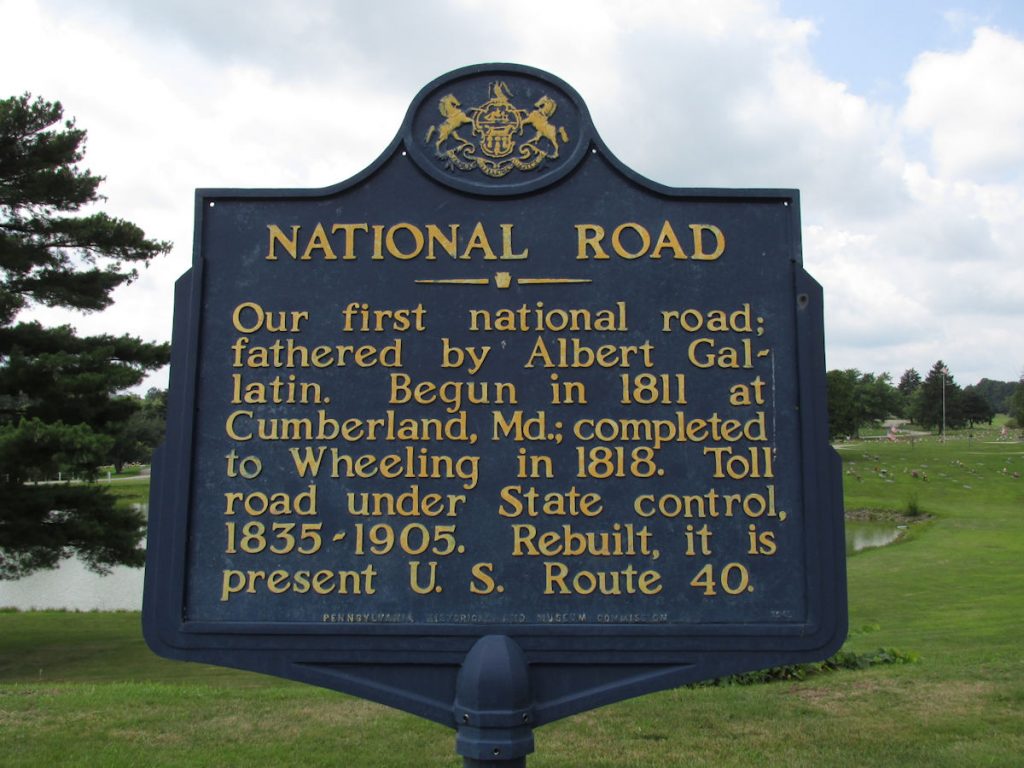
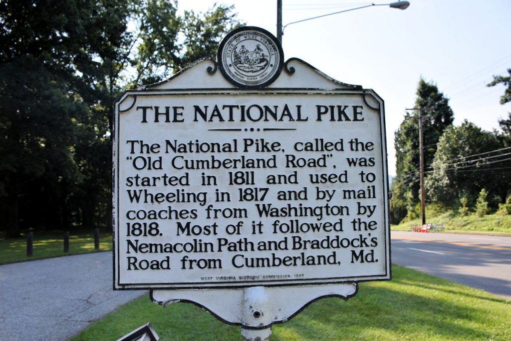
Originally planned to span from Cumberland MD to Wheeling WV, the National Road (also National Pike or Cumberland Road) was later extended east to Baltimore MD and planned to reach west to St Louis MO and beyond. However, the coming of the railroad westward in the mid 1800s put an end to construction in Vandalia IL about 2 hours away from St Louis MO.  One hundred years later, the invention of the automobile renewed interest and construction resumed. Once again, another new technology – the interstate highway system – put the brakes on the National Road.  Instead of weeks to cross the country on 2-lane roads, stopping in each small town along the way, drivers could now go coast to coast in just days. Many small towns along the National Road dried up as travelers (and their money) drove by on the nearby interstate I-70.  At one point, Rt 40 reached from Atlantic City NJ to San Francisco CA. With realignments and such, Rt 40 currently ends at Silver Summit UT. At many points along the way, I-70 was laid right over the old road and the two roads are one.

More information and history of the National Road

https://en.wikipedia.org/wiki/National_Road

https://www.fhwa.dot.gov/infrastructure/back0103.cfm

Mile 0 – Riverside Park, Cumberland, Maryland.
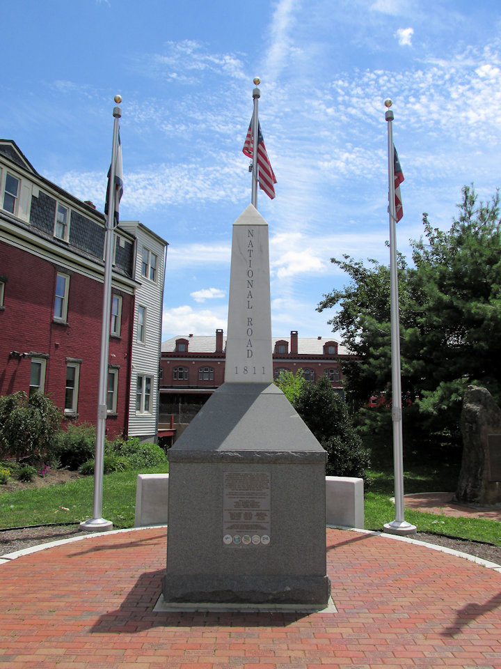
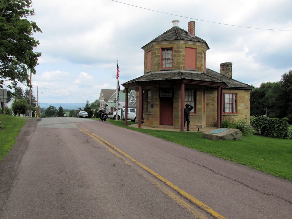
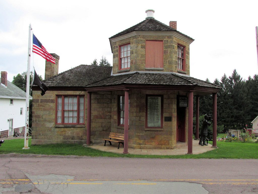
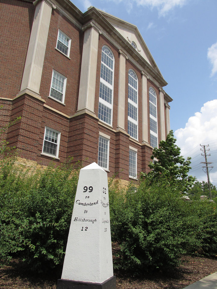
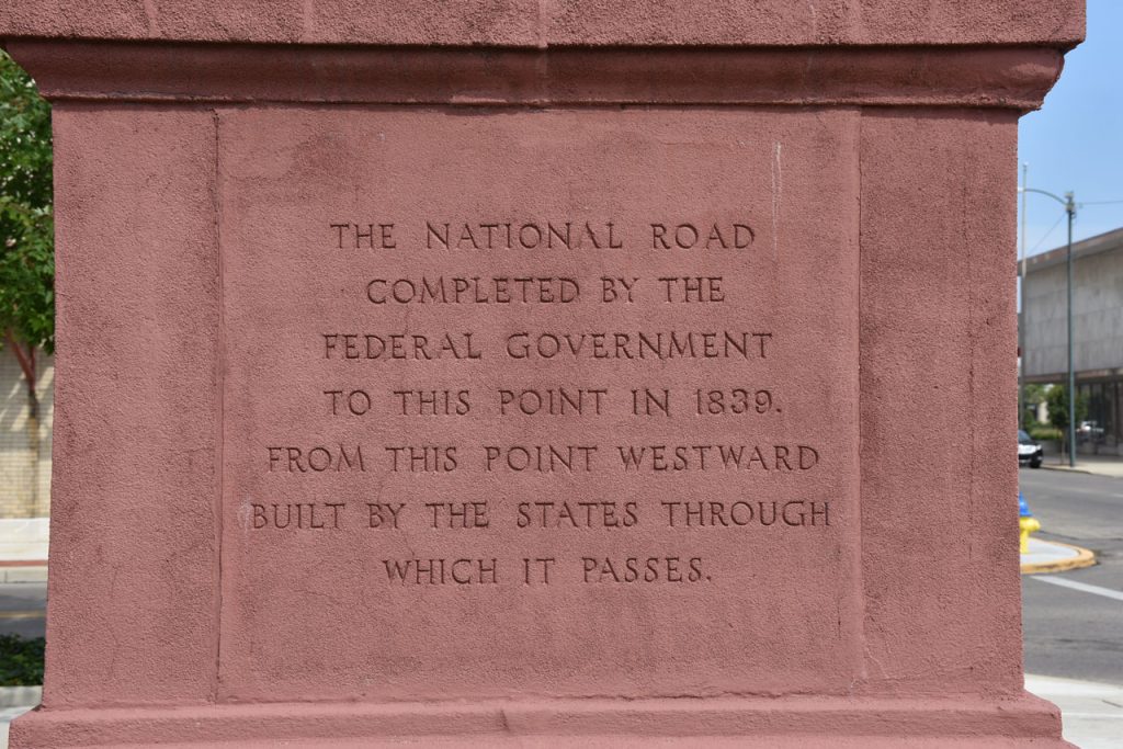
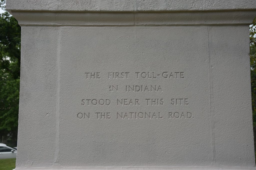
This monument marks the beginning of the National Road.

Riverside Park, where the National Road begins its westward trek.
This plaque at Riverside Park gives a brief history of the National Road.
There is more history at Riverside Park besides the National Road.

This mural on a nearby building highlights the history of the National Road (now Rt 40)

As I left Cumberland, I turned around to take this photo of the welcome sign.

Just west of Cumberland, the National Road (Rt 40) goes through the town of LaVale.

This Maryland historical marker gives a brief history of the National Road (aka Cumberland Road and National Pike)

Leaving LaVale westbound, we come to the first toll house. Yes, the National Road was not a “free ride”.

This Maryland historical marker tells about the toll house.

Tolls were listed in great detail. The costs are cents for miles depending on your mode of transportation.
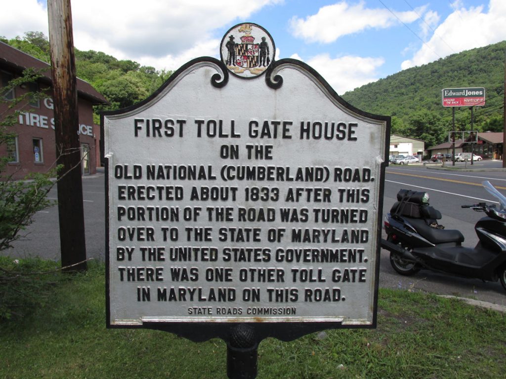
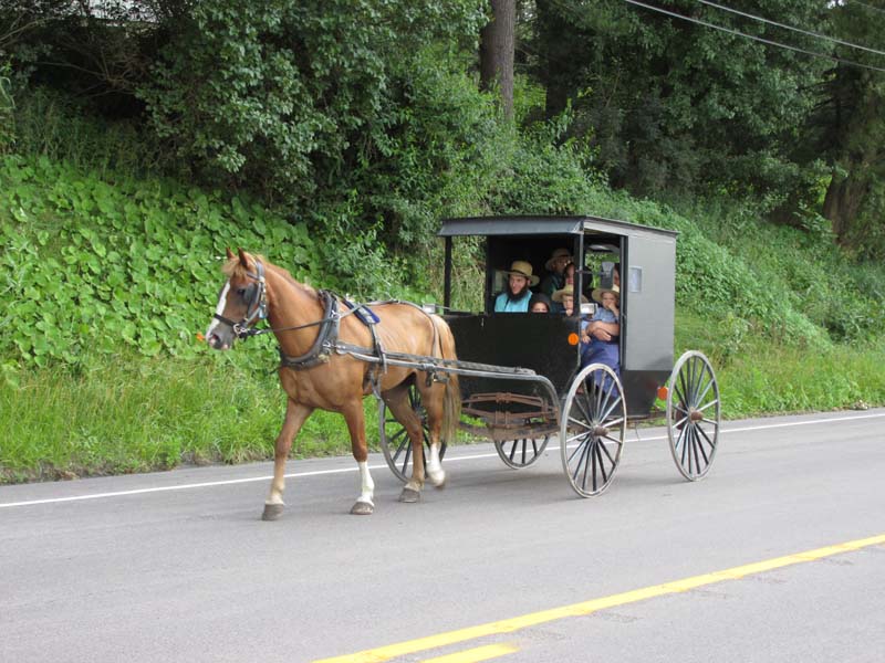
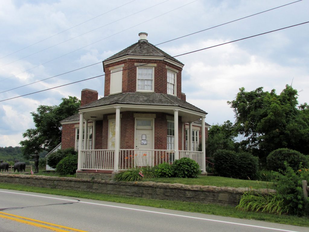
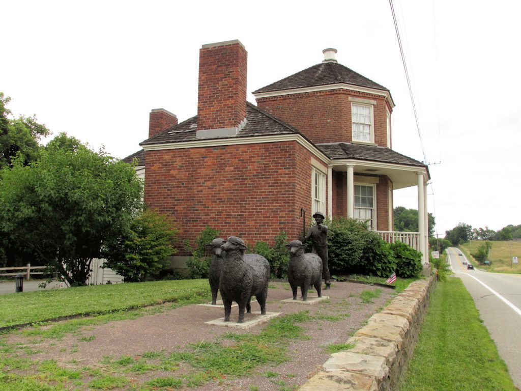
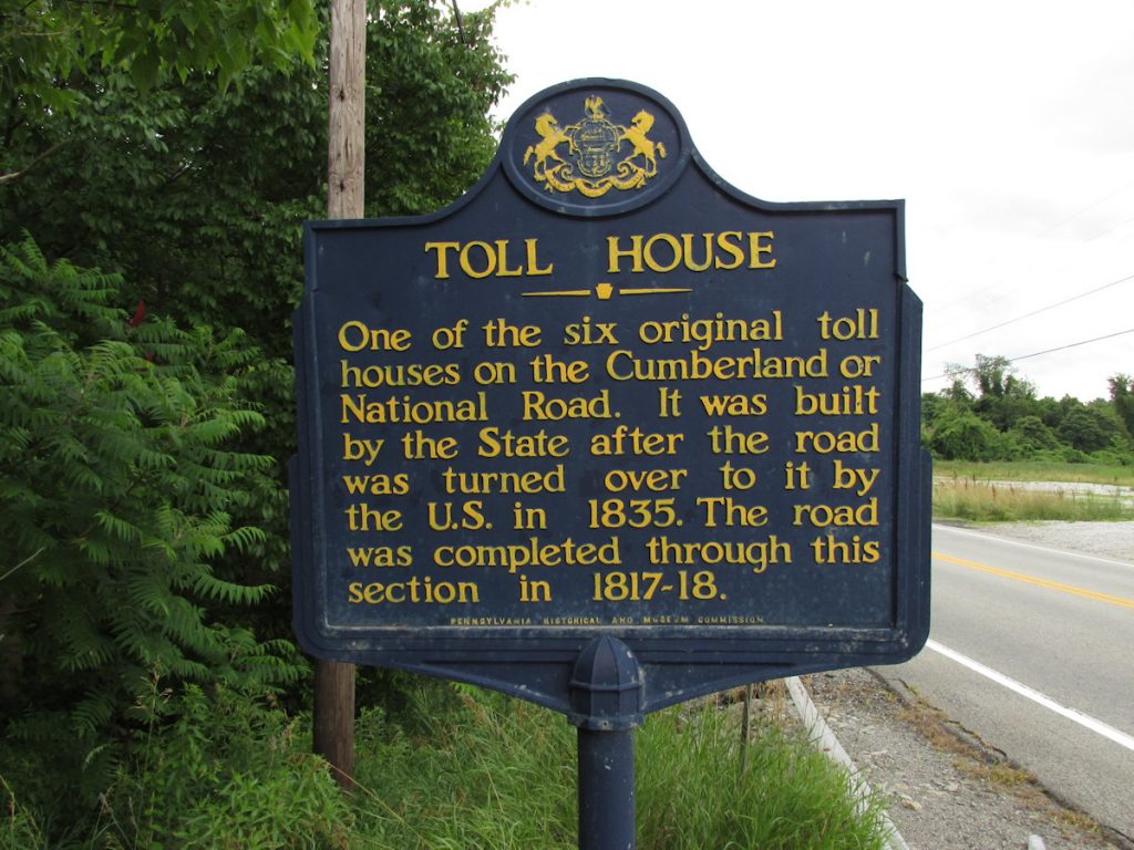
Remember, this was during the 1800s, decades before motorized traffic.

Leaving nothing to chance.

A few miles west is Frostburg, Maryland, home of Frostburg State University.

Frostburg is a quiet, old town full of history. Great place to walk around.
View approaching downtown Frostburg, MD.

West of Frostburg, the National Road parallels I-68. It also goes through an area with many Amish and Mennonite farms.
Horses and buggies packed with large families are fairly common along the highway.
There are often Amish and Mennonite buggies along the National Road in western Maryland.

More scenic farmland along the National Road near Grantsville.

Although most are missing, there are still several of these mileage markers (obelisks) along the road. They tell how far it is to the destination (Wheeling) and also to the next town (in this case, Petersburgh).

Remnants of the 1900s era, there were roadside buildings like this gas station that once were busy places.

Occasional reminders that we are on an historic road.

No reminders needed about the nice scenery.

And occasional reminders we are still on the National Road (or Cumberland Road, or National Pike)

I’m not sure what the designs on the side of barns signify, but I did see several.

The Casselman Bridge is one of the original stone bridges on the National Road.
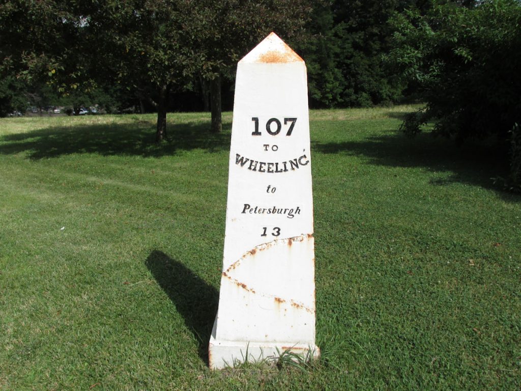
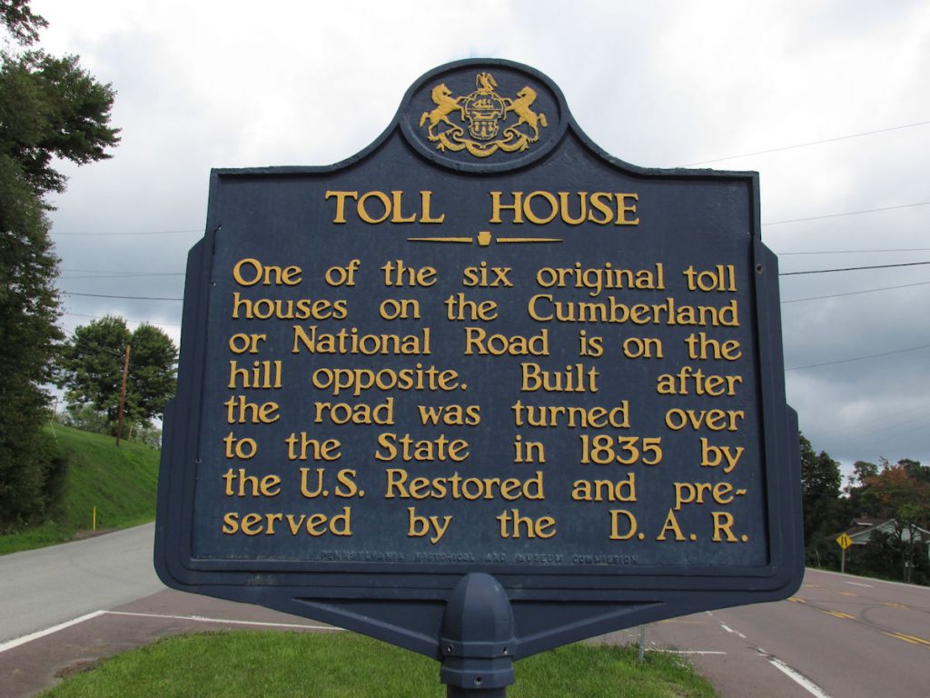
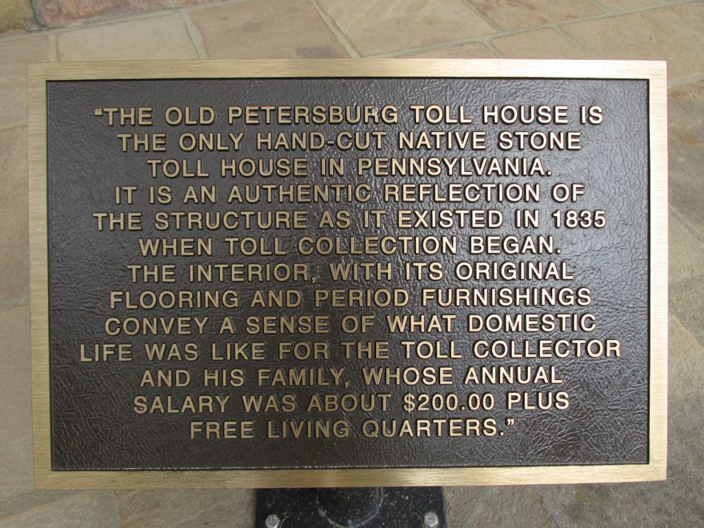
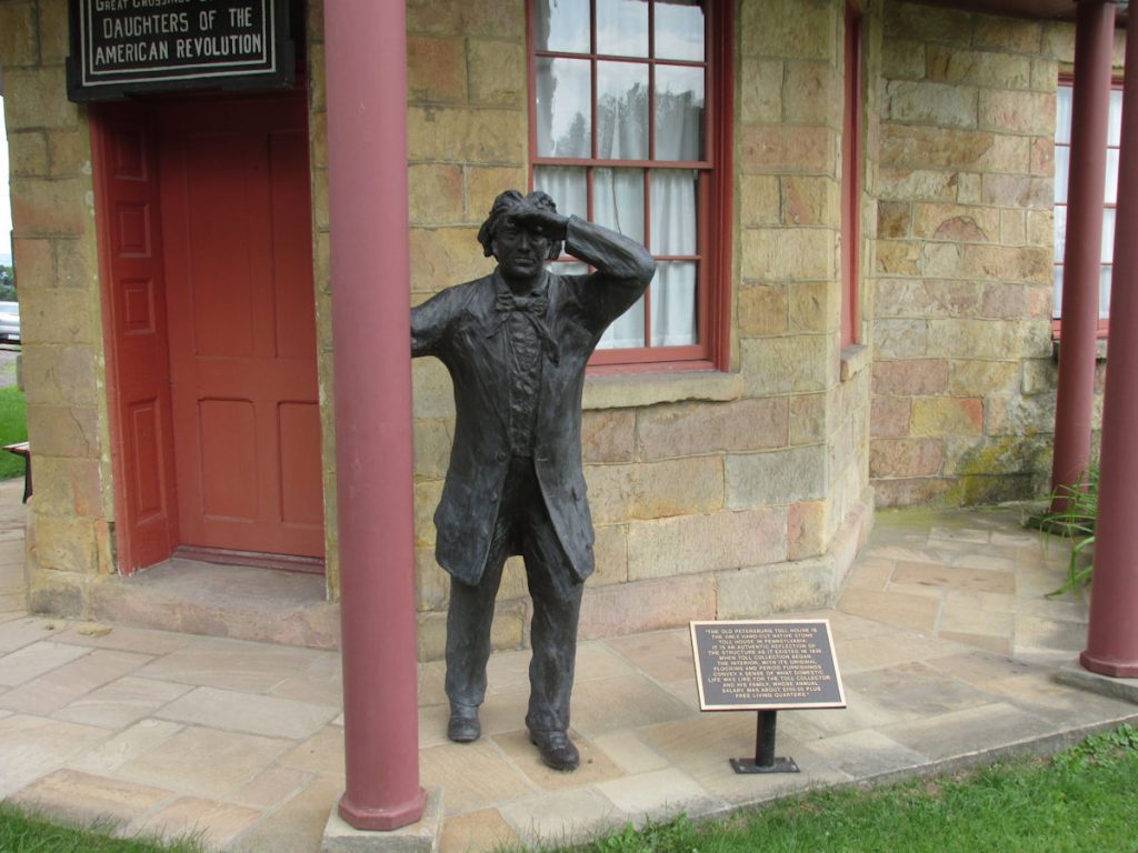
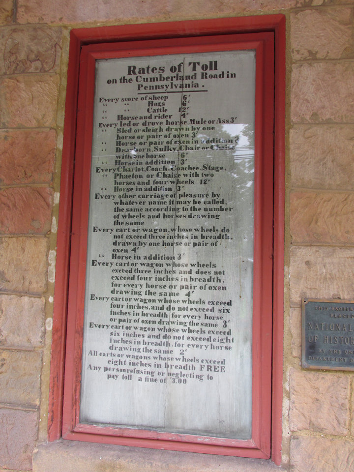
It was built in 1813-1814. (Photos taken in Oct 2018)
Approaching Casselman Bridge. Used for motor traffic until 1953. Now used for foot traffic only.

View from opposite side of Casselman Bridge.
Continuing west, we pass into Pennsylvania. One of the first towns is Addison, home to the Petersburgh Toll House.

Another view of the Petersburgh Toll House. (Note the statue to the right. We will visit him shortly.)

This Pennsylvania historical marker tells about the Addison Toll House.

This plaque on the Addison Toll House gives more information. Remember the statue of a man in the previous photo?

That statue on the porch is the toll collector. Here, he is looking down the road for approaching traffic.

The toll collector’s view up the road.
Just like the toll house in Cumberland, the tolls are explained in great detail.

Moving west from Addison, the National Road veers slightly north towards Washington, PA.

Nearing the mid-point between Cumberland MD and Wheeling WV.

Just west of Uniontown PA is the second surviving toll house in PA. Four of the original six are no longer standing.
Searight’s Tool House. (Photos July 2014)

Interesting statues showing a depiction of early traffic on the National Road.

This Maryland historical marker gives some history.

The Pennsylvania Madonna of the Trail statue is located just east of Washington PA.

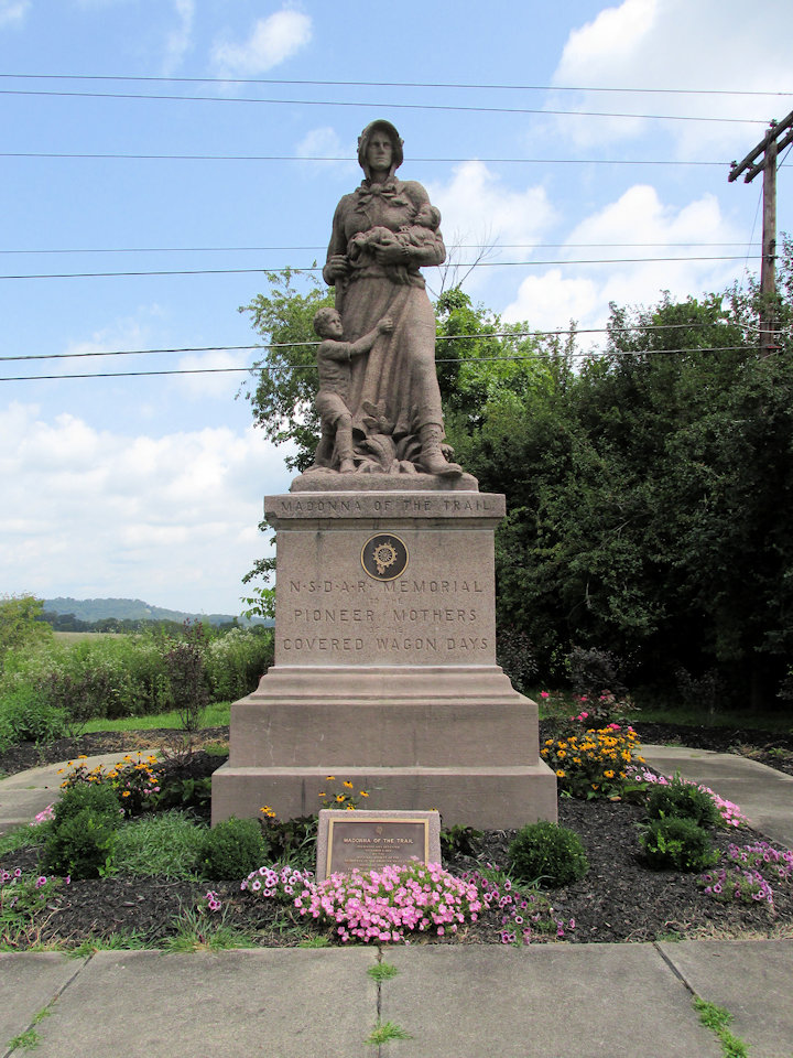
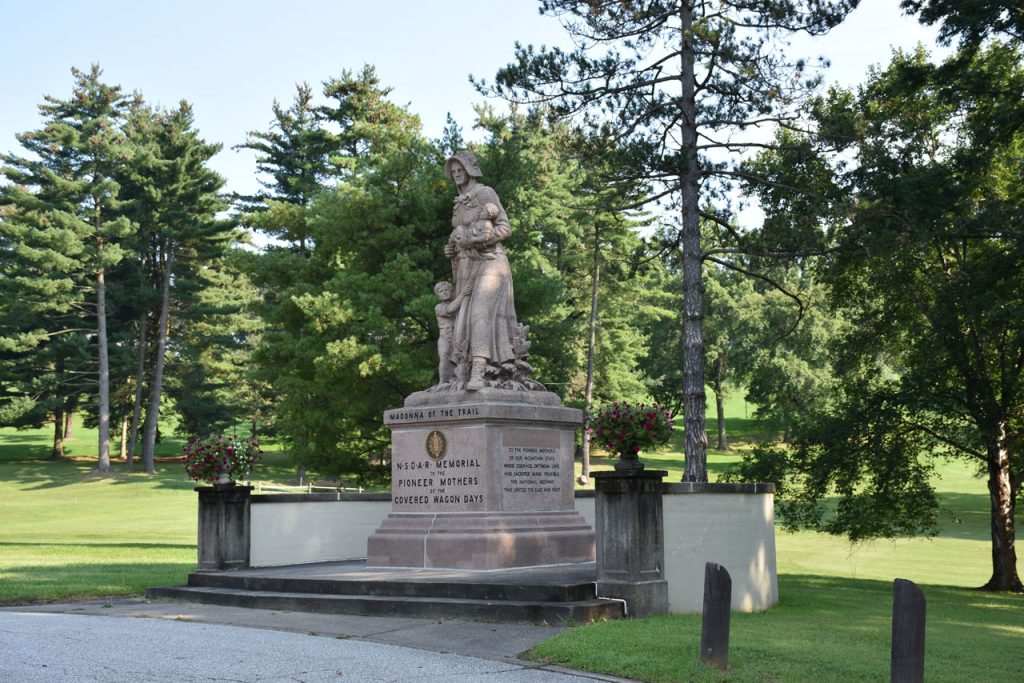
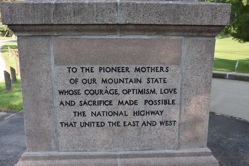
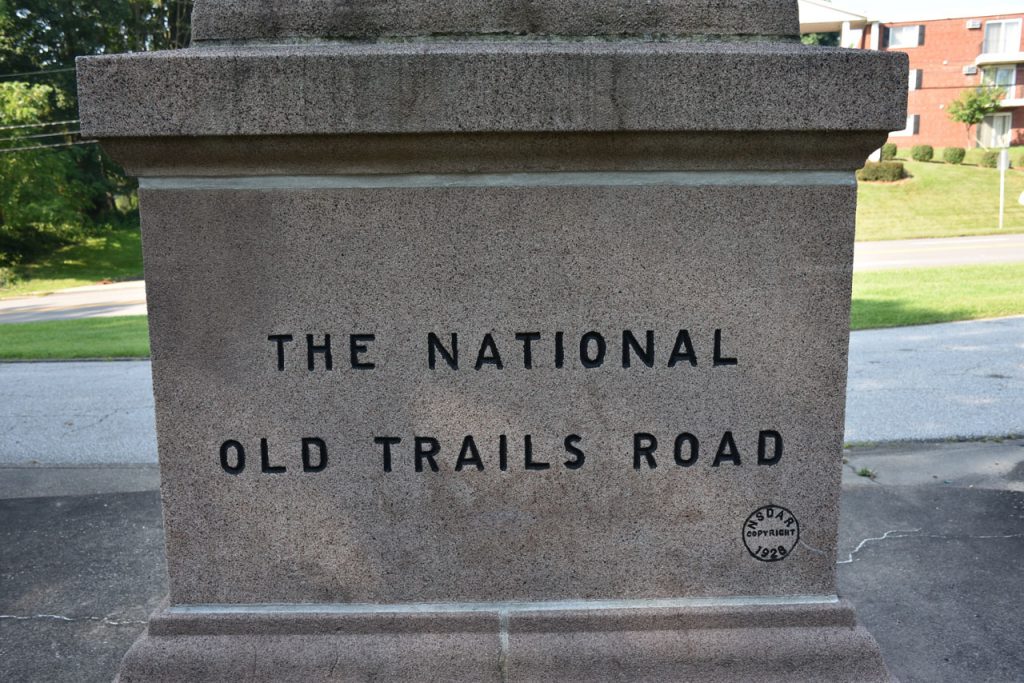
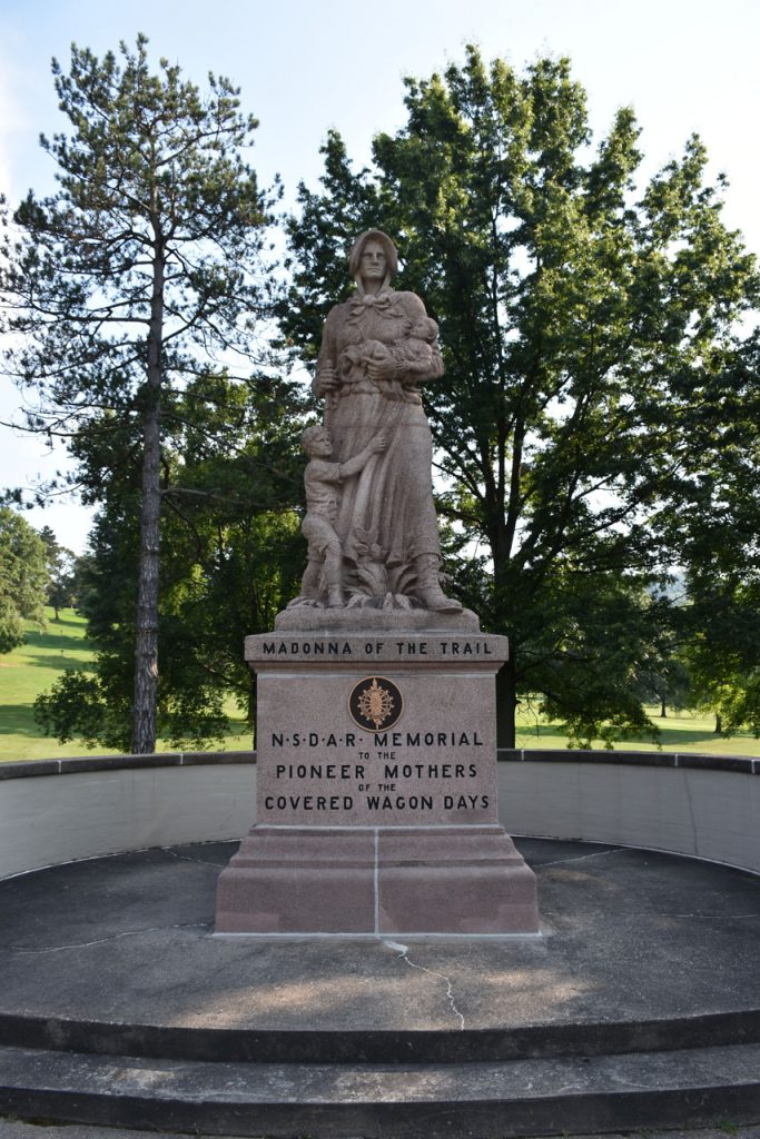
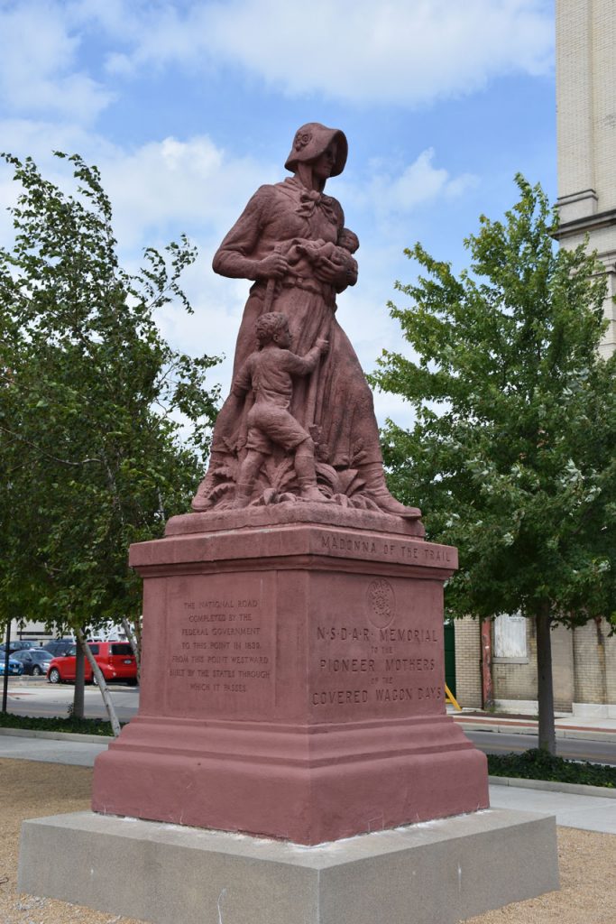
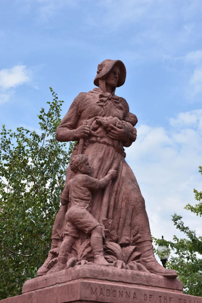
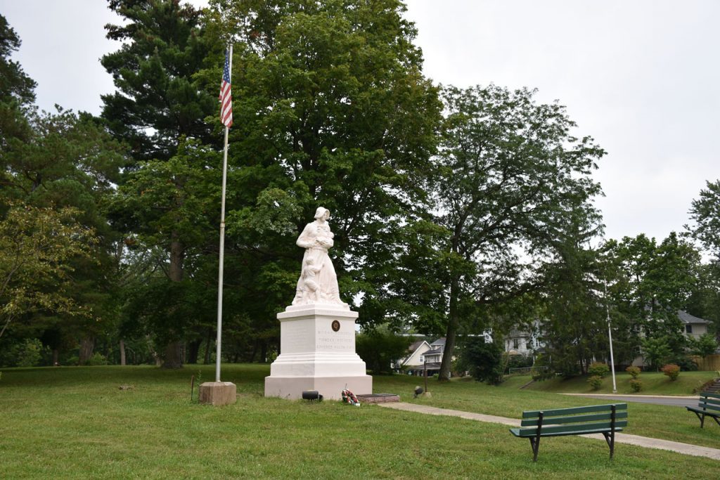
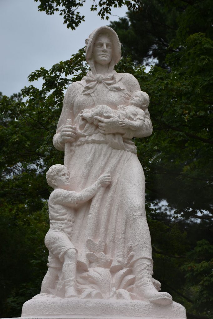
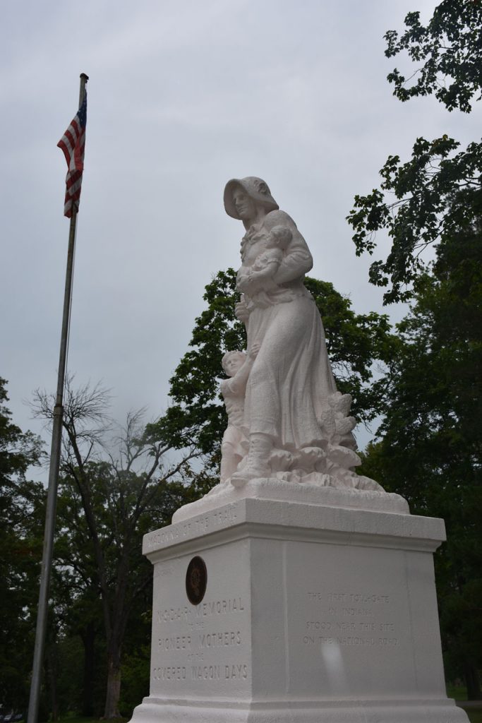
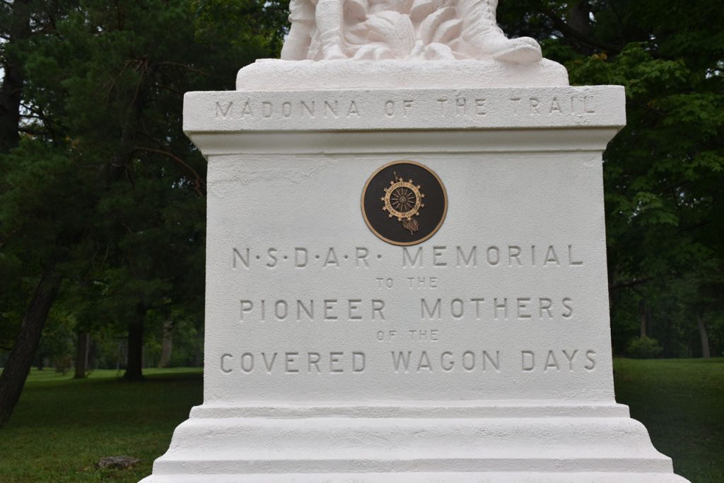
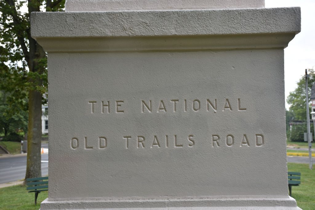
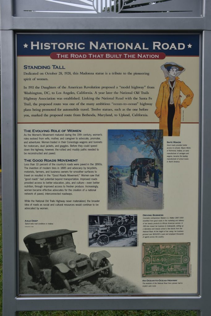
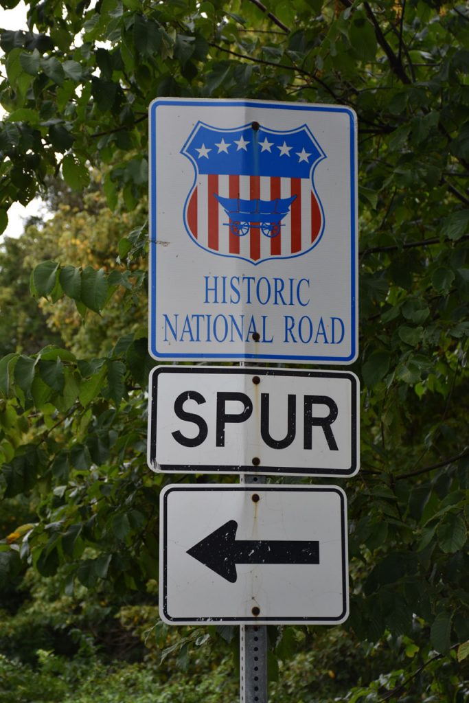
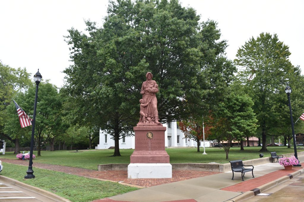
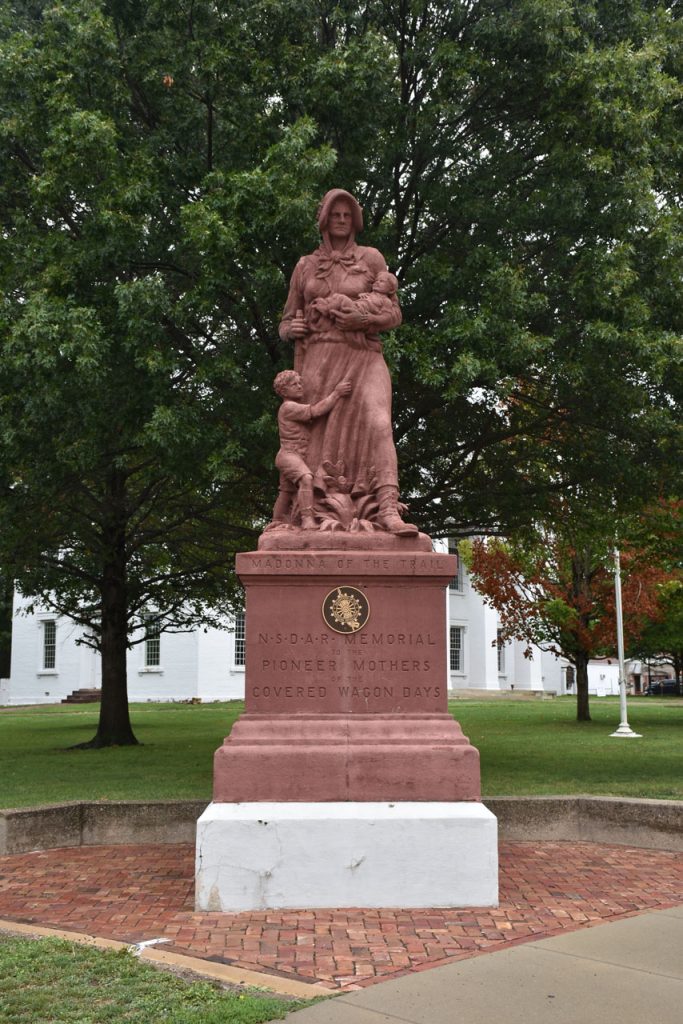
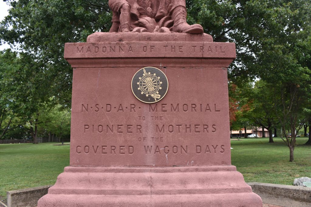
One of the things I wanted to do on this drive was photograph the Madonna of the Trail statues in each state.

https://en.wikipedia.org/wiki/Madonna_of_the_Trail

In the early 1900s, a series of 12 statues honoring the bravery of the pioneer women were erected in

12 states along the path of the National Road from Maryland to California.

One of the mile marker obelisks is located in Washington PA by the campus of Washington and Jefferson College. Only 32 miles to Wheeling.

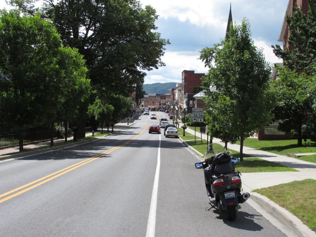
Part 2: Washington, PA to Vandalia, IL

August 2017

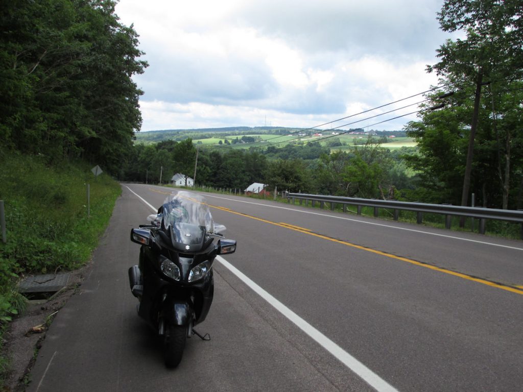
In August 2017, I attended the retirement ceremony of a Judge Advocate General I worked for when I was a Paralegal in the US Air Force.  Instead of taking the Interstate 600 miles to Scott Air Force Base, Illinois (just east of St Louis, MO), I decided to take a leisurely two days getting there on old Rt 40, better known as the National Road. I would pick up where I left off on Part 1.

Let’s get started!

I got on Rt 40 just west of Washington PA.  Rt 40 only goes through about 20 miles of West Virginia.
Just before entering West Virginia, this “S” Bridge (and many more) was once part of the National Road.
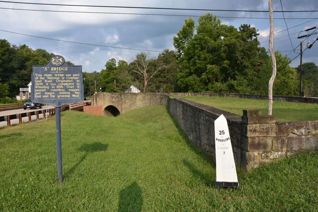
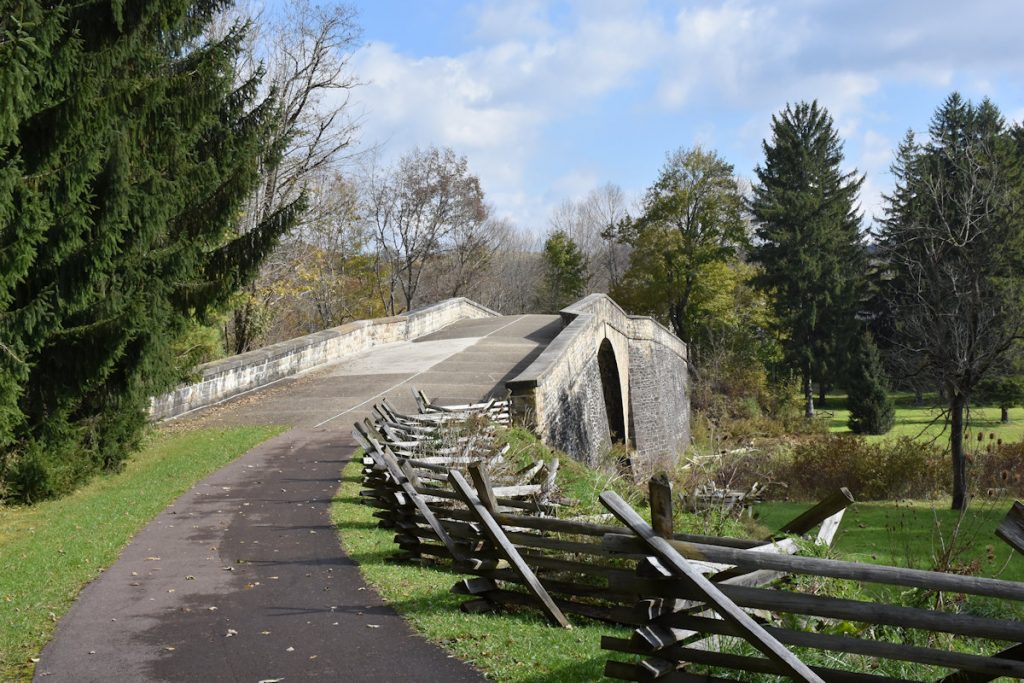
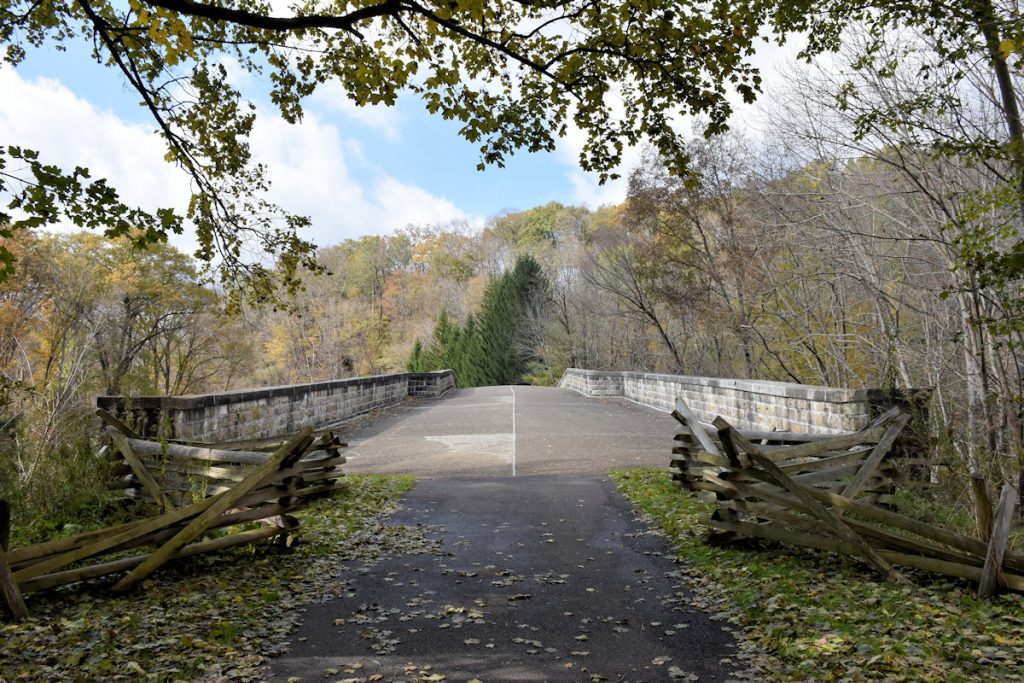
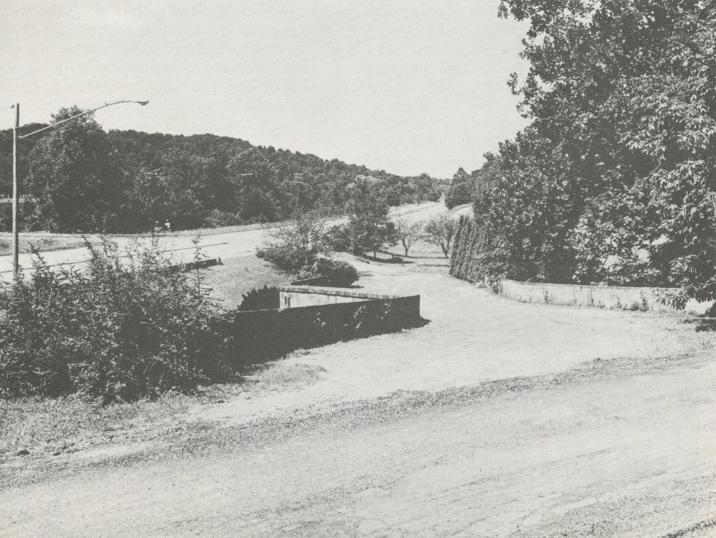
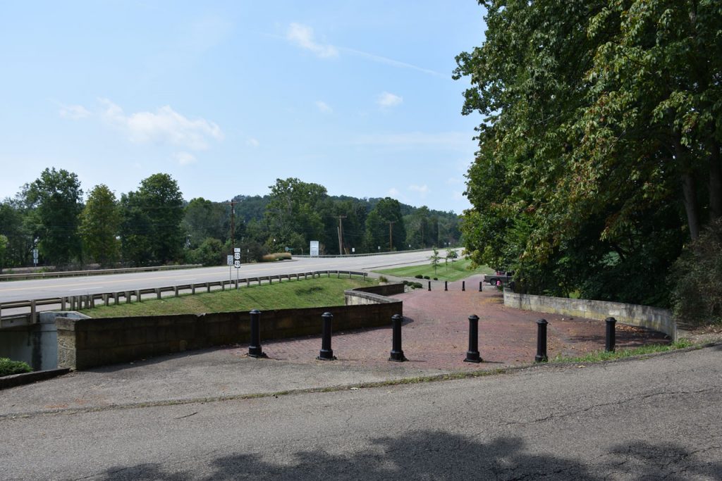
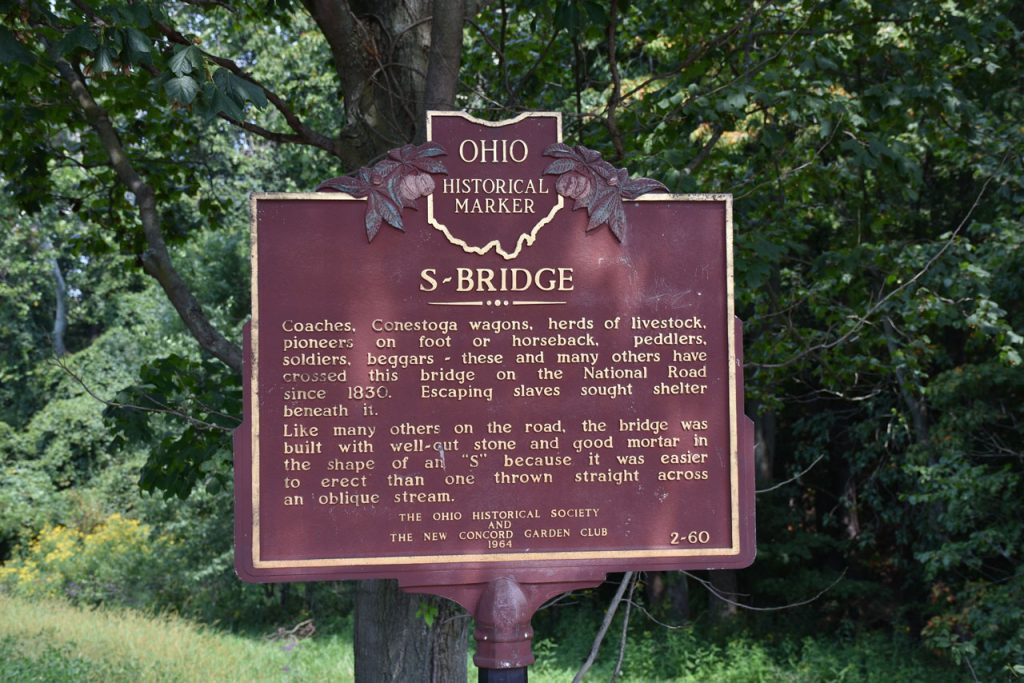
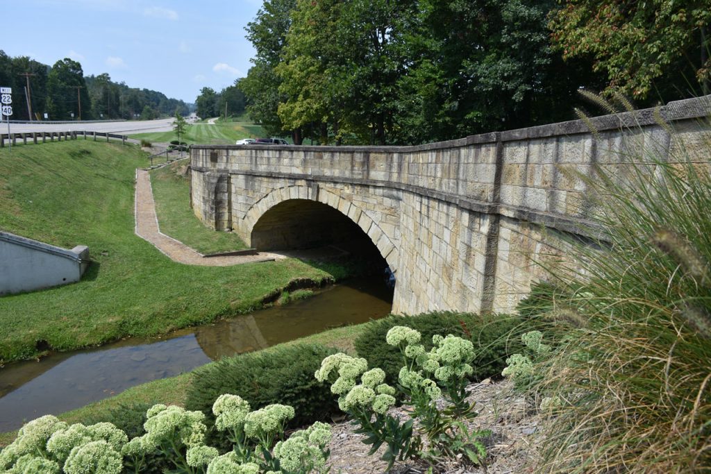
Why “S”?  The creek is at an angle. If the road continued straight, it would need a longer (and more expensive) arch across the water.
By adding a curve and going perpendicular to the creek, the arch could be much shorter.
Since most traffic at the time was horse and buggy, the curve was not a safety issue.
 
https://en.wikipedia.org/wiki/S_bridge 

The West Virginia Madonna of the Trail monument is located on Rt 40 just east of Wheeling WV.

Wheeling WV marked the end of the original National Pike, but later it was extended west.
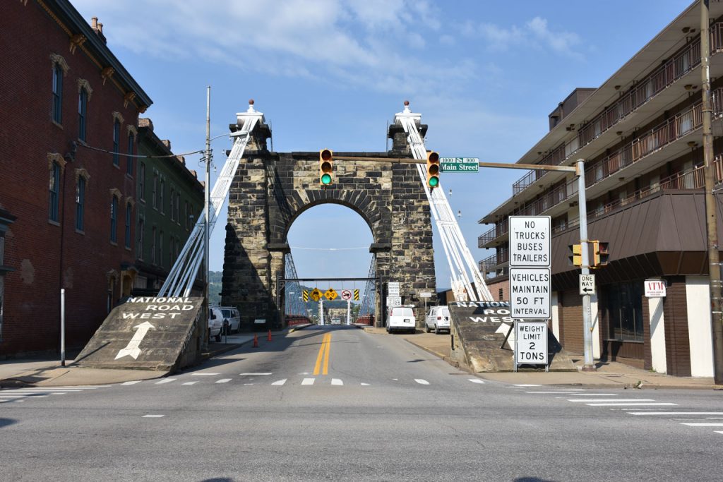
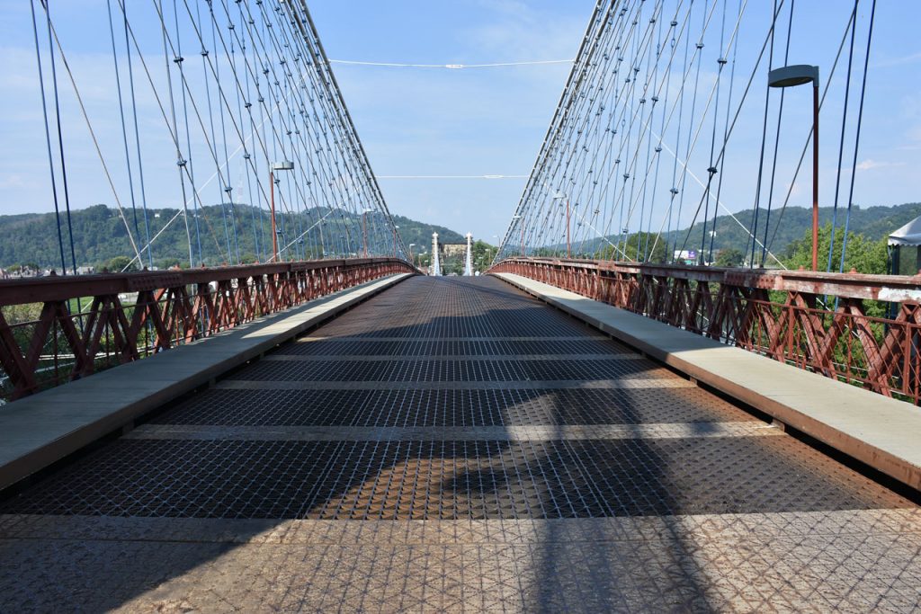
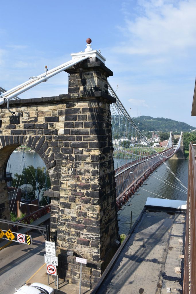
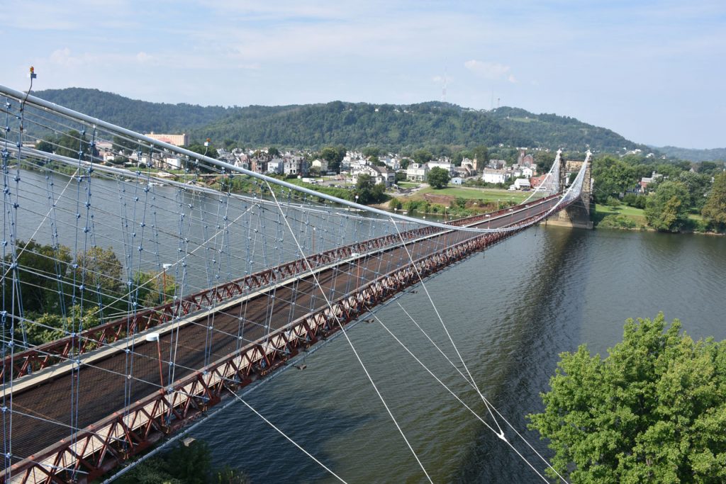
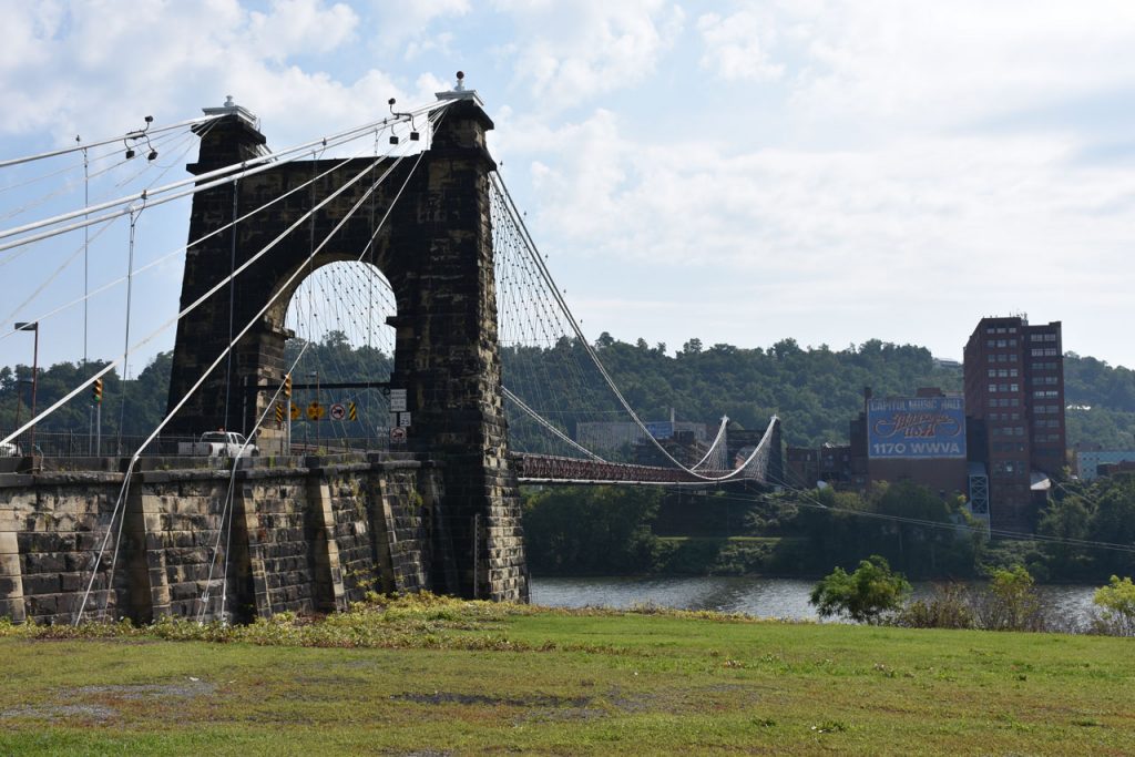
This is the historic Wheeling Suspension Bridge crossing into Ohio.
It was the world’s longest suspension bridge when completed in 1849.
 
https://en.wikipedia.org/wiki/Wheeling_Suspension_Bridge 
View west across the Wheeling Suspension Bridge.

View of the bridge from nearby overlook.

Another view of the bridge from a nearby overlook.

Nearby, this sign reminds me of the days when Wheeling was famous for its cigars.
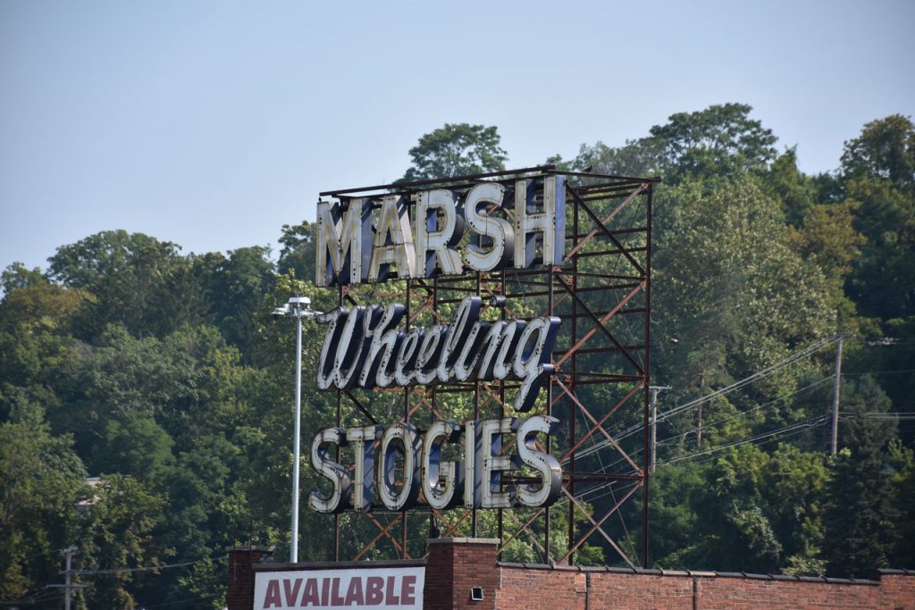
Marsh Wheeling was the oldest cigar manufacturer in the United States.
 
https://en.wikipedia.org/wiki/Marsh_Wheeling

Across the river and looking back on the grand Wheeling Suspension Bridge.

OHIO

Just 10 or 15 miles into Ohio, there is a spur (old section of road to the side of the current road) of the original Rt 40.
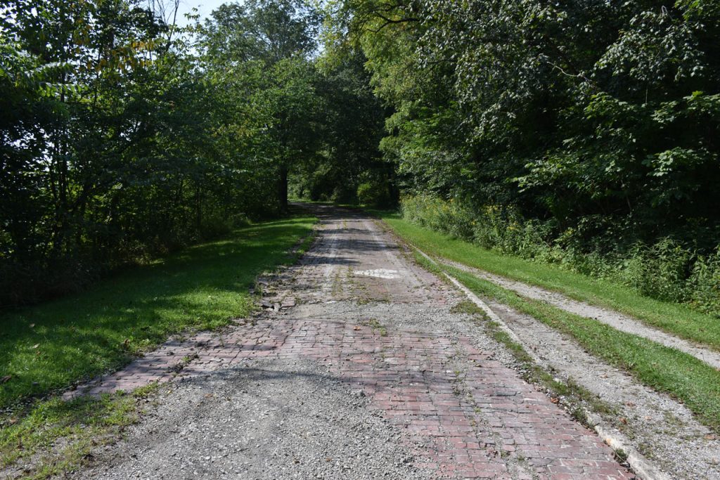
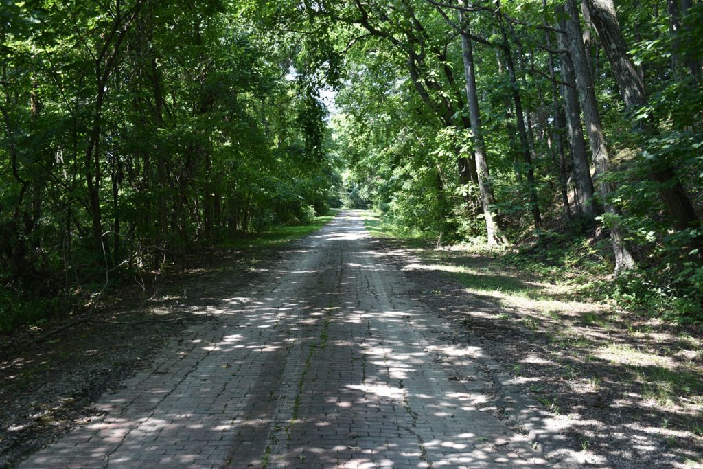
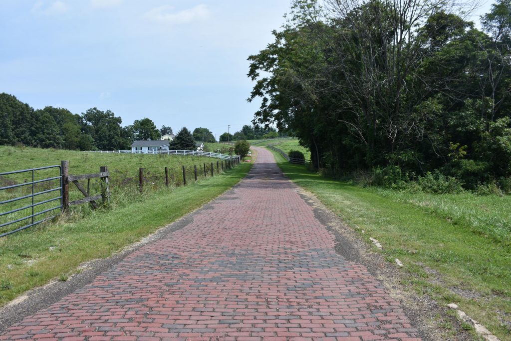
It was paved with bricks, many of which survive to this day.
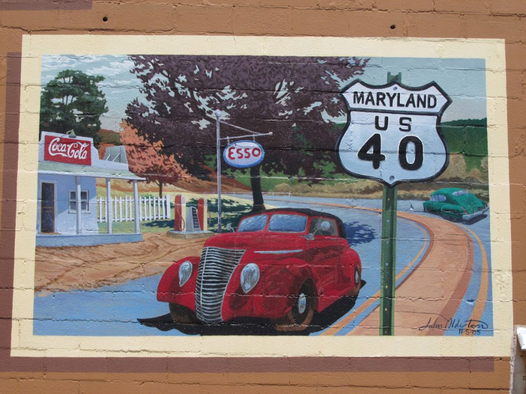
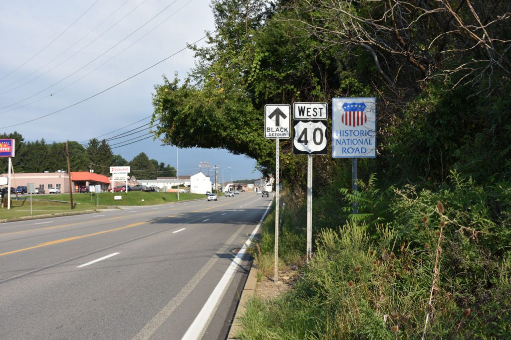
The spur (Old Rt 40) continues for about 2 miles through the woods and past a few small farms.

One last farm on the old Rt 40 before coming back to the current road.

U.S. 40 Today

Thirty Years Of Landscape Change

Thomas R. Vale and Geraldine R. Vale

Buy The Book At Amazon

To prepare for this trip, I purchased the book “U.S. 40 Today” and marked spots I wanted to visit and photograph. Back around 1950, George R. Stewart drove cross country on Rt 40 and photographed numerous landmarks.  Thirty years later, the Vales re-traced his route and photographed the exact same landmarks as closely to the original framing as possible. This showed a great deal of change in that 30 year span. I wanted to follow up and find some of those locations for new photographs.

The first was downtown Cambridge, Ohio.

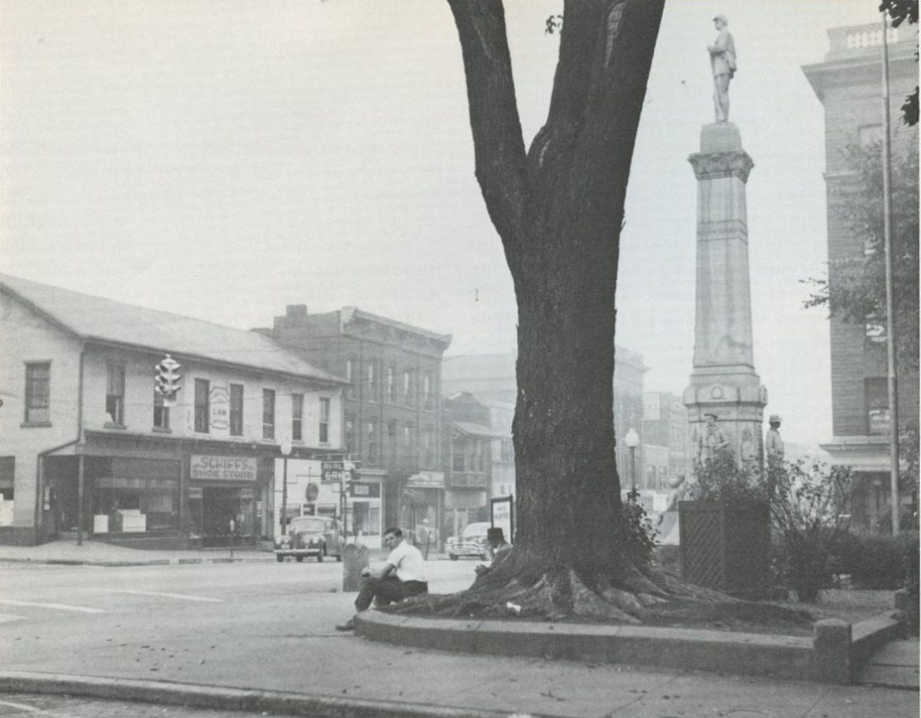
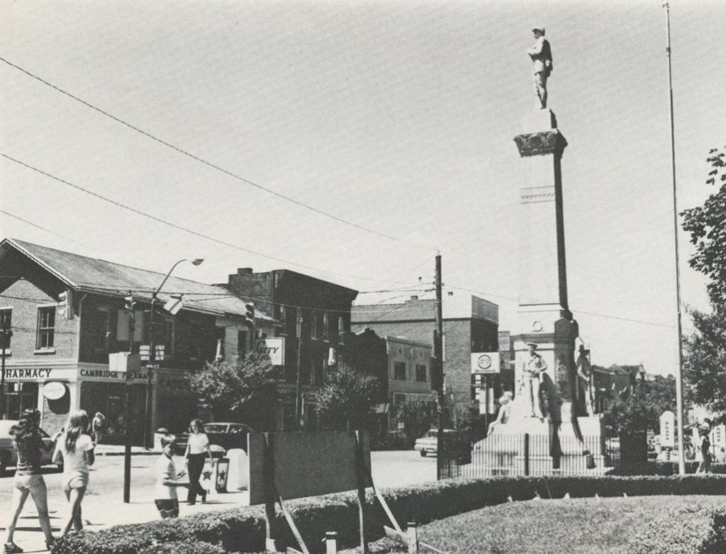
Cambridge, Ohio (Left, 1950, George R, Stewart)  (Right, 1980, Thomas & Geraldine Vale)

Cambridge, Ohio – August 2017.  I had to move slightly to the left since the tree was blocking the statue.

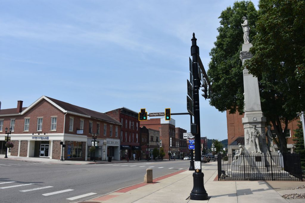
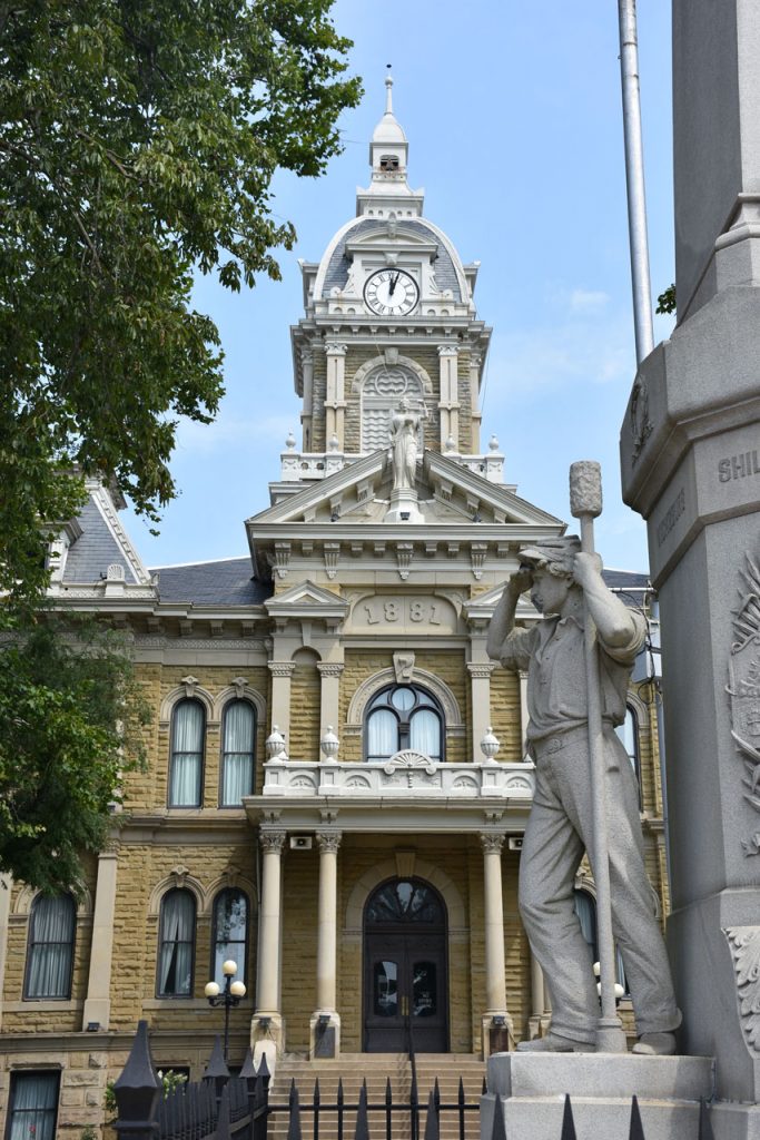
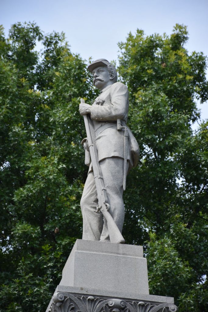
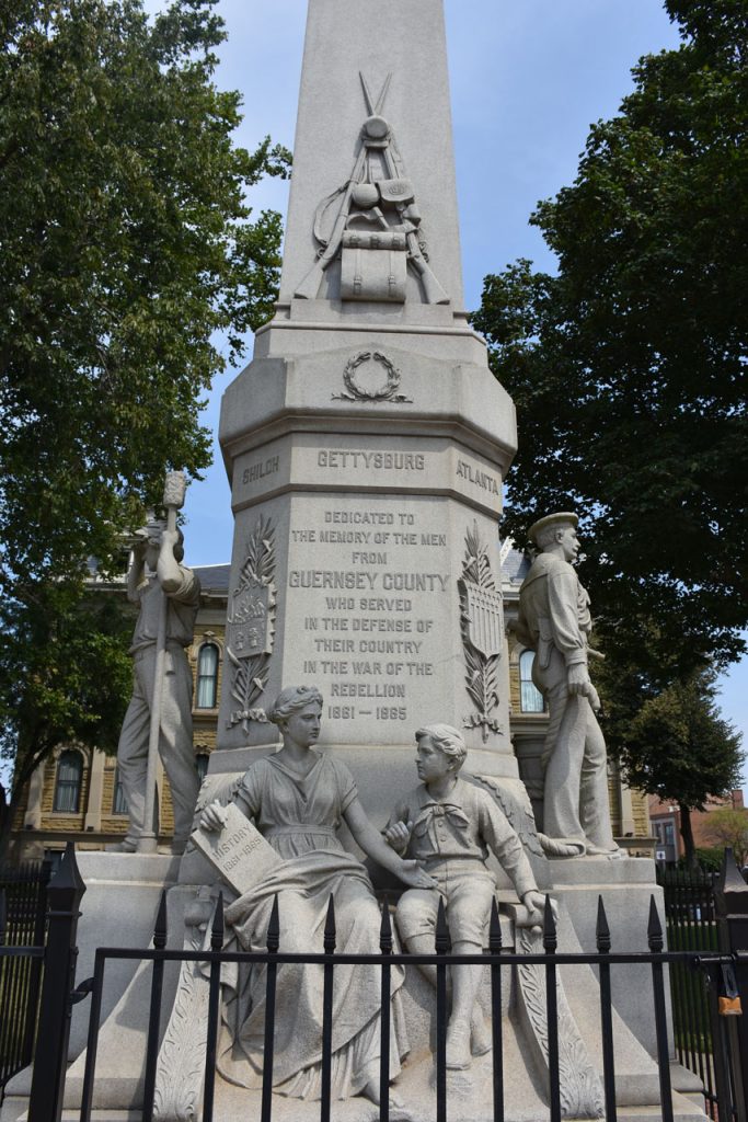
Scenes from the statue and the Court House.

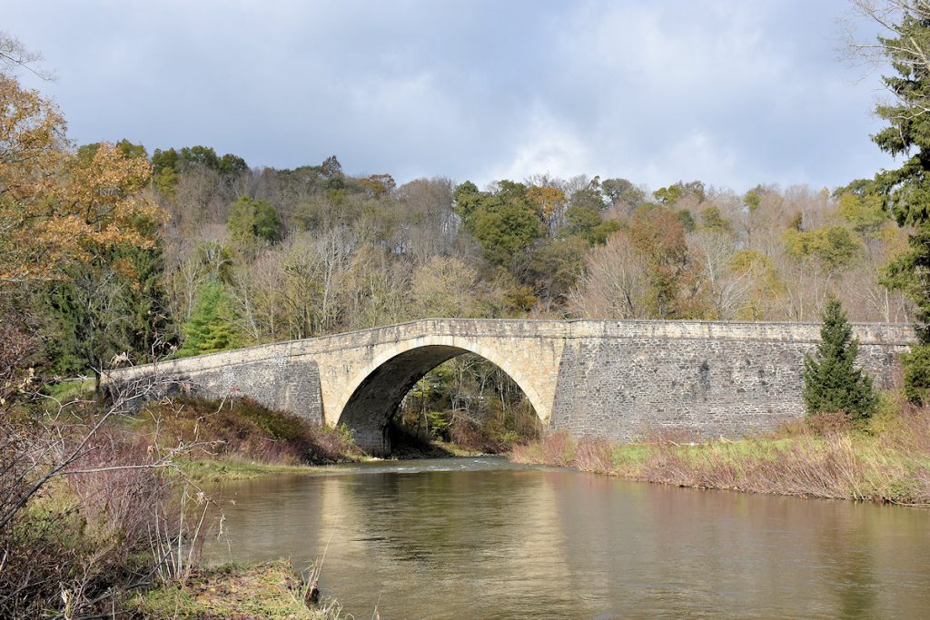
A few miles west of Cambridge, there is another “S” Bridge.

This one was photographed by Stewart and the Vales in 1950 and 1980.

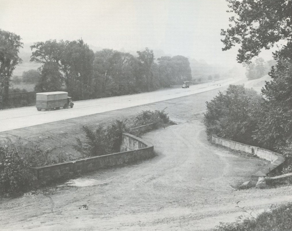
“S” Bridge at Fox Creek (Left, 1950, Stewart)  (Right, 1980, Vales)

“S” Bridge at Fox Creek, August 2017
Historical Marker by the “S” Bridge
150 years old and still beautiful!
An old original mile marker at the “S” Bridge.
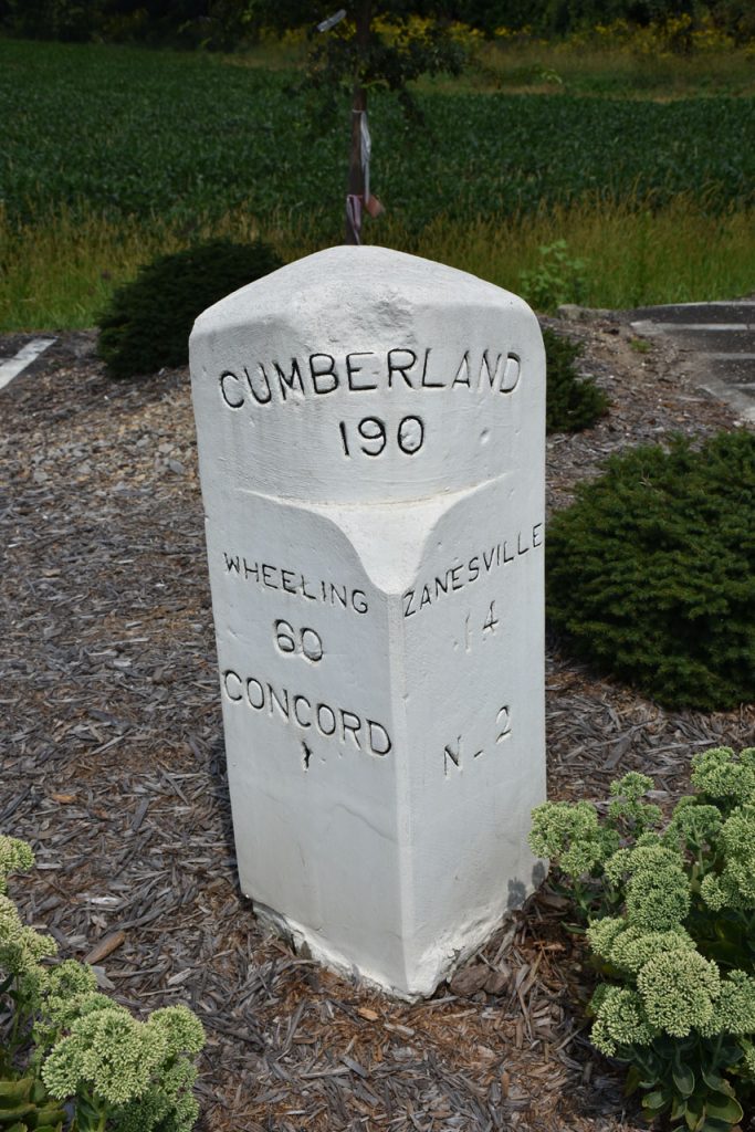
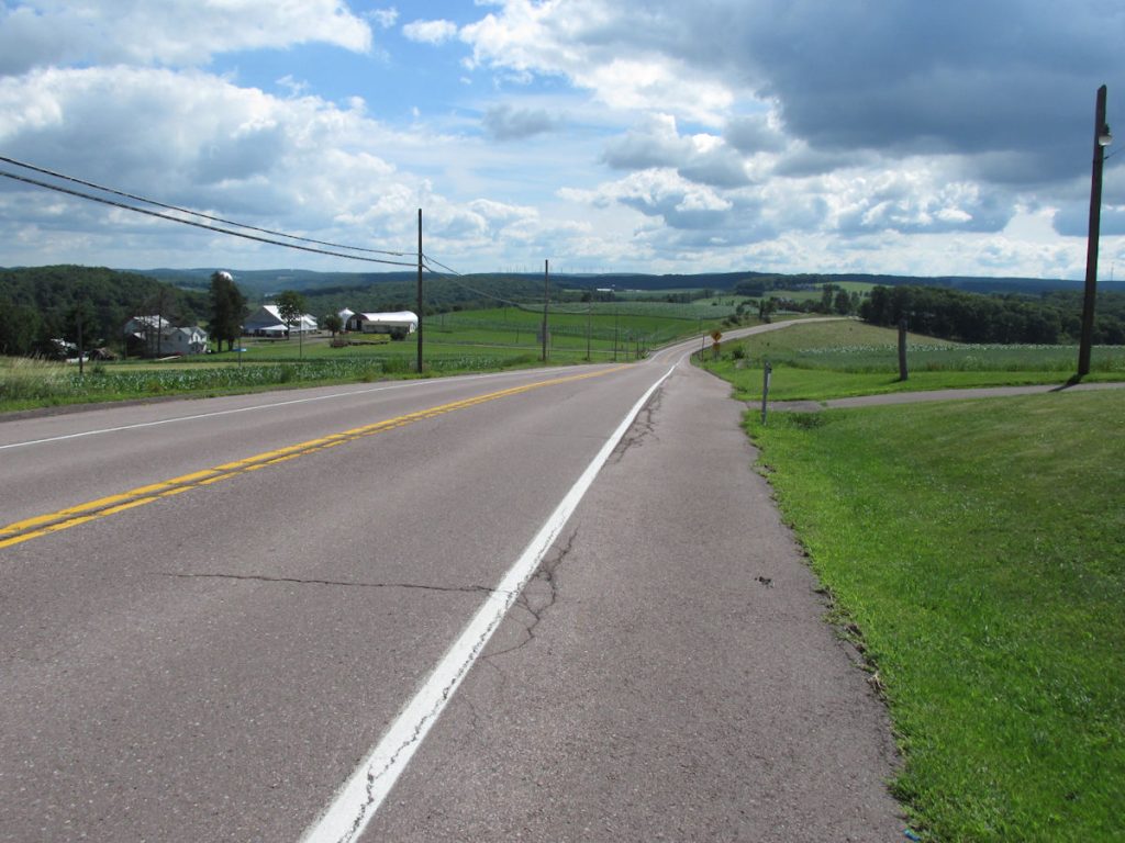
 Shows 190 miles from Cumberland MD, 60 miles from Wheeling WV,
and 14 miles to go to Zanesville OH.

A few miles west of the “S” Bridge, I spotted a small sign pointing off to a small section of the old Rt 40.
Paved in bricks – still looking good after 100 years. 

Being a musician, I always appreciate being in harmony. But it won’t be the last time!!
 (Harmony OH)

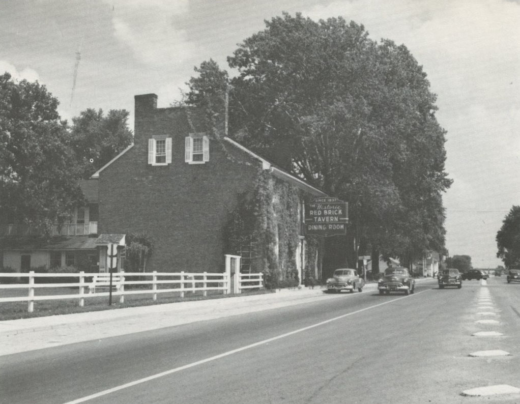
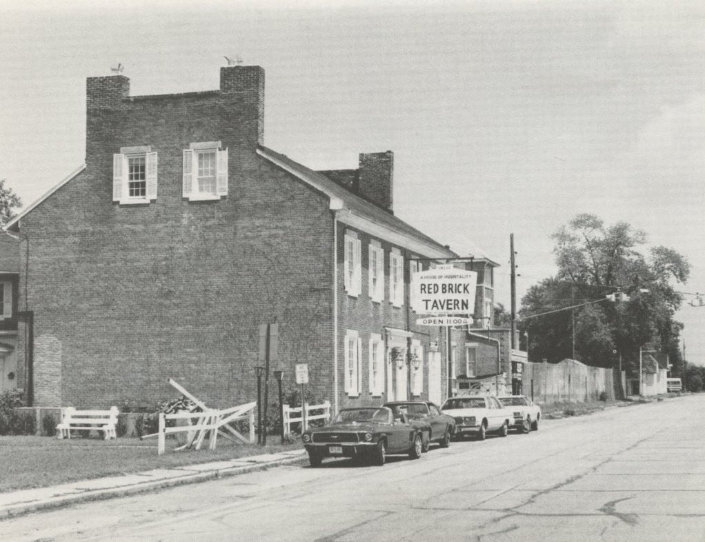
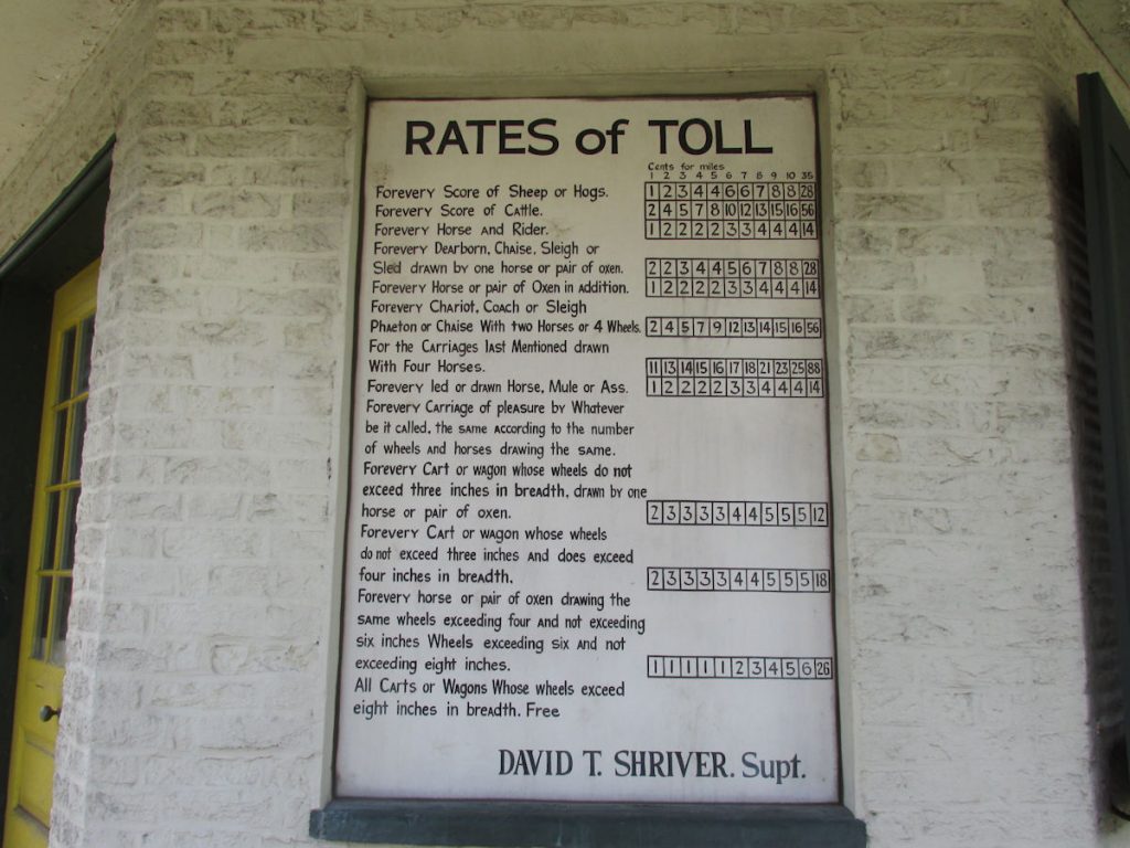
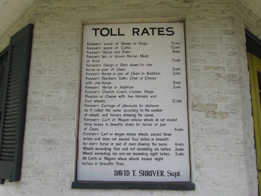
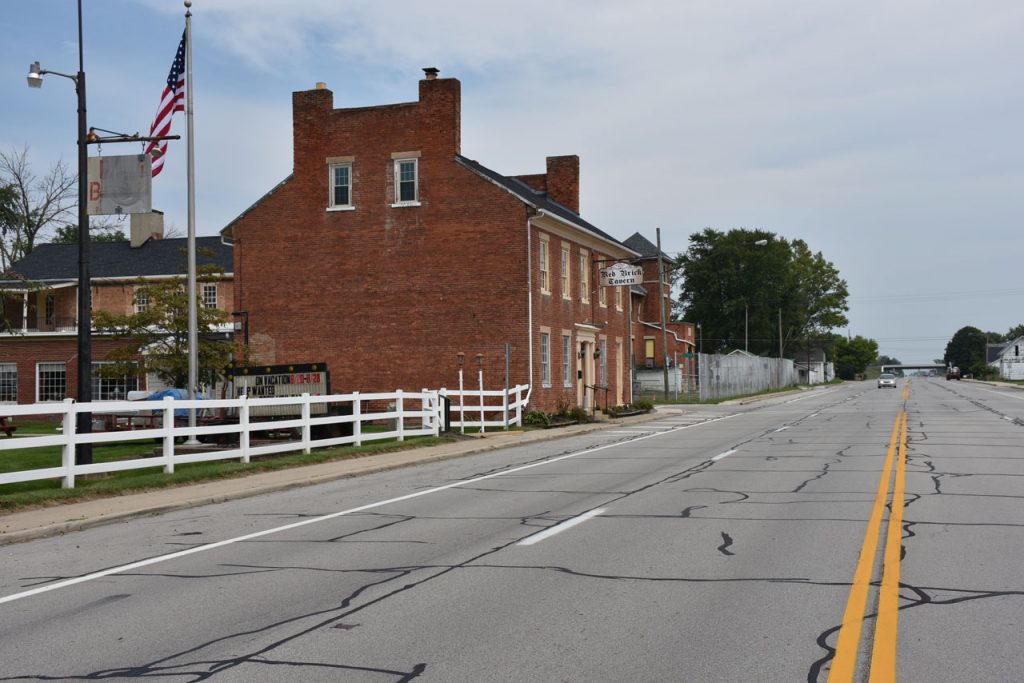
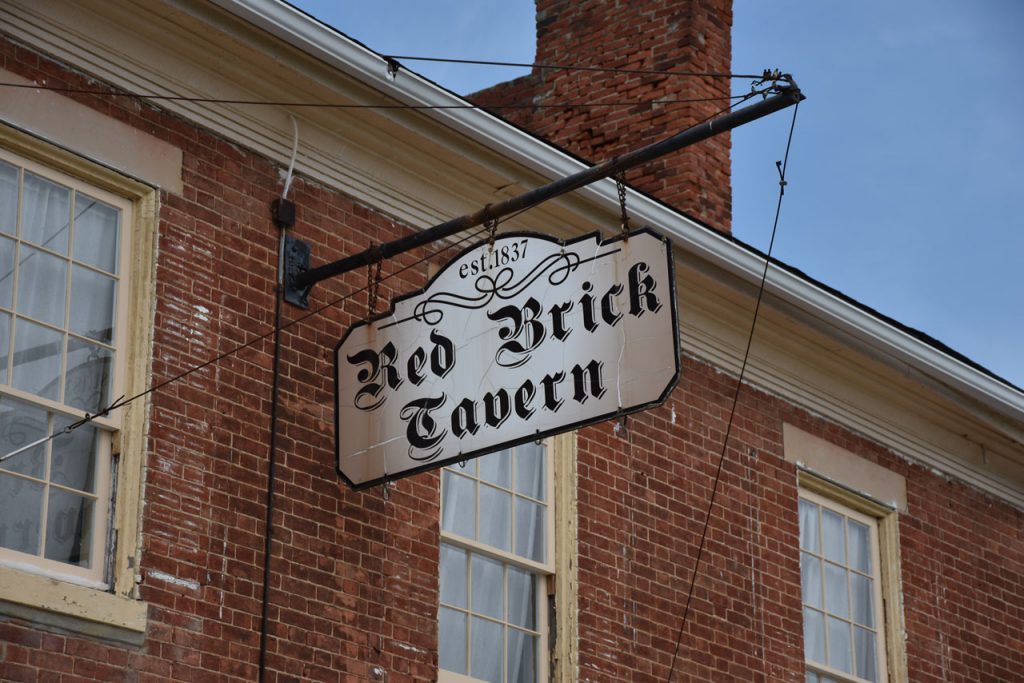
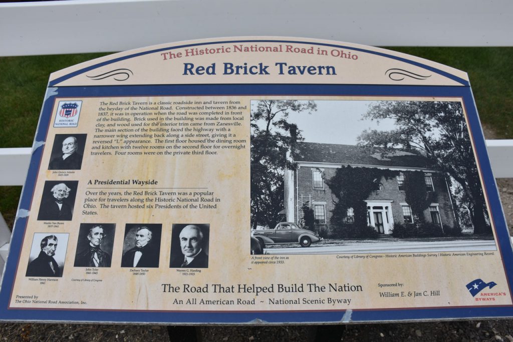
Located about 20 miles west of Columbus OH is the Red Brick Tavern. Built in 1837, it is the second oldest tavern in OH.

Five presidents from 1830-1850 dined here.

(Left, 1950, Stewart)    (Right, 1980, Vales)

Red Brick Tavern, August 2017.

The Ohio “Madonna Of The Trail” is located in downtown Springfield.

The Ohio “Madonna Of The Trail” monument.
Close-up. 

Just a short distance down the street from the Madonna Of The Trail monument, I passed this old International Trucks dealer.
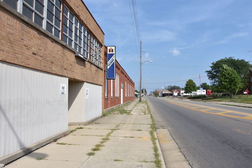
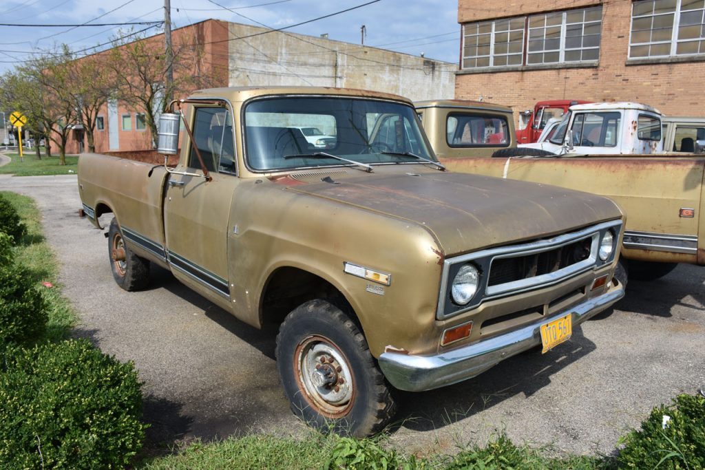
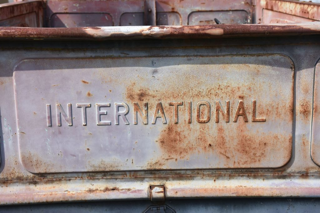
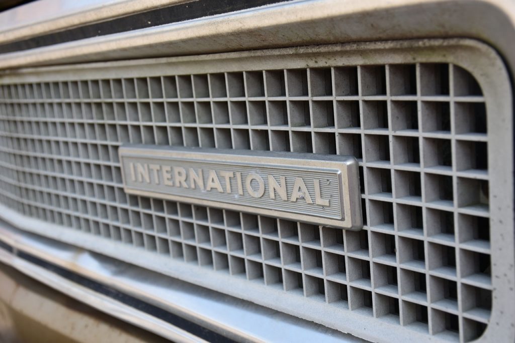
These trucks were quite popular when I was growing up in the 60s and 70s.  They were “unbreakable”!
Unfortunately, International stopped selling “light duty” vehicles around 1980.
 
https://en.wikipedia.org/wiki/International_Harvester_Scout 
 
Not bad for 40+ years old.  This old truck has probably done more than its share of hard work.

It was a common sight for drivers following these trucks down old 2-lane roads at 30 MPH. 

Classic!


Then, it was back on the road again.  Westward, ho!

Going through the Midwest farming country, I passed a lot of small white churches.
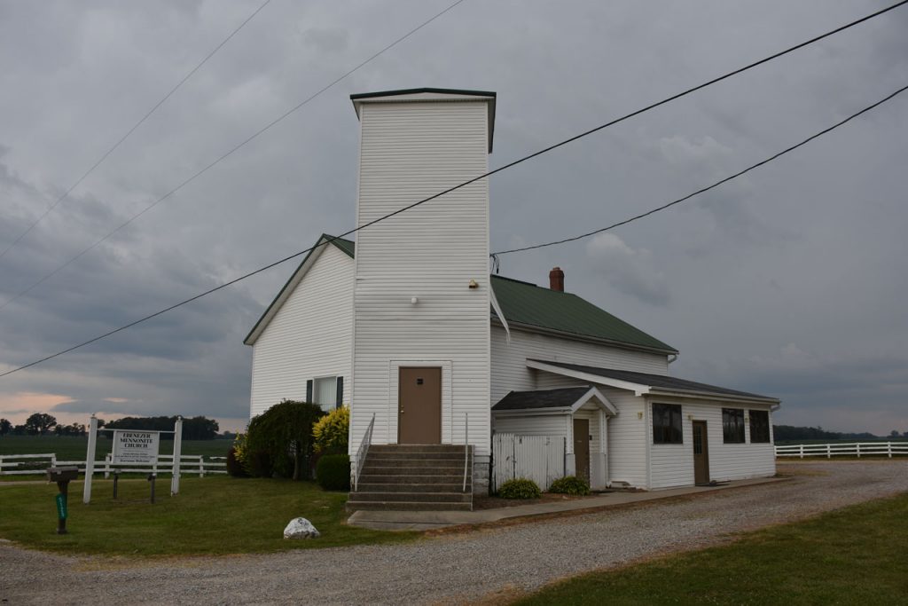
This is a Mennonite church near the Ohio/Indiana border on Rt 40.

Sign out front of the church.

Last of the farmland in Ohio as we near the border of Indiana. Looks like rain ahead.

Indiana

The Indiana “Madonna Of The Trail” monument was waiting at the Glen Miller Park in Richmond IN.
Nearby were these plaques with historical information.
Another informational plaque about the National Road. Lots of history here!!

At this point, I was running later than I planned.  I had reserved a room at airbnb , an online site where people rent out rooms

in their homes.  They have to meet lots of guidelines and have online reviews by people who stayed. I stayed at the home

with a dad and two daughters, and had a private bedroom and bath in a big new house on the west side of Indianapolis. Cost was only $32.

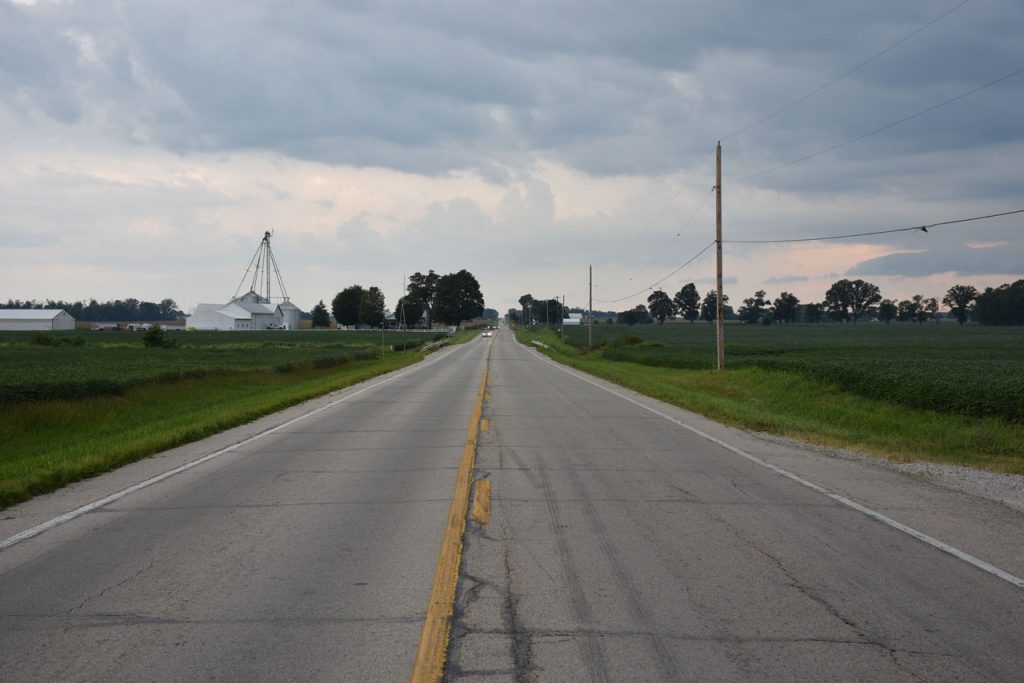
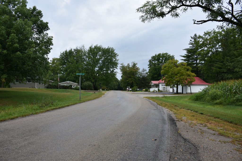
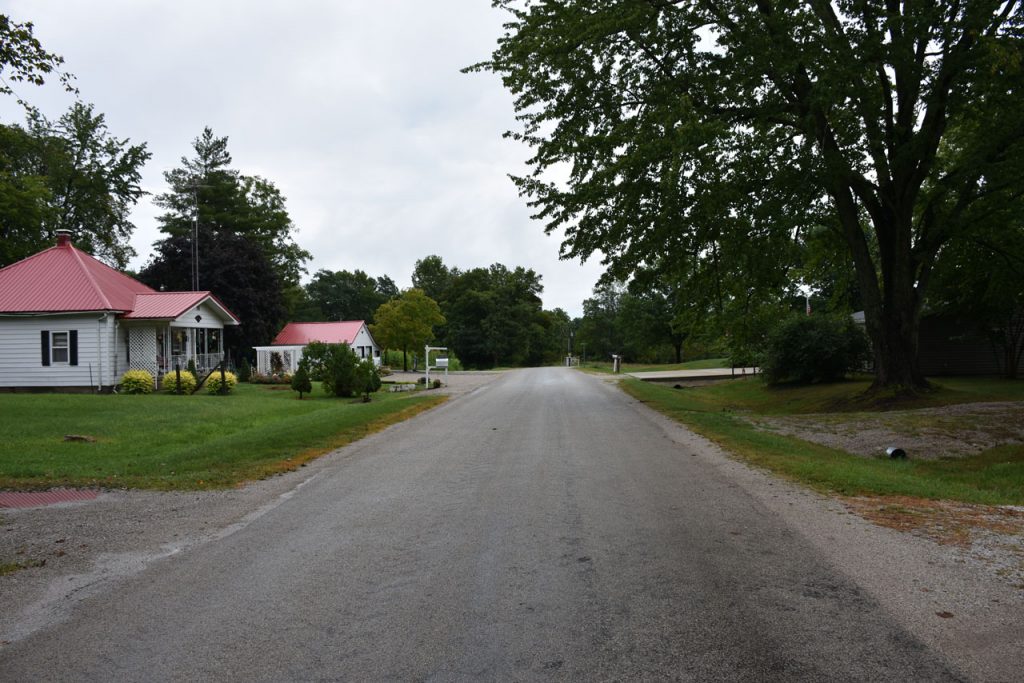
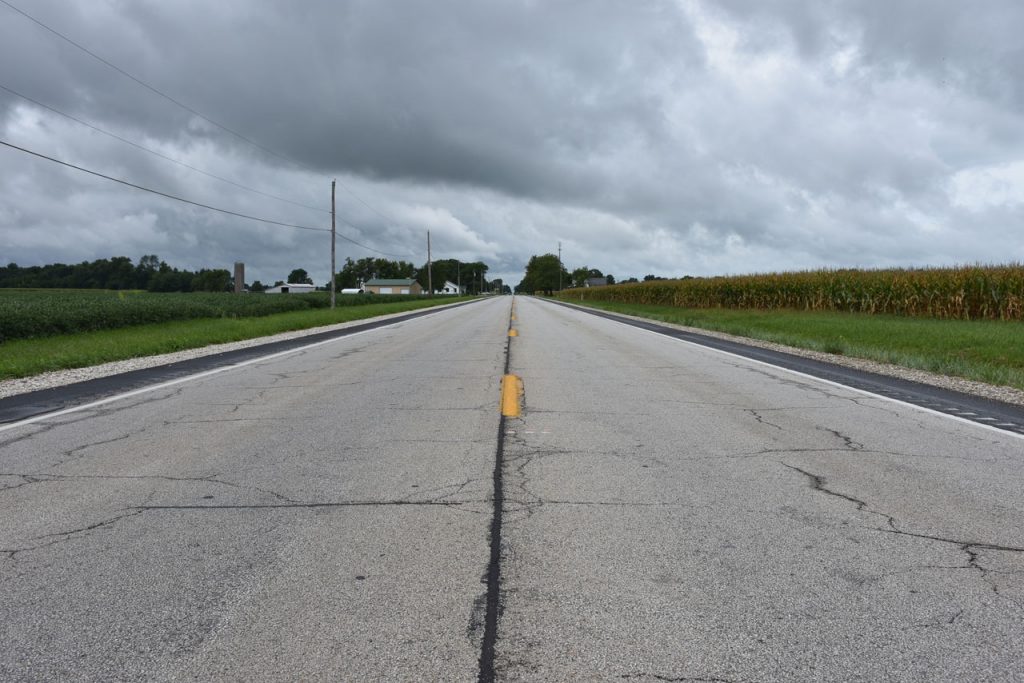
The next day, I left early and continued west on old Rt 40 past Indianapolis.

Sunrise on the farm.  About 25 miles west of Indianapolis.

Along the way were reminders of the “glory days” in the 50s and 60s when motels like this one
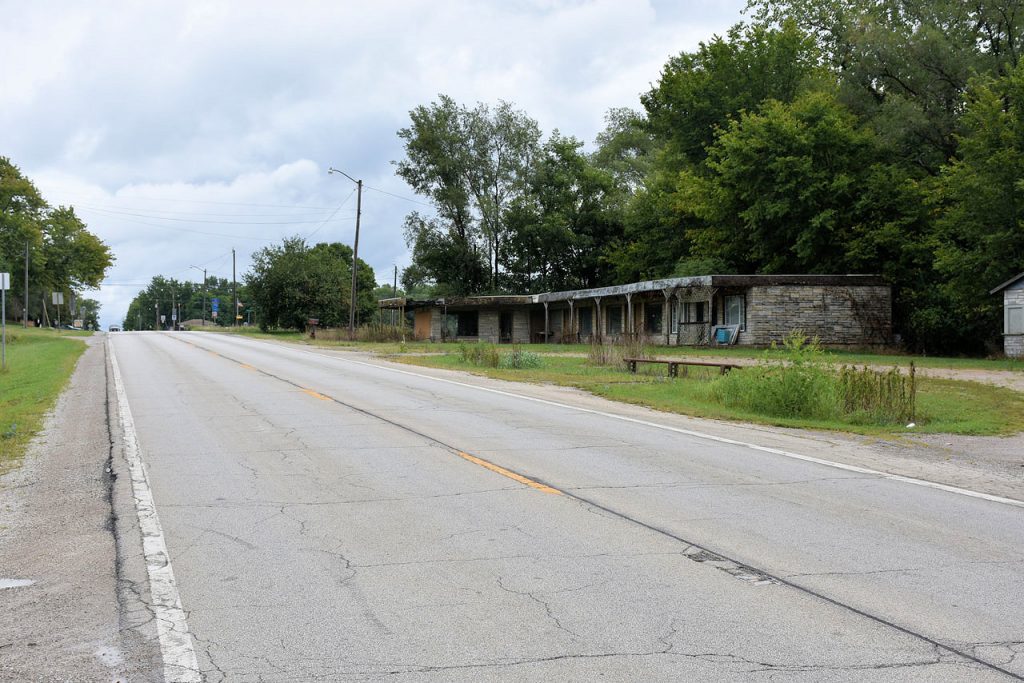
stood ready for weary travelers (and their money).  Then came the interstate highways.
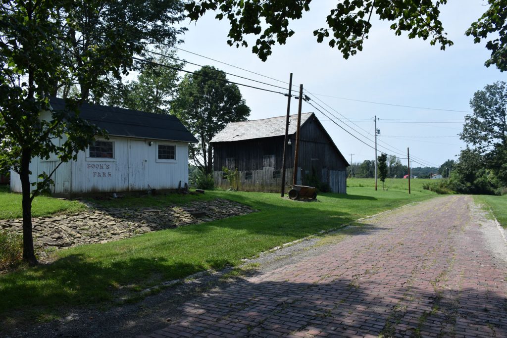
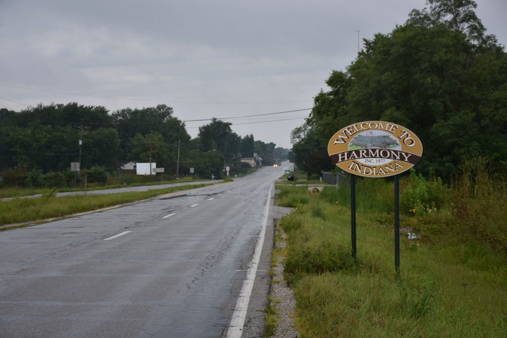
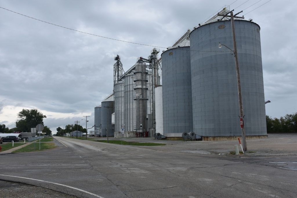
This one is located about mid-way between Indianapolis and the Illinois border.

Now it appears the hotel is home for a few people.   “No Trespassing” signs all over, though.

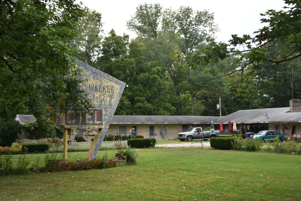
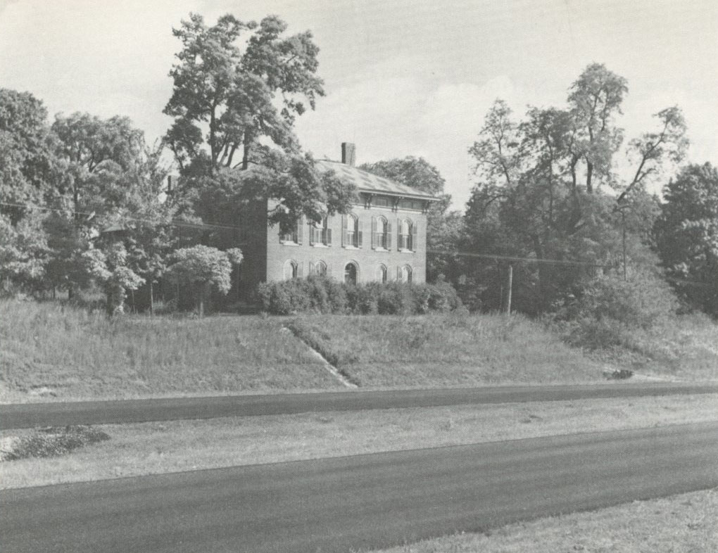
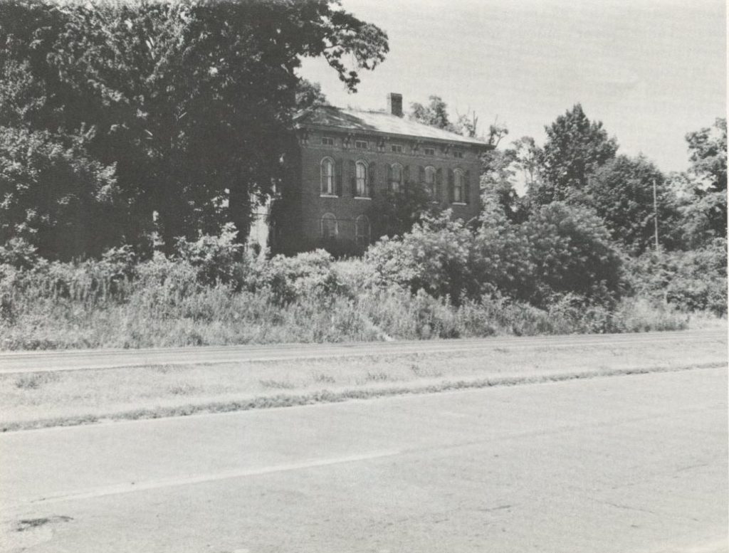
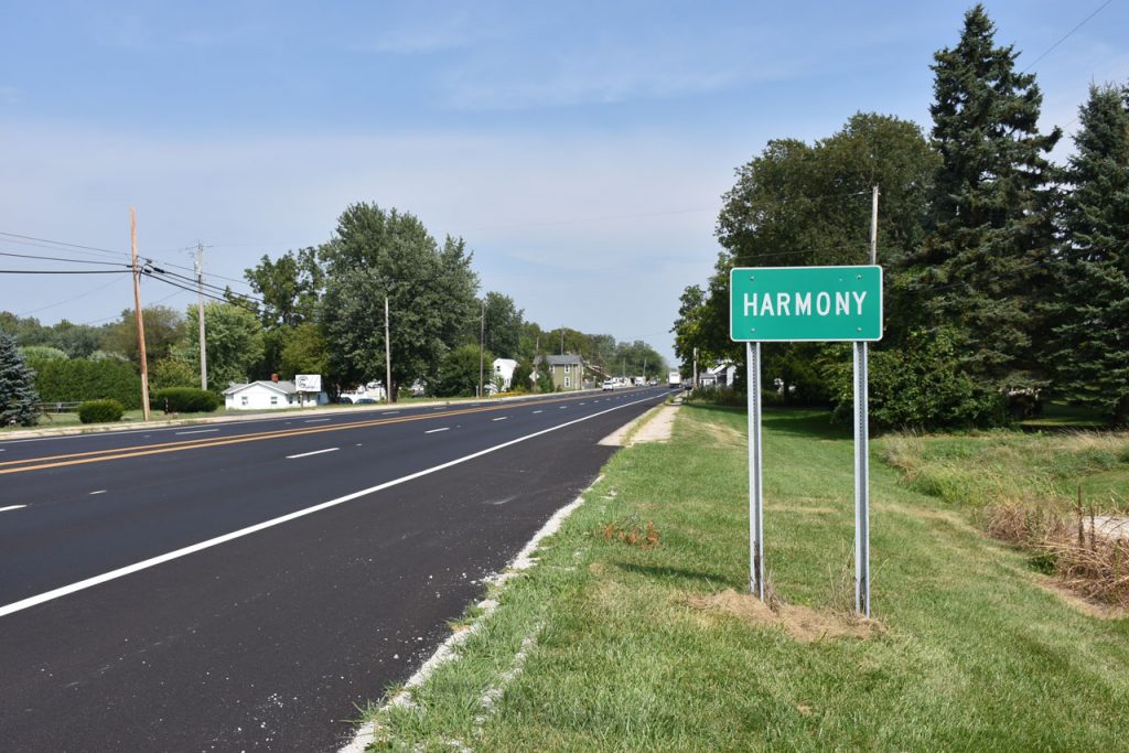
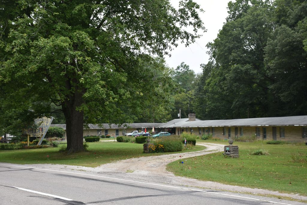
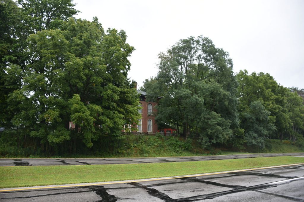
Just east of the town of Harmony, IN lies this old Victorian home hidden by the trees.

The house was abandoned and neglected in the 1980 photo (right), but has since been bought and restored.

(Left, 1950, Stewart)   (Right, 1980, Vales)

Victorian Home, August 2017
Look closely and you can see a large new shed behind and to the right.
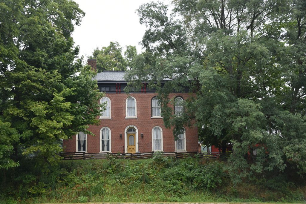
Victorian Home, August 2017
Nicely restored.

One again, I’m in harmony!  (Harmony IN). I also caught up to the rain.

Illinois

After a brief hop on the interstate to bypass Terre-Haute, I was across the border to Illinois.

Almost immediately, I got off the first exit and back onto old Rt 40.

Nice farm scene in Illinois, just west of the Indiana border.

Just a short distance down the road, I spotted this sign.
Good chance to view some of the original National Road.
A scene that could be from the 60s.  (Spur – old Rt 40)

Another view along the Rt 40 spur road.

After those few houses, the old road went through this grove of trees before re-joining the current Rt 40.

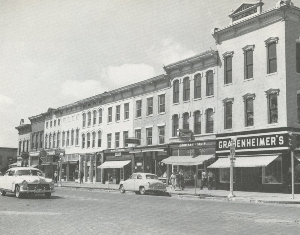
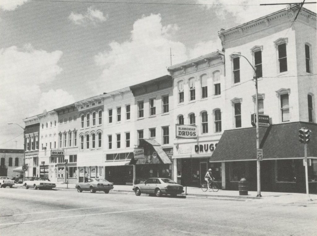
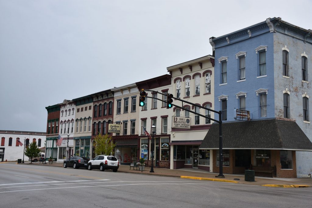
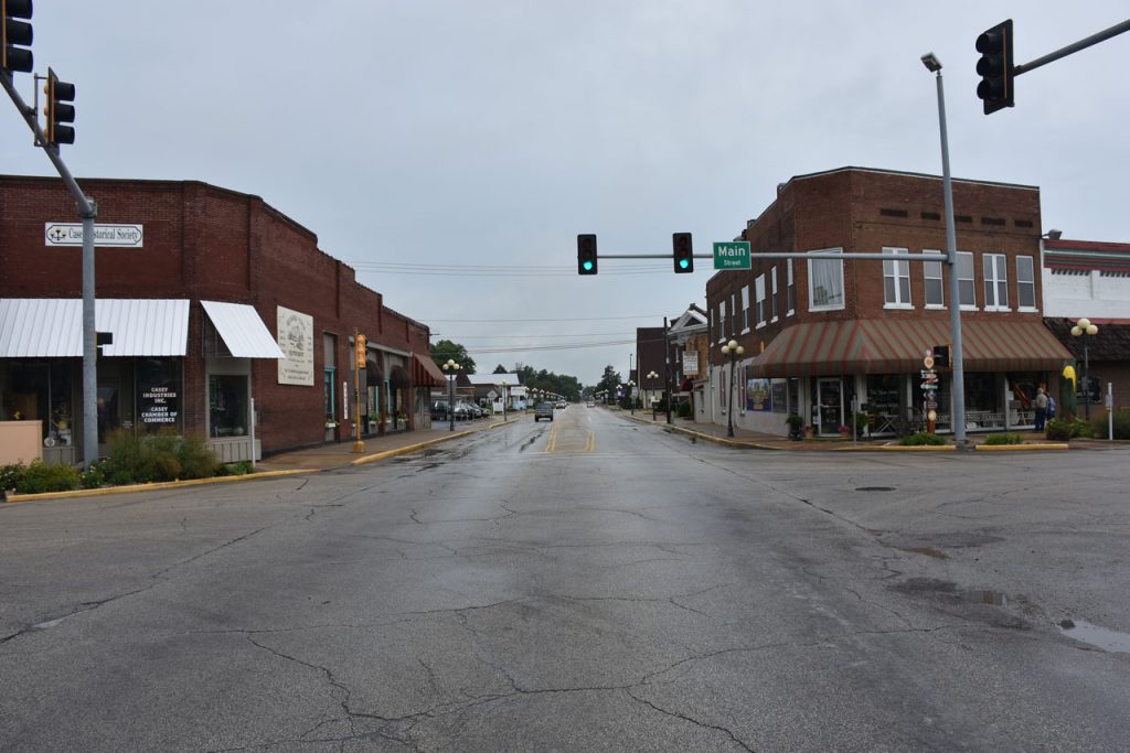
The next stop in the “U.S. 40 Today” book was Marshall IL, a small but vibrant town.

(Left, 1950, Stewart)  (Right, 1980, Vales)

Marshall IL in August 2017.

Just west of Marshall is this historical old stone bridge.
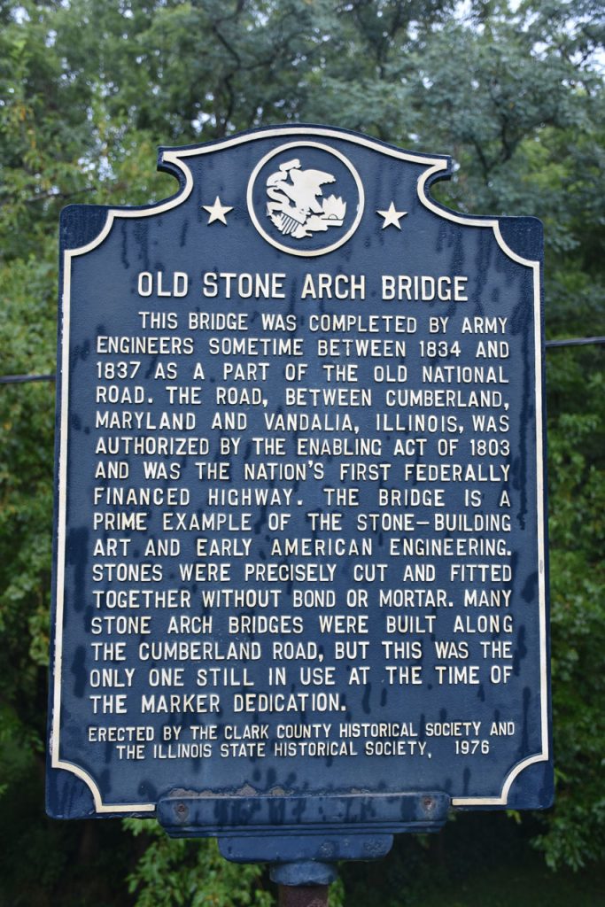
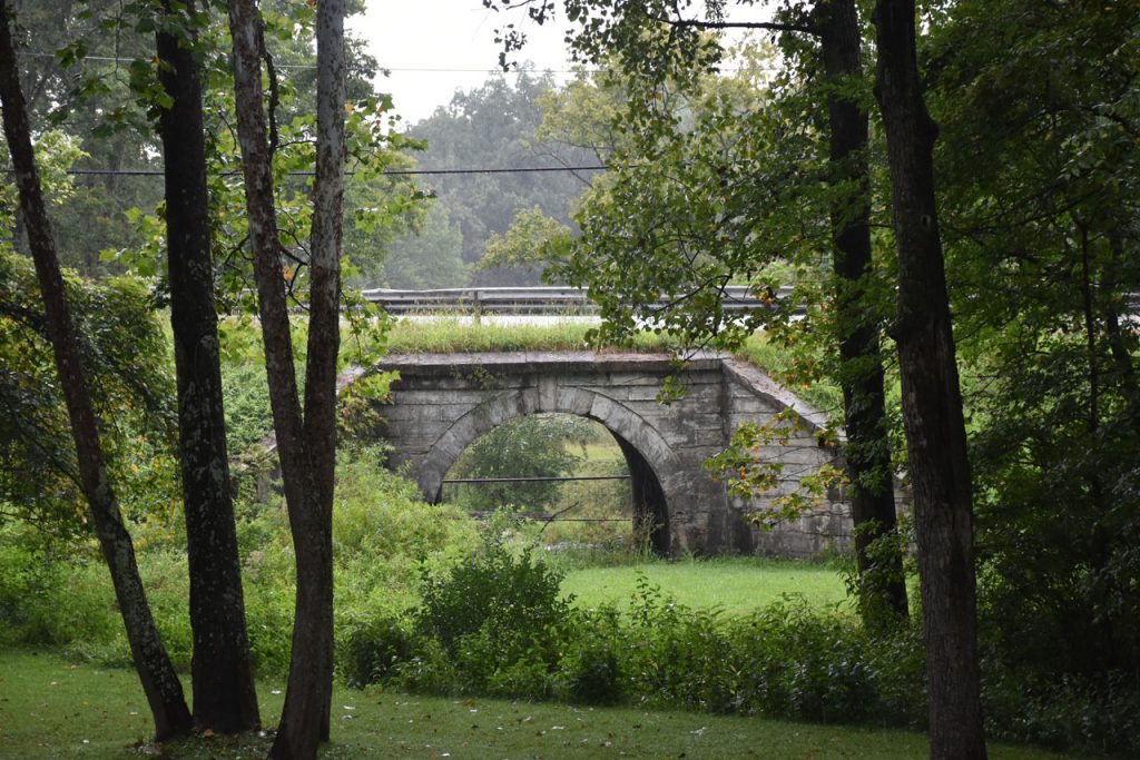
This is the only original stone bridge still used on the National Road.

View of the old stone bridge. 
Near Martinsville IL, just west of the Illinois border.
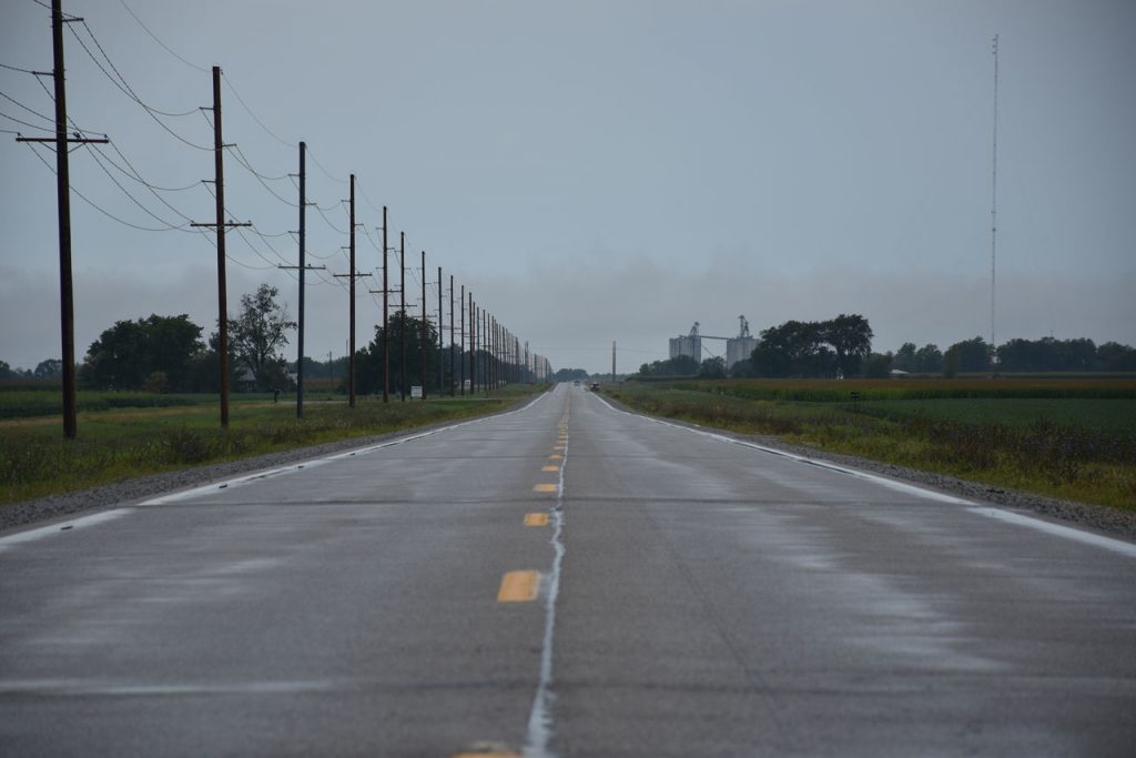
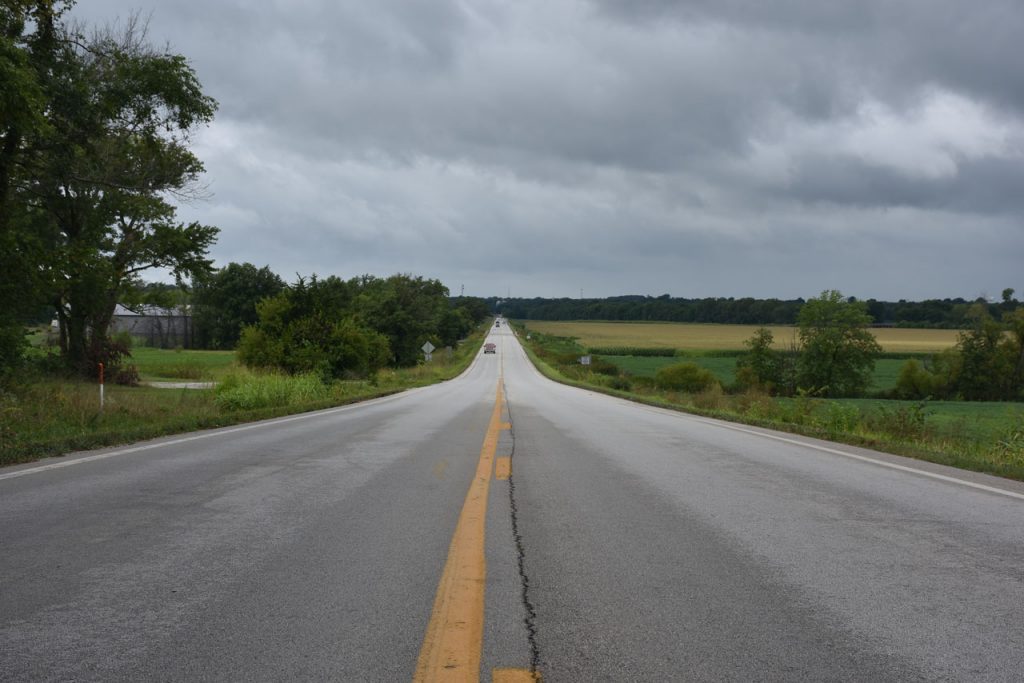
The roads are getting straighter and straighter. Clouds are getting darker by the minute.
Lots of these huge grain elevators along the railroads.

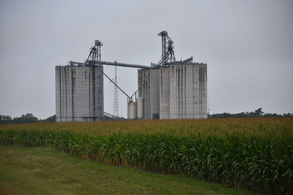
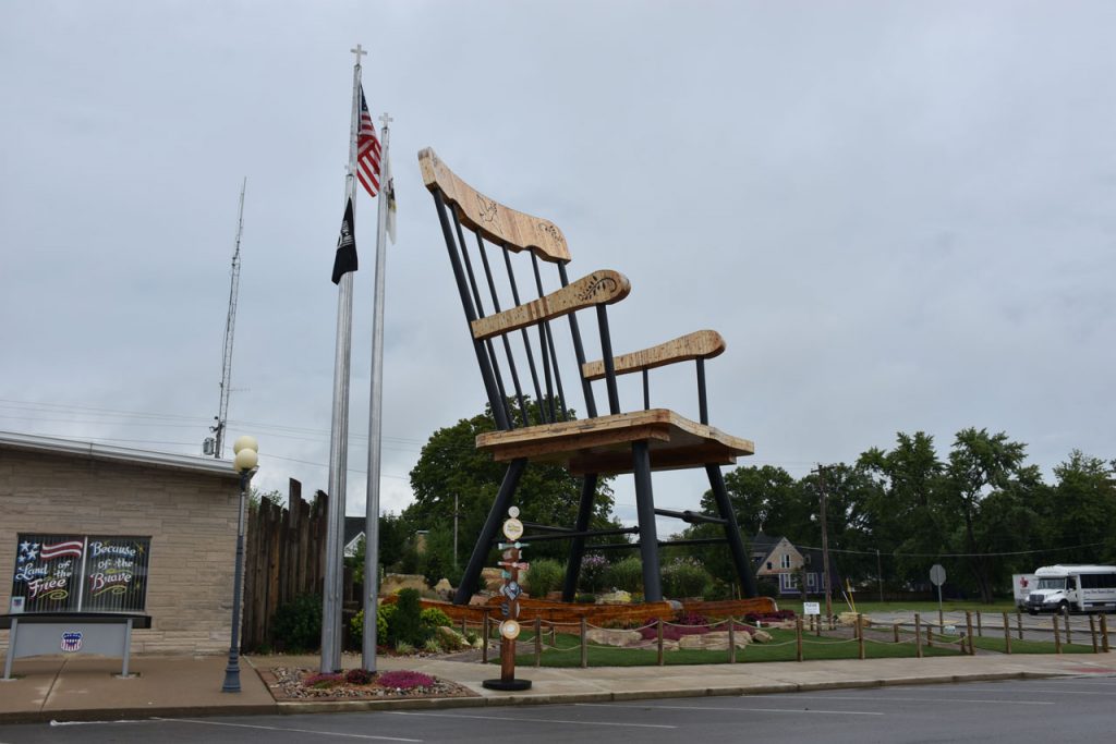
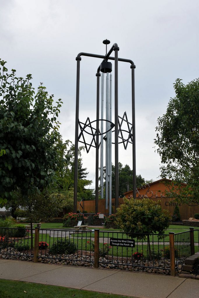
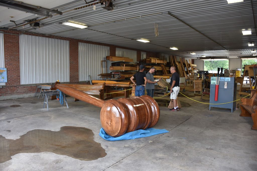
The next stop was not planned until just a few days before I left.  Watching the evening news, the last 5-minute spot featured a small Midwest town that decided to build “big”.  They built a giant wooden rocking chair and the world’s largest wind chime. Interesting.

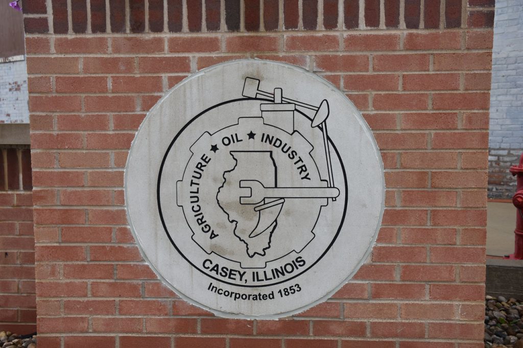
When I looked up where the town of Casey IL was located, lo and behold, it was right on old Rt 40. Time for a short detour!

Welcome to Casey IL.

Main Street – Casey, Illinois

Nice mural on building.  It’s farm country!

Nice café along the main street.
It didn’t take long to find the big rocking chair.
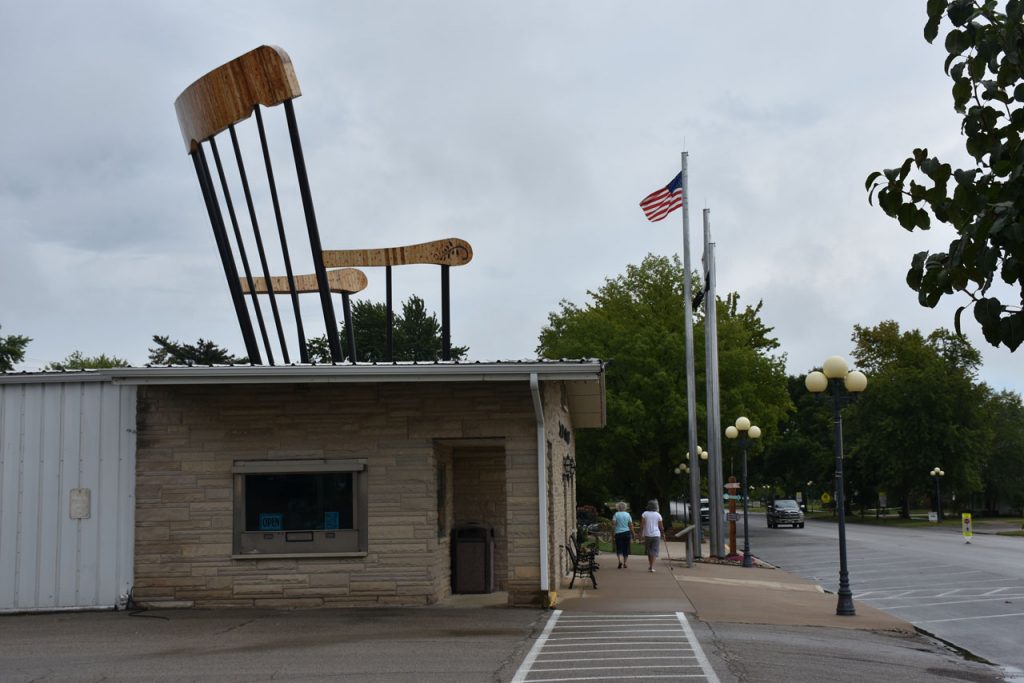
Hard to hide a thing like that in a small town.

It’s big, all right!

Across the street is the world’s largest wind chime.
Carrying on the theme of “big”, this woodworking shop builds huge items such as this gavel.

Just west of Casey is the Cumberland County Covered Bridge.
 
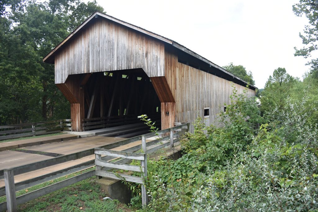
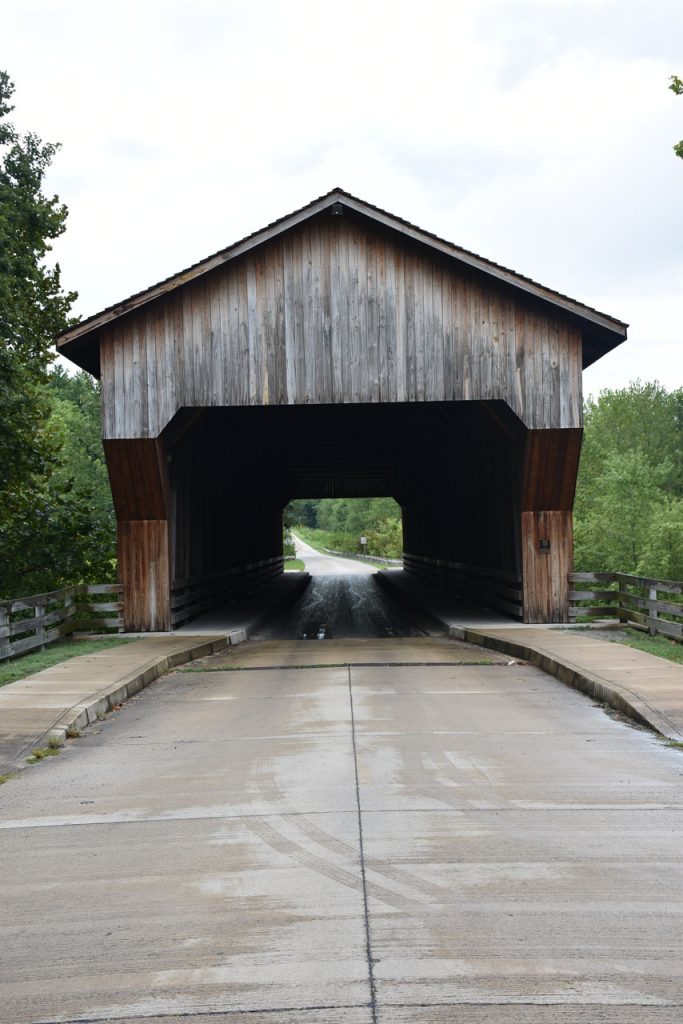
http://www.waymarking.com/waymarks/WM2AAG_Cumberland_County_Covered_Bridge_Greenup_IL 
 
View through the bridge.

Some more grain elevators along Rt 40 near Montrose IL.

More long, straight roads through cornfields.
More remnants of decaying motels from 60 years past.

And even more long, straight roads through cornfields.  Must be Illinois!
Vandalia IL – Statehouse, the Illinois Capitol from 1836-1839.
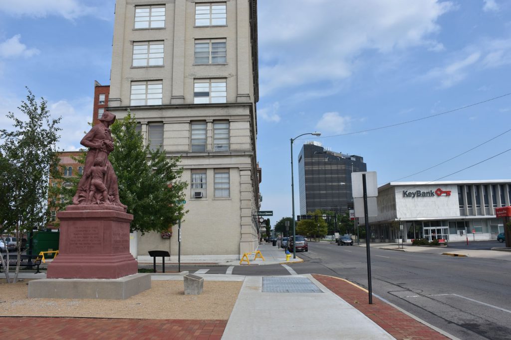
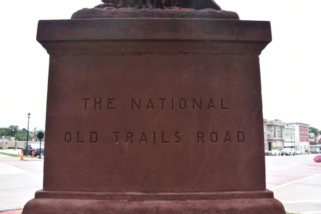
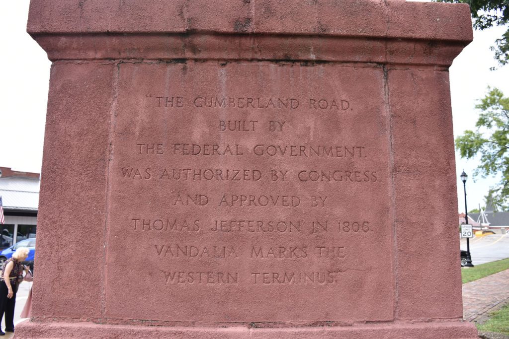
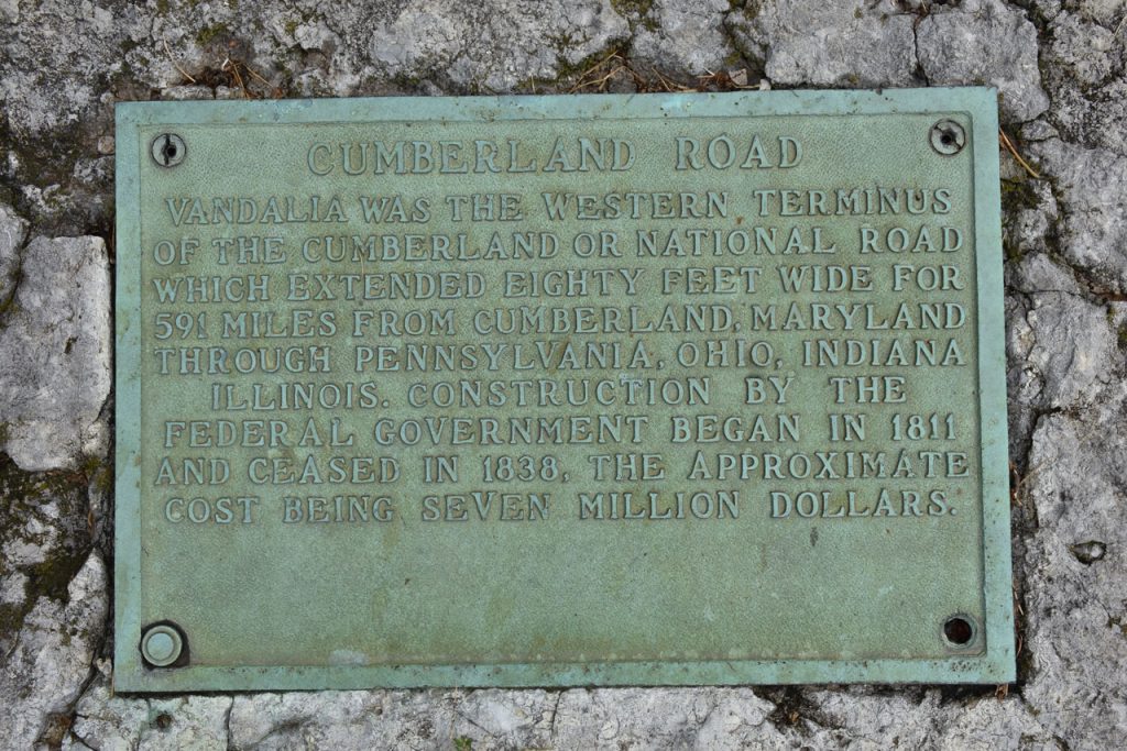
End of the National Road is about 100 feet to my left.

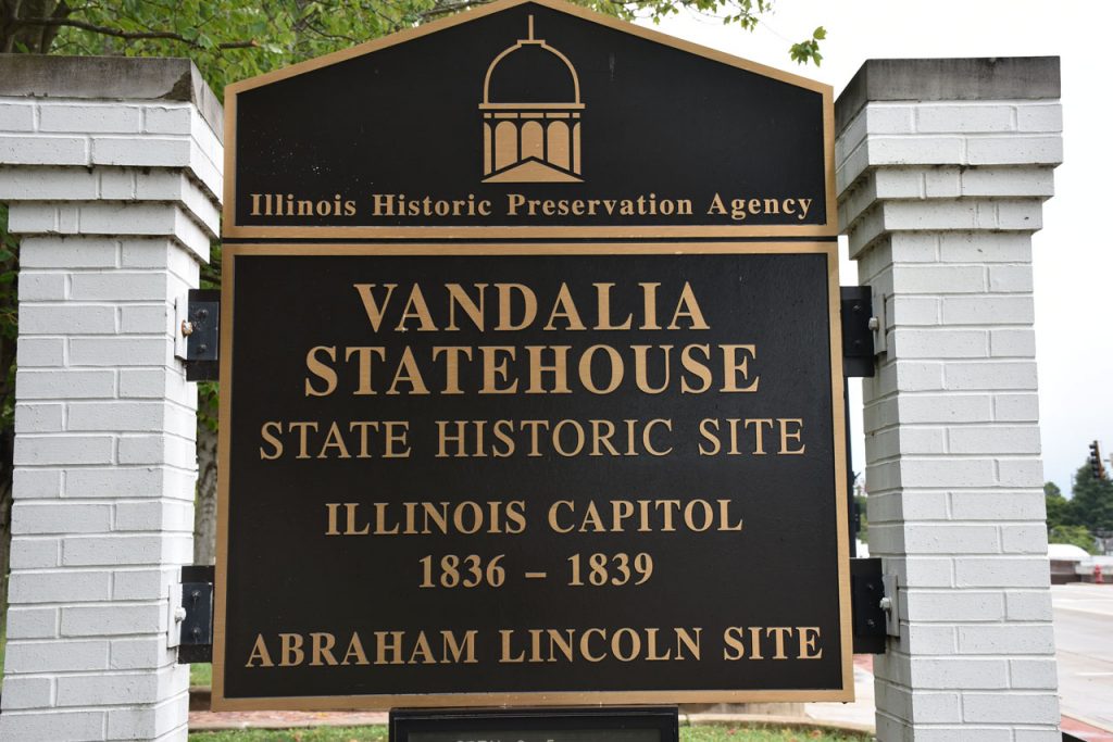
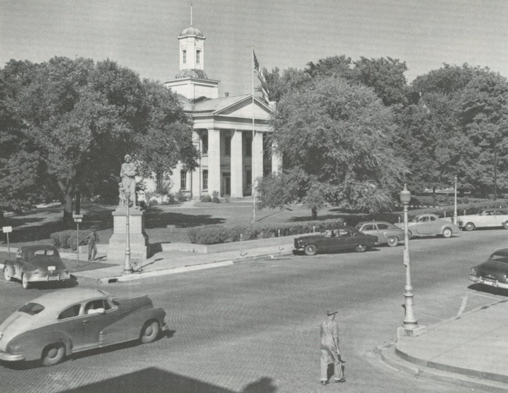
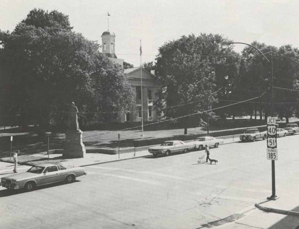
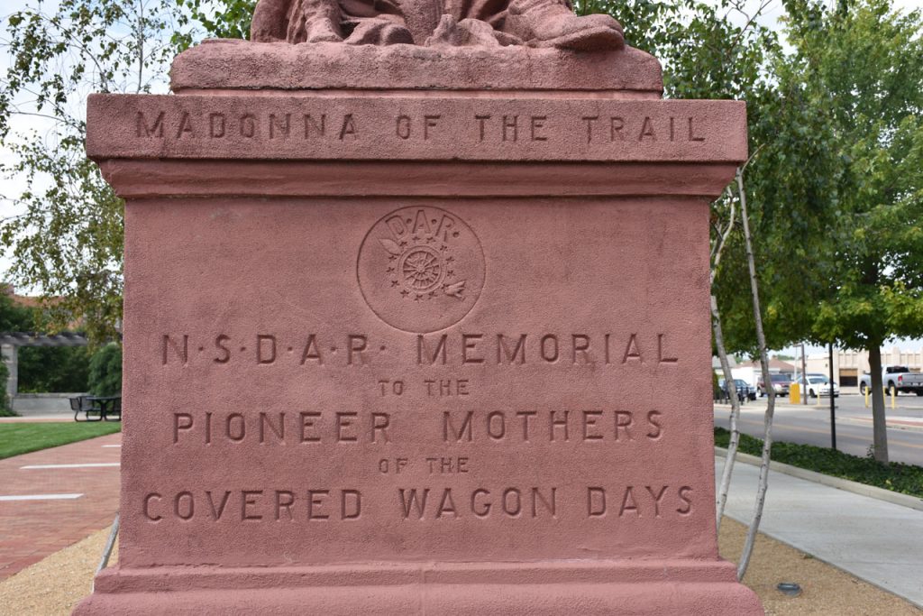
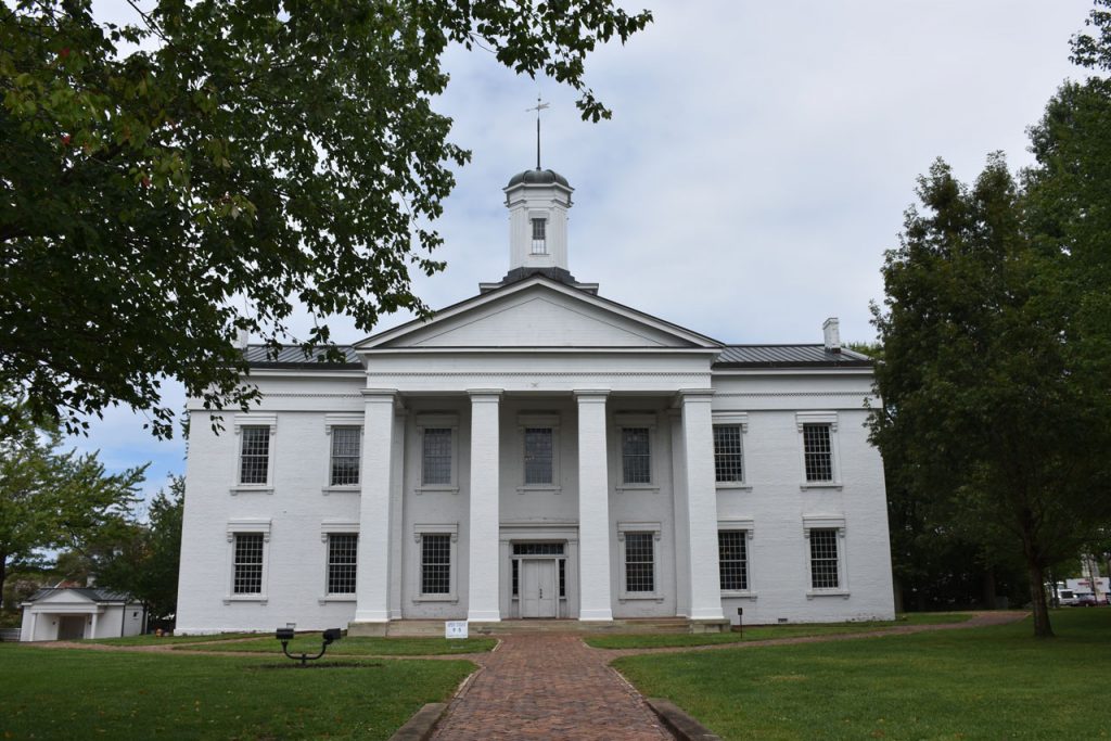
Vandalia – Original terminus of the National Road.  Madonna Of The Trail was the end point.

(Left, 1950, Stewart)   (Right, 1980, Vales)

Vandalia – Original Terminus (August 2017)
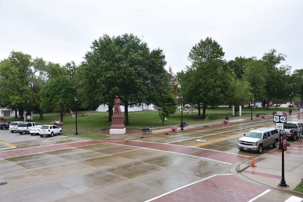
From the original photos above, I noticed they were taken at a raised location.
On the building diagonally across the street were fire escape stairs coming down the side.
I went in the antique shop, showed them the original photos, and they gave me permission to climb the steps.

Illinois “Madonna Of The Trail”.  This one marked the original end of the National Road.

Jerry Swarms runs the National Road Interpretive Center in Vandalia just down the street from the original terminus.
Jerry was very helpful.  Stop by and say hi! 
 
http://nationalroadvandalia.org/ 

Hope you enjoyed traveling Rt 40 (National Road)

RETURN TO FAMILY TRAVEL PAGE