
Southwest USA
Retirement Trip
September 2019
29 Days – 6,500 Miles – 19 States
7 National Parks
Several State Parks – 6,000+ Photos
1 Trillion Insects Squished by Car Windshield
From 108 Degrees to Snow
From 282 Feet Below Sea Level to 12,000+ Feet
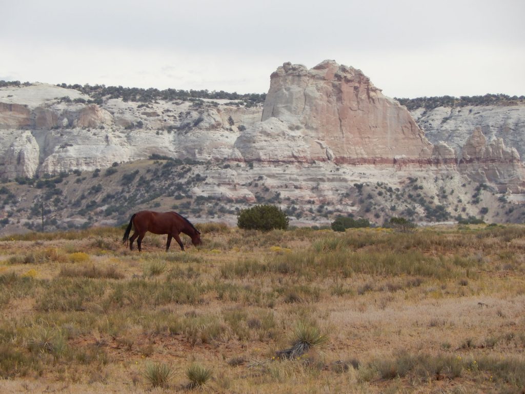
Bison, Elk, Prairie Dogs, Lizards, Wild Horses
Elvis, Aliens, John Wayne Westerns
Walking In The Footsteps of Forrest Gump
And More!
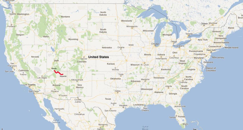
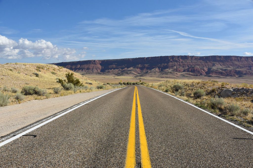
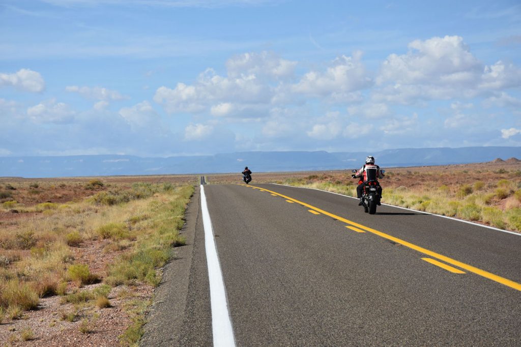
Today, we traveled from Kanab, Utah to Kayenta, Arizona.
We pass through Vermilion Cliffs, Marble Canyon, Horseshoe Bend, and more.
Since we explored the Grand Canyon North Rim yesterday, we could take our time today and see
more sites along the route from Kanab to Kayenta. There is plenty to see, so let’s begin!
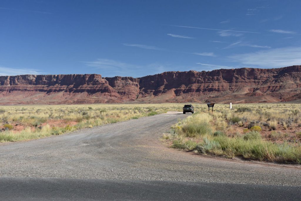
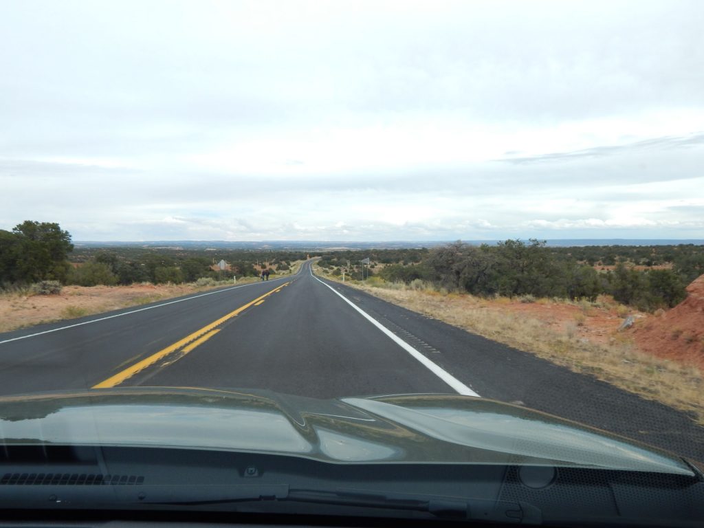
After a good breakfast at the hotel in Kanab, we loaded the car and headed south
on Rt 89A past the entrance to the Grand Canyon North Rim
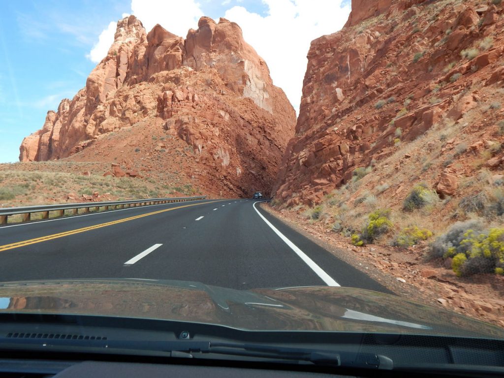
(where we explored yesterday). Within an hour, the scenery changed once again.
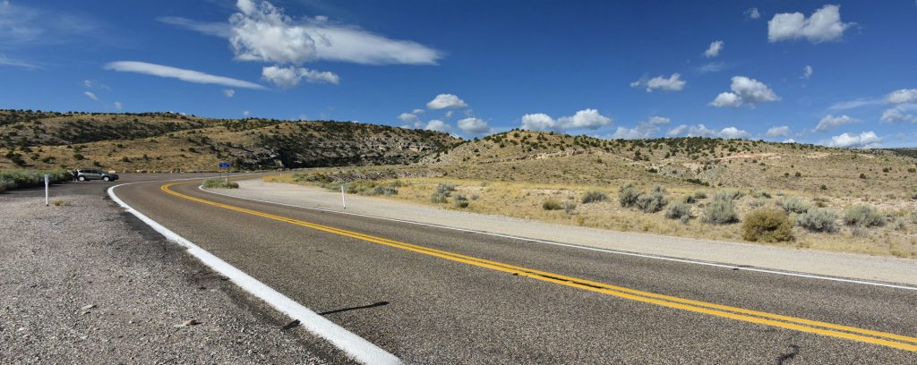
the forests gave way to hills and semi-desert landscapes.
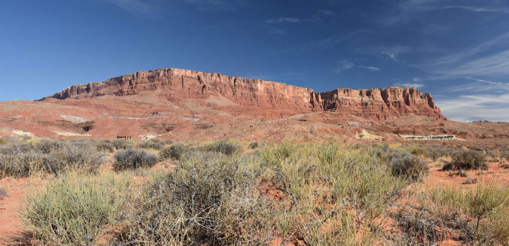
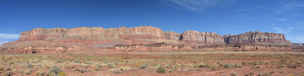
It stretched from one side of the windshield to the other. And beyond!
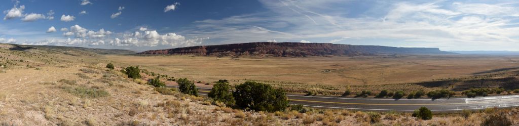
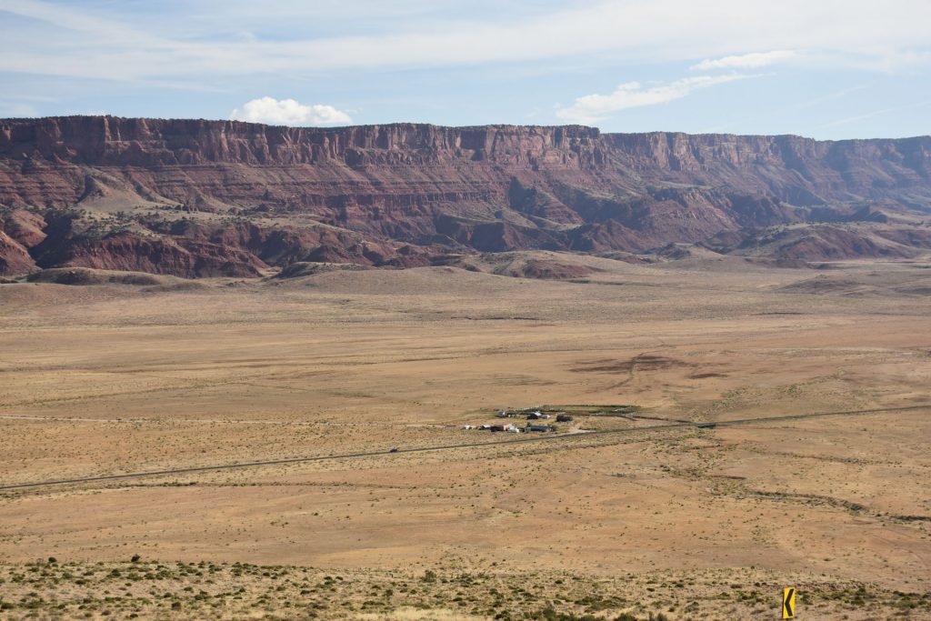
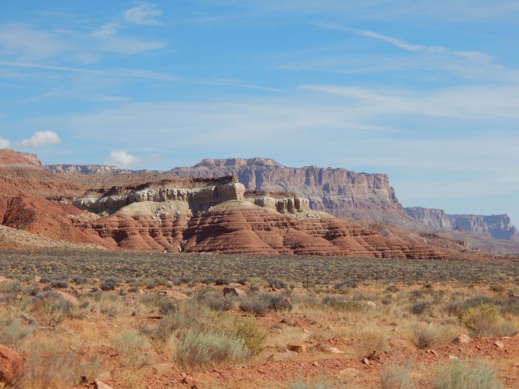
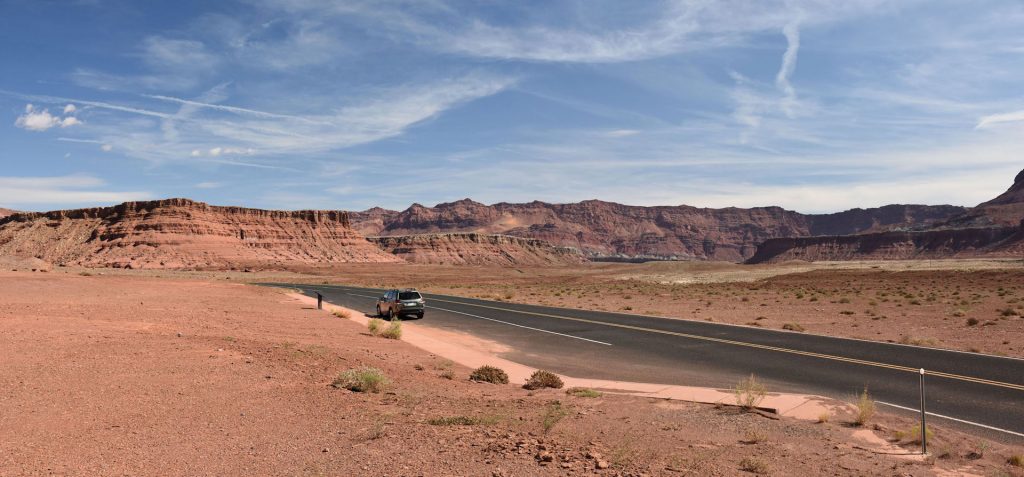
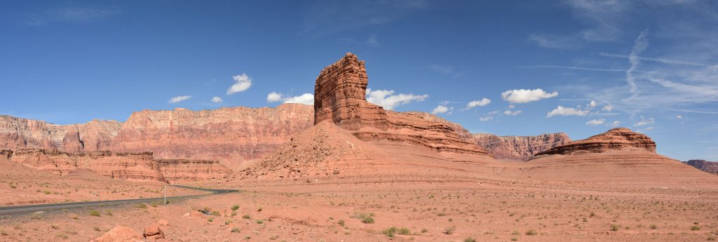
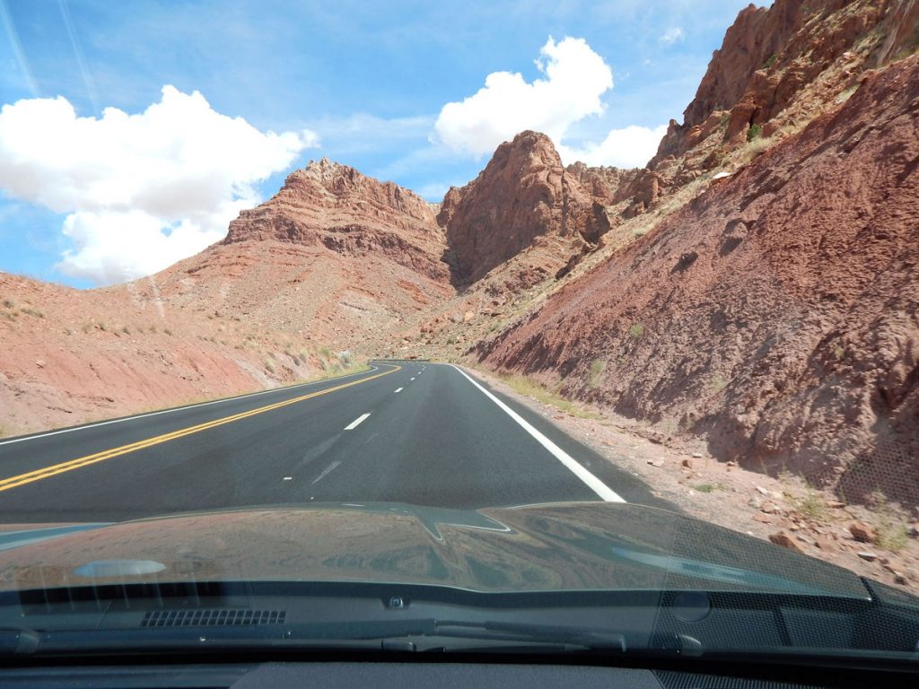
The Vermilion Cliffs National Monument covers nearly 300,000 acres in northern Arizona.
These cliffs run along the southern and eastern edges.
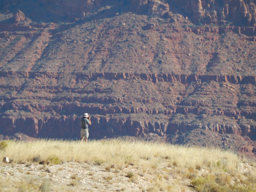
How’s that for peace and solitude?
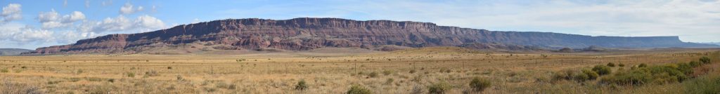
It is over 20 miles from one end of the cliffs to the other end.
The Dominguez-Escalante Expedition was a Spanish journey of exploration conducted in 1776 by 2 Franciscan priests, Atanasio Dominguez and Silvestre Vélez Escalante, to find an overland route from Santa Fe, New Mexico, to their Roman Catholic mission in Monterey, on the coast of modern-day California.
The land was harsh and unforgiving, and hardships encountered during the travel forced the group to return to Santa Fe before reaching Monterey. The Dominguez-Escalante route eventually became an early template for the Old Spanish Trail.
(Notes from Wikipedia)
For more information: https://en.wikipedia.org/wiki/Dom%C3%ADnguez%E2%80%93Escalante_expedition
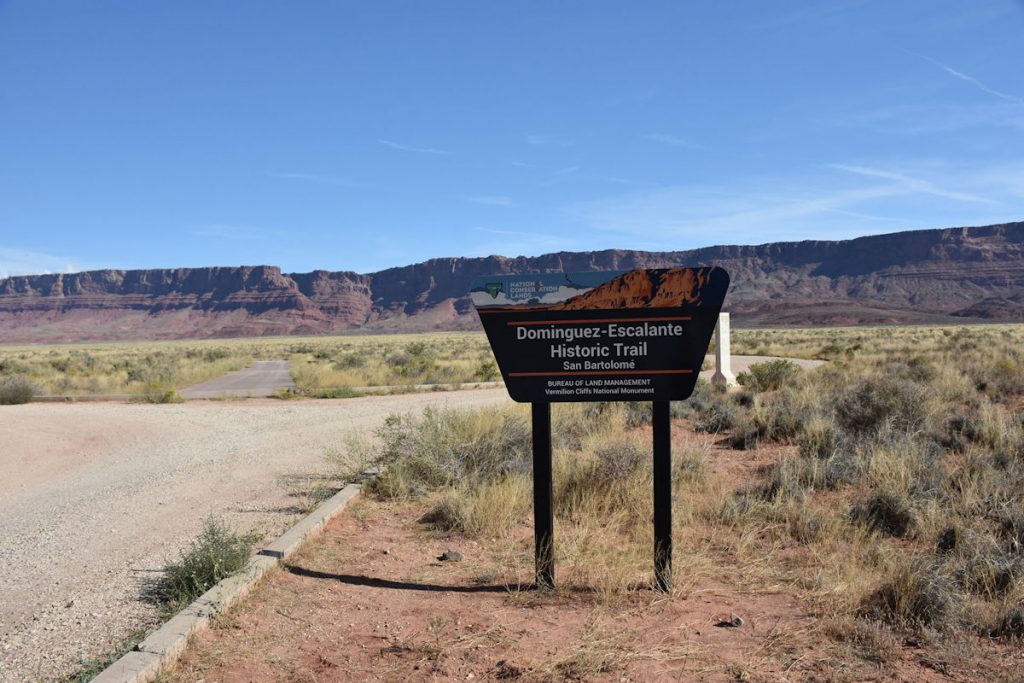
Learn more about Vermilion Cliffs: https://en.wikipedia.org/wiki/Vermilion_Cliffs_National_Monument
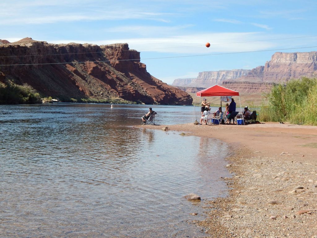
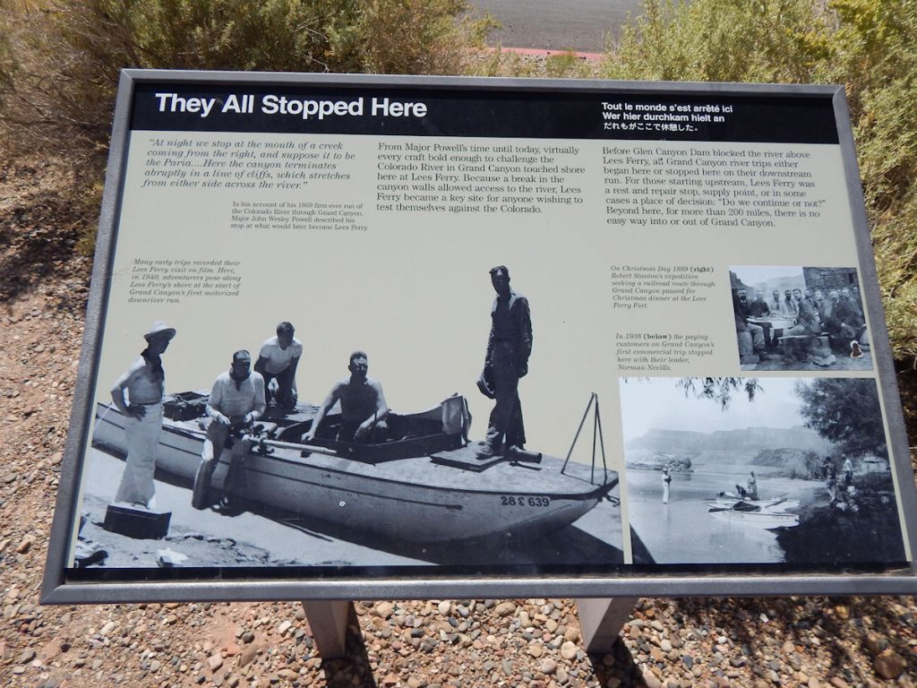
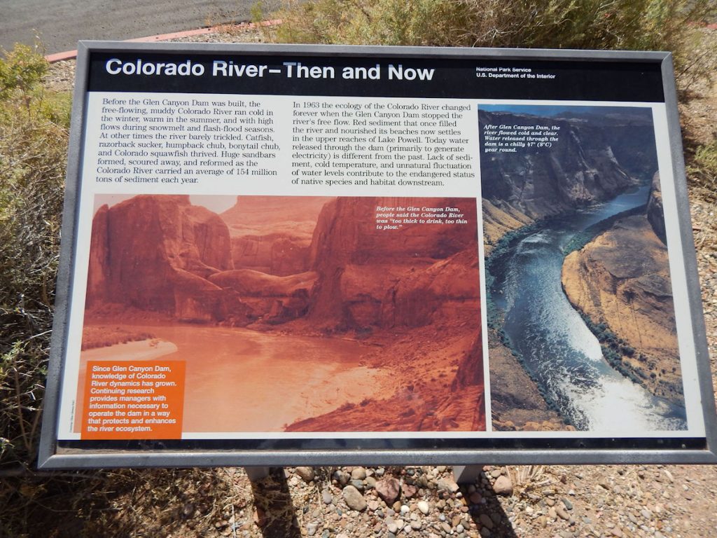
LEE’S FERRY
Just a few miles east, we took a detour to Lee’s Ferry, just on the southern tip of the Glen Canyon National Recreation Area.
The road goes through about 6 miles of beautiful canyons before coming to the
Colorado River at Lee’s Ferry, upstream of the Grand Canyon.
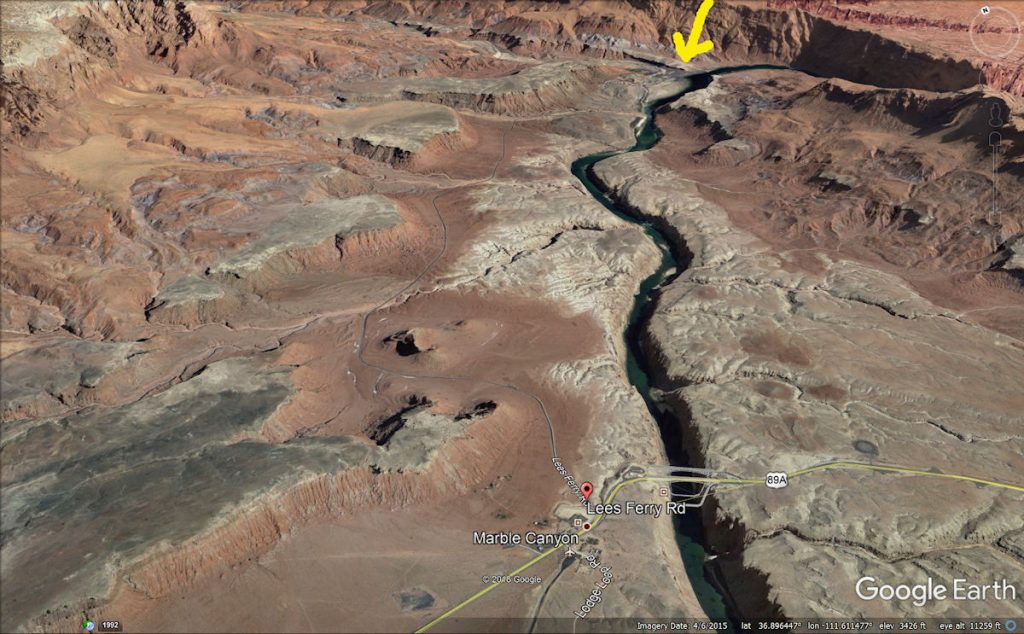
We were driving on Rt 89A from left to right and turned north at the red marker onto Lee’s Ferry Road.
We followed that north until we came out at Lee’s Ferry, indicated by the yellow arrow.
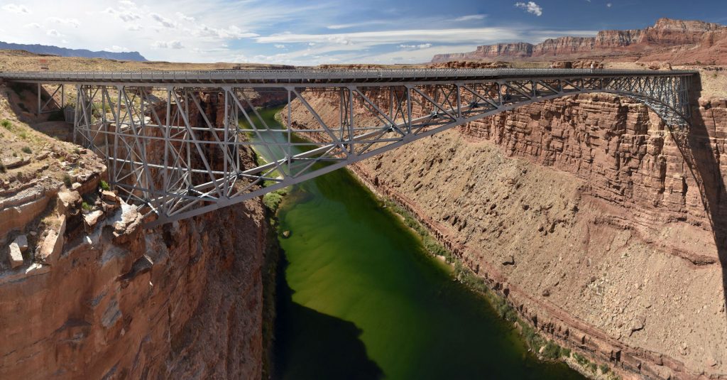
After we leave here, we will return to Rt 89A and see the new and old Navajo Bridges as they span the Colorado River canyon.
You can also see both of the bridges on this image.
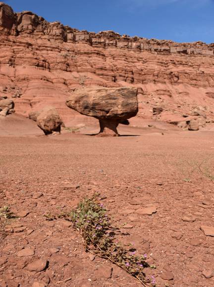
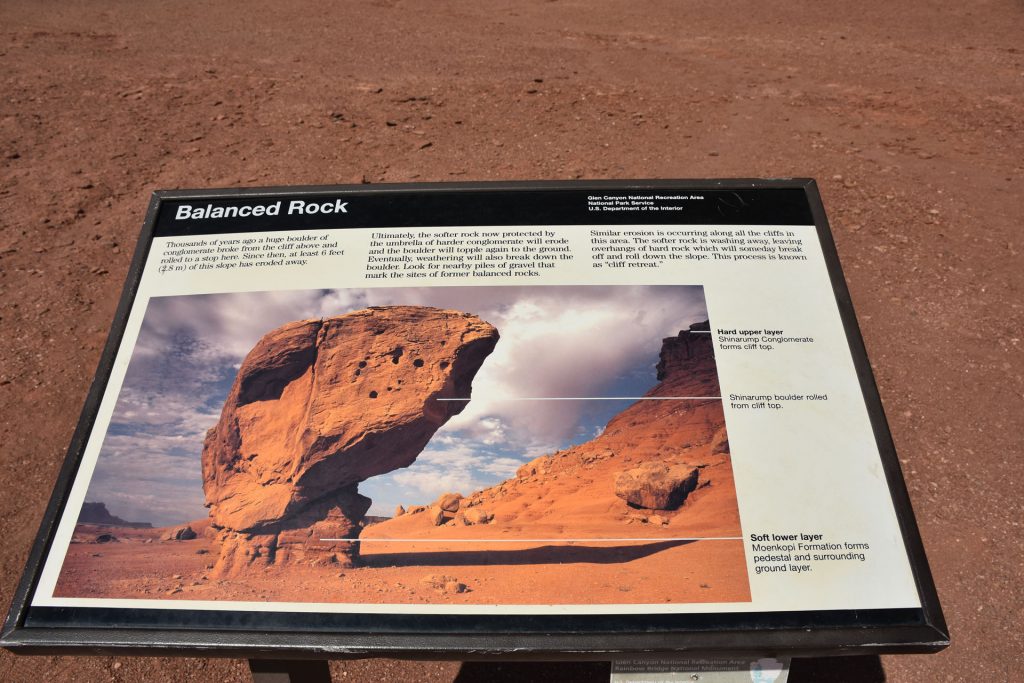
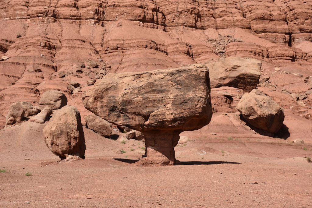
To put it in perspective, these rocks are over 2 miles away, and as tall as the Empire State Building.
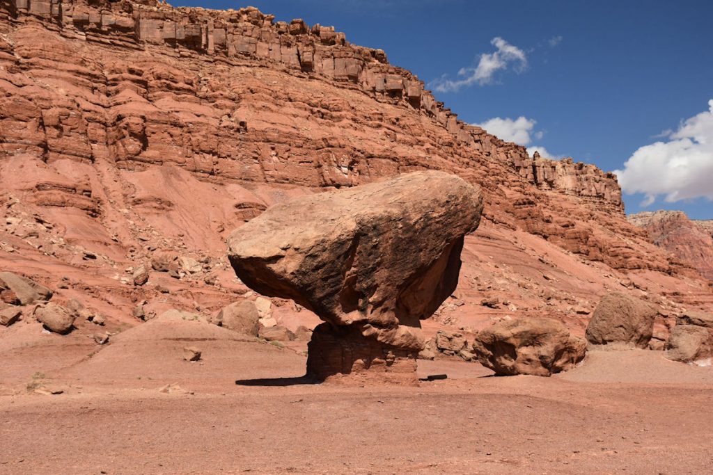
These are formed when a large rock made of hard material rolls down the hillside into softer rock/soil.
As the rain erodes the surrounding soft rock/soil, the hard rock on top protects the rock/soil underneath.
Eventually, though, the soft rock/soil will erode to the point where the large rock falls to the ground, and
the process starts all over again. Check back in a few thousand years for updates.
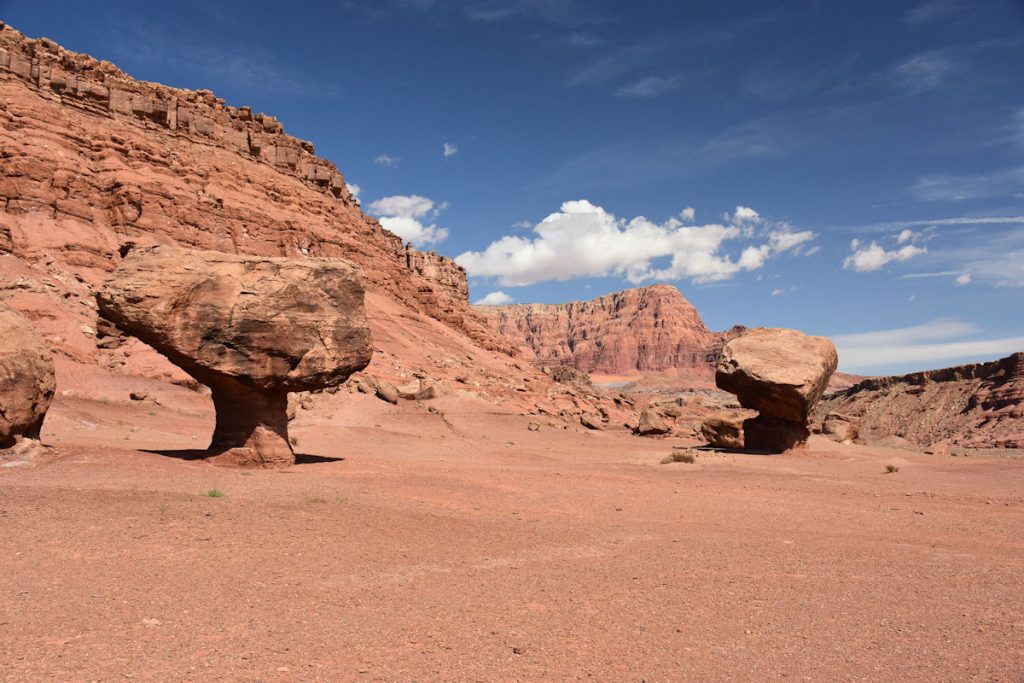
I can see a Road Runner vs Coyote cartoon in the making!
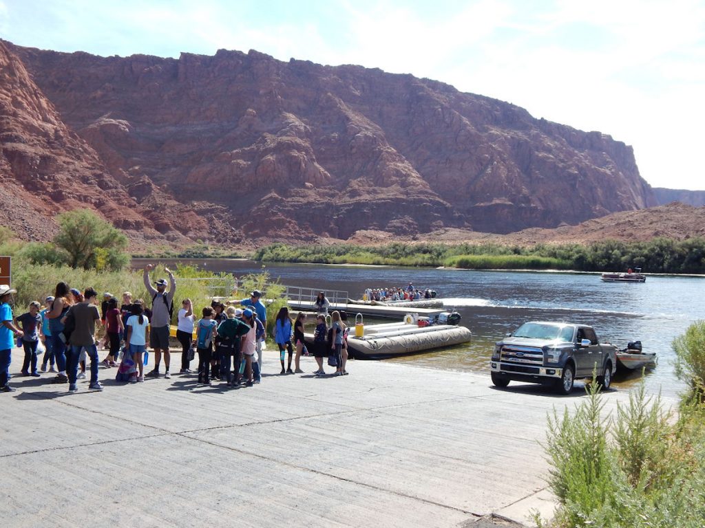
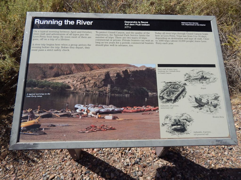
Today, bus loads of kids waited to board rafts to go explore the river and canyons.
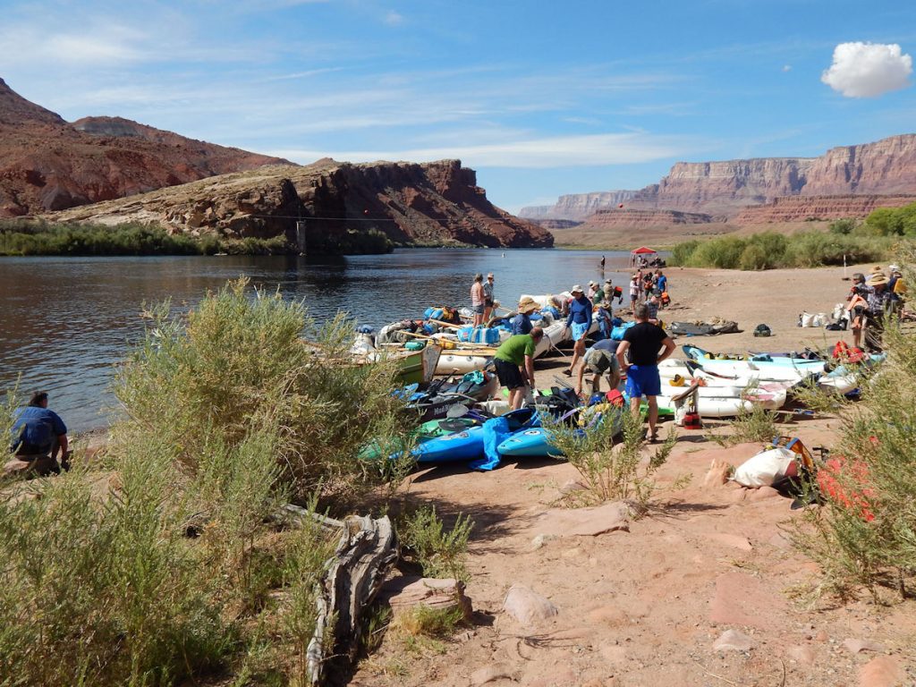
The road we came in on (and will be leaving on) goes along below the cliffs in the upper right.
Some say it was not all for the better.

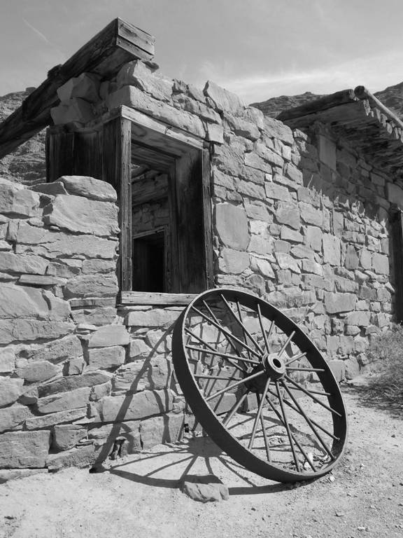
This is one of those photos that begs to be in Black and White. Which do you prefer?
Next, we returned to Rt 89A and turned left (east) just in time to see the old and new Navajo Bridges.
(You can see them both on the Google Earth photo earlier)
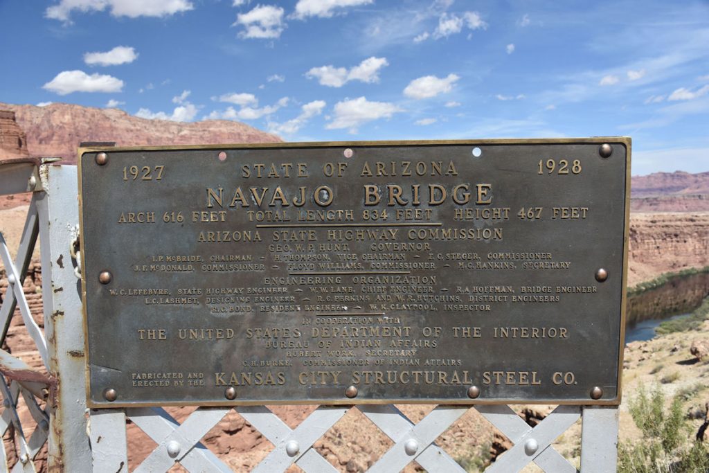
NAVAJO BRIDGES
Just east of Lee’s Ferry is a pair of similar-looking bridges spanning the Colorado River.
The original was built in 1927-1929 and carried traffic for nearly 70 years.
In 1995, a new bridge was built to replace the overworked old bridge.
To read more: https://en.wikipedia.org/wiki/Navajo_Bridge
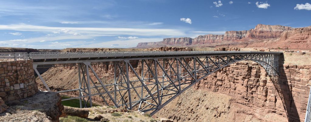
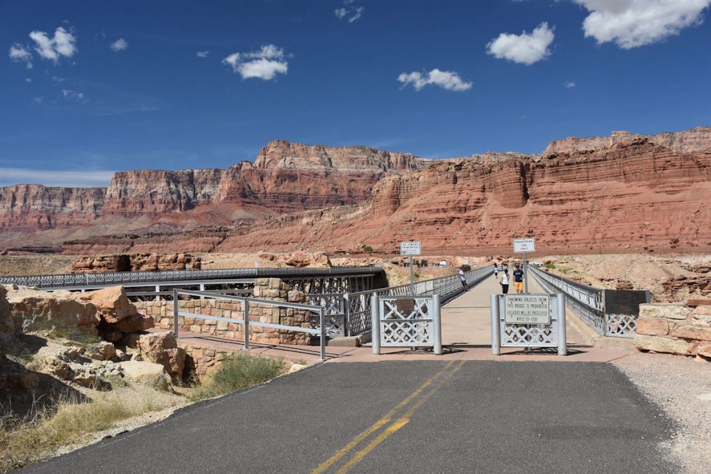
You can walk out on the old bridge for great views.
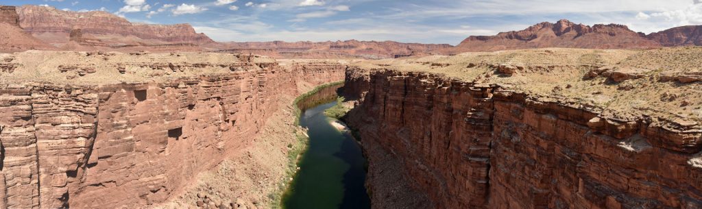
Lee’s Ferry is just a few miles up.
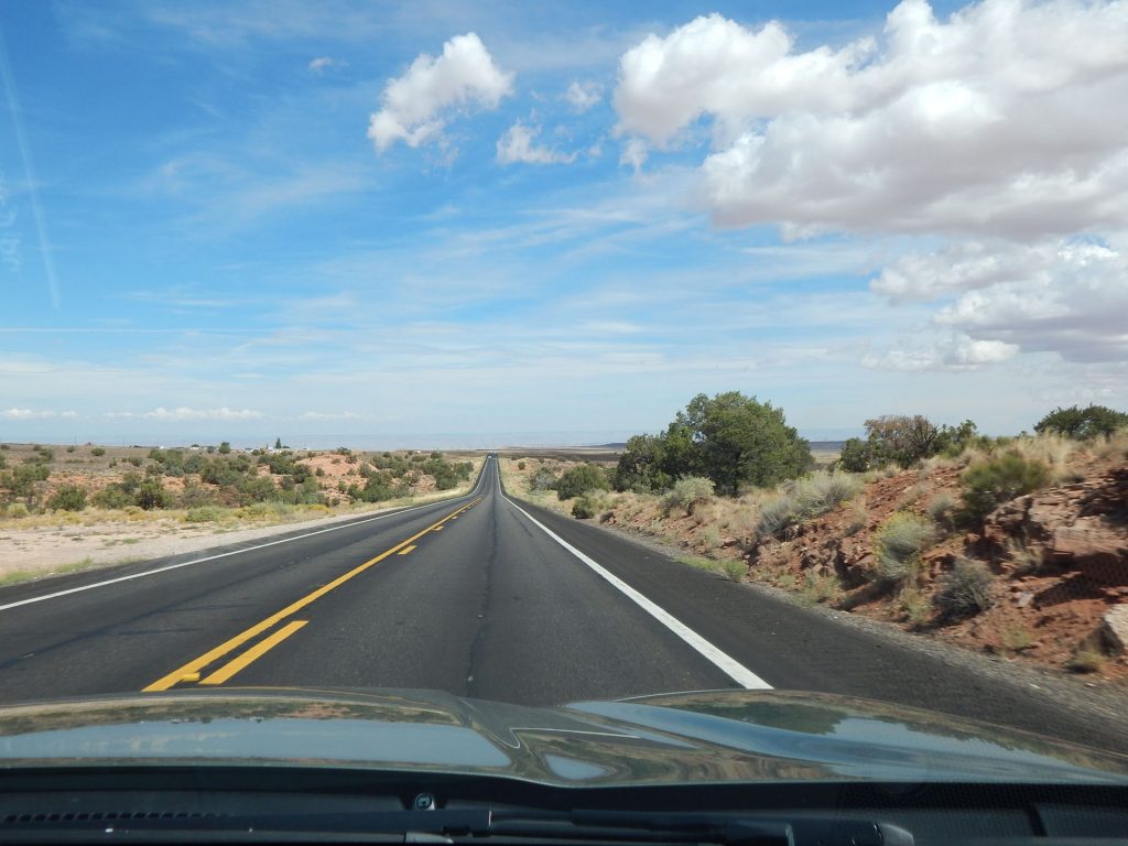
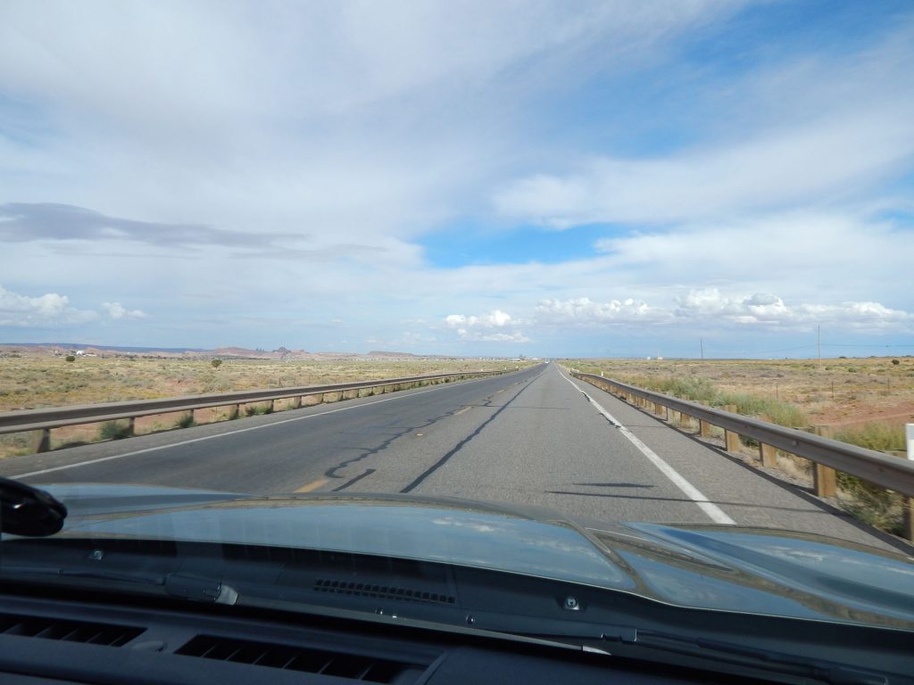
From here, we continued east and then north toward Page AZ.
Our next stop is Horseshoe Bend, which you may recognize from the photos.
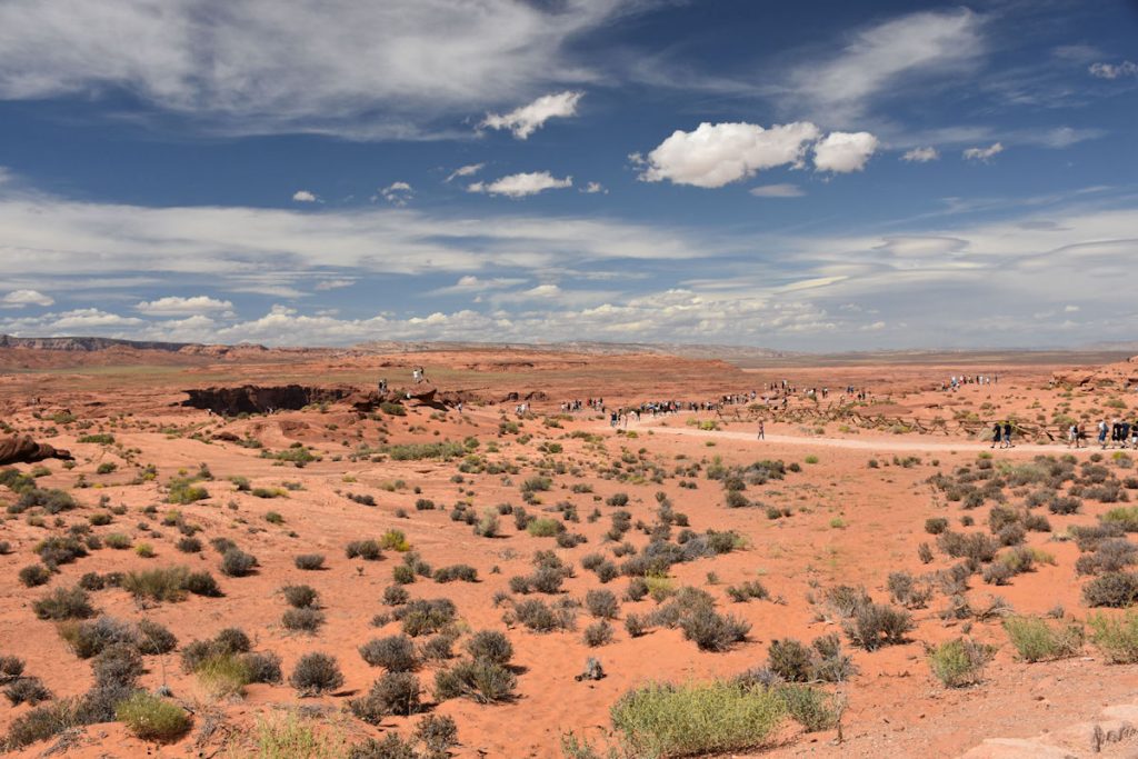
HORSESHOE BEND
Located just south of Page AZ is Horseshoe Bend.
To get there, you must pay to park, then hike 1.5 miles to the overlook.
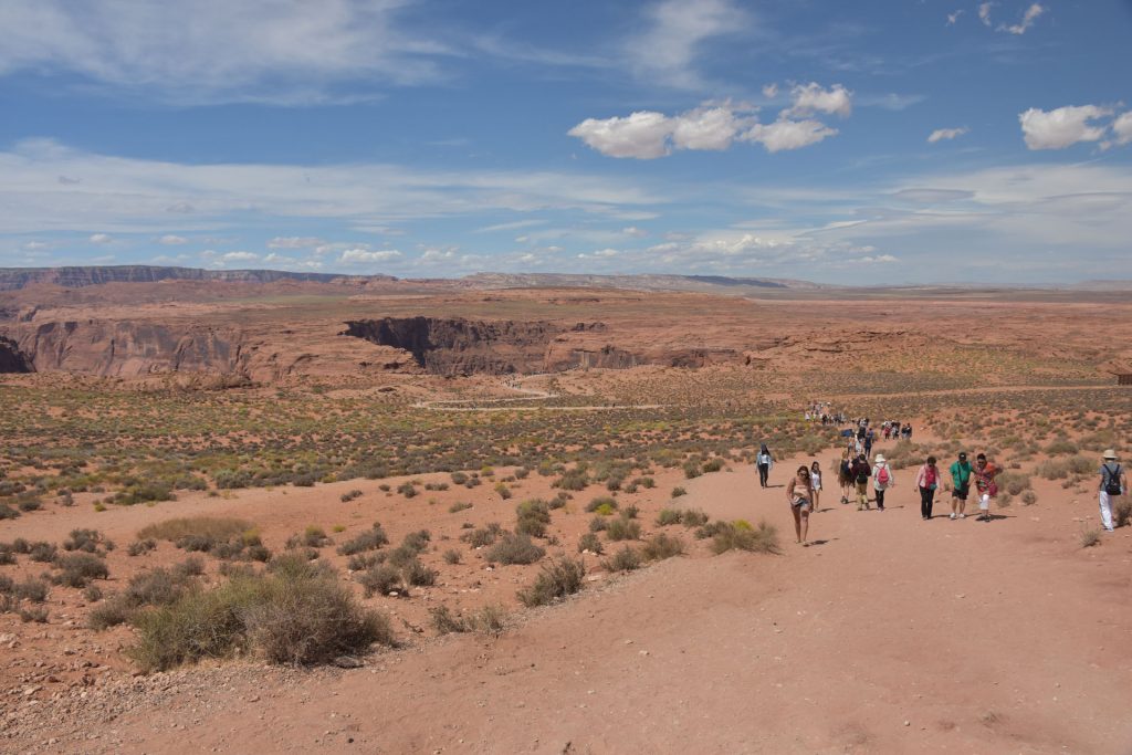
Not much else to see at this point, except that canyon up ahead and to the left.
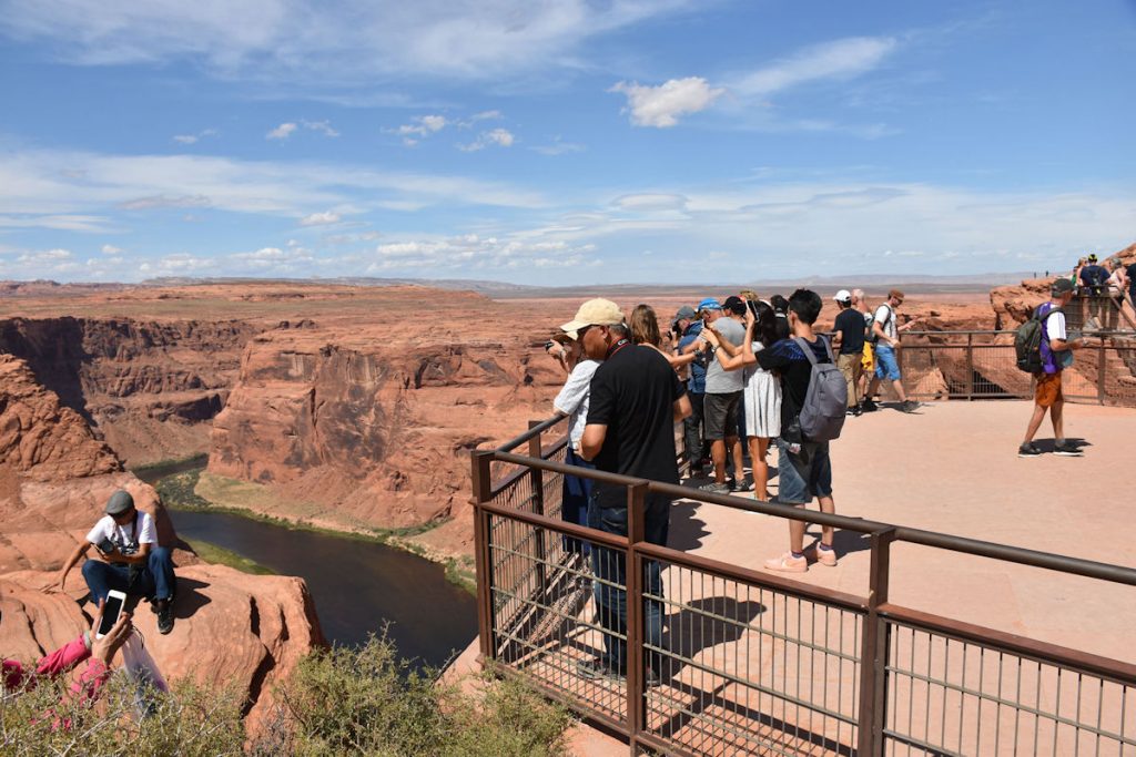
(Even though there are “Stay Off The Rocks” signs all over, some people climb out to the edges.
That’s why you hear about people falling 1,000 feet to the death each year. Oh well.)
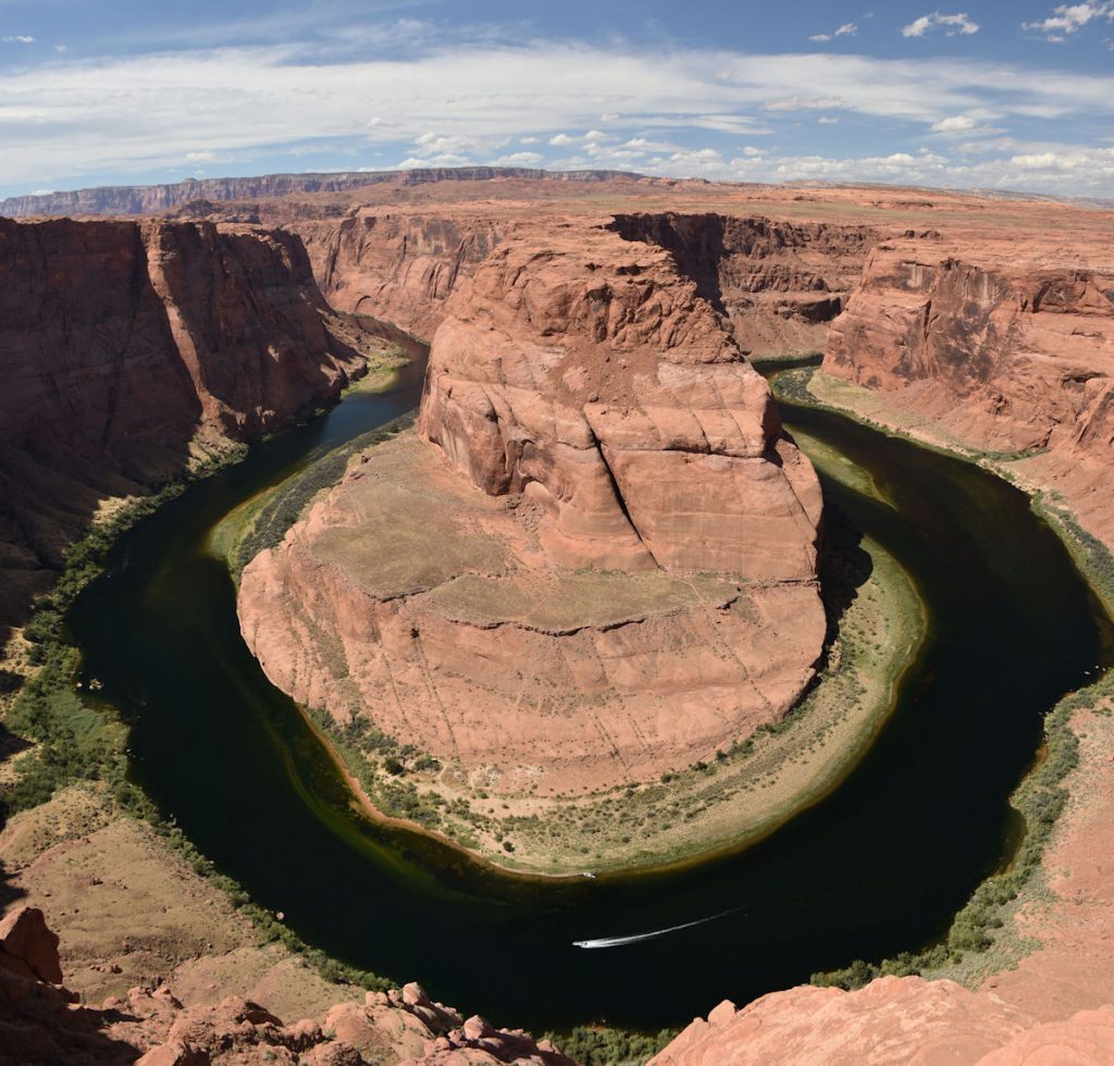
Horseshoe Bend is a good name. It really is a 1,000-foot drop from here.
For more information on Horseshoe Bend: https://en.wikipedia.org/wiki/Horseshoe_Bend_(Arizona)
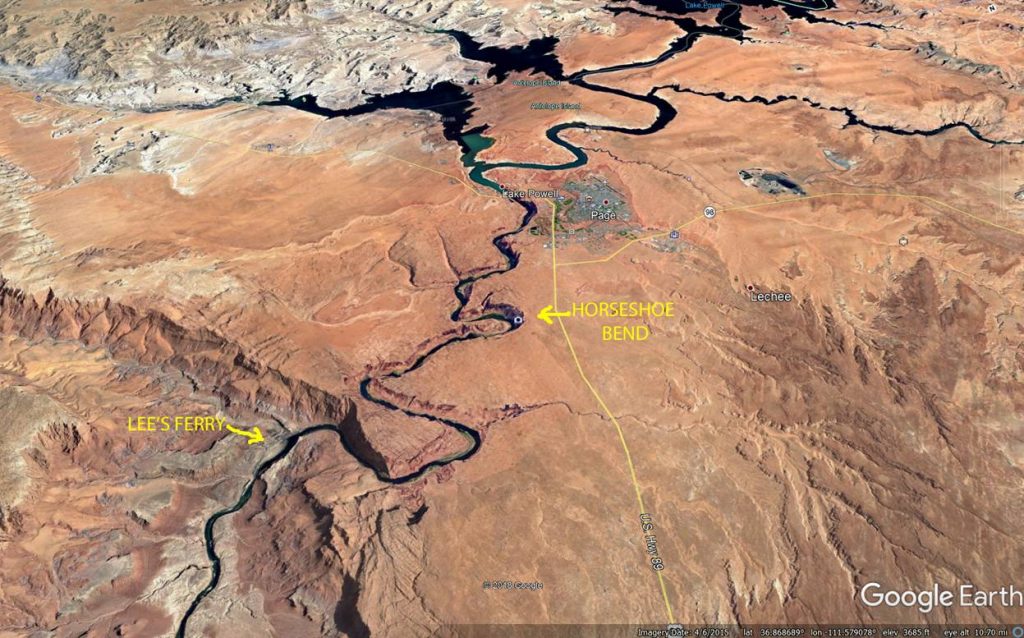
This Google Earth image shows the twisty path of the Colorado River.
Next, we will be heading east on Rt 98 off to the right.
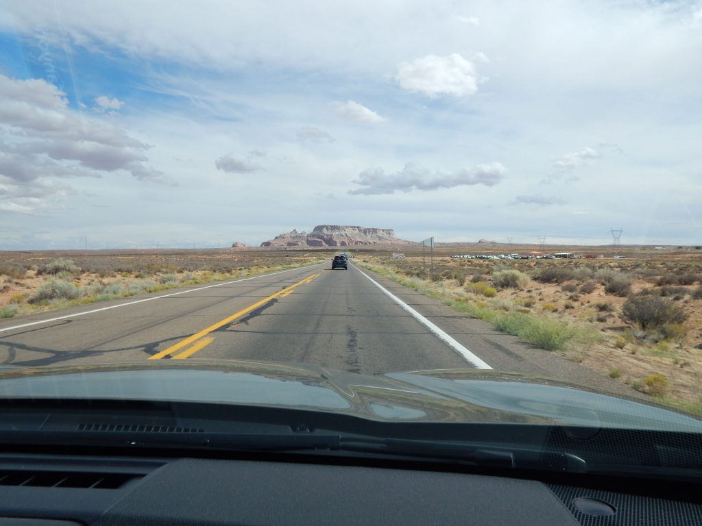
PAGE / ANTELOPE CANYON
Now it was lunchtime and we were hungry. Since we have been trying a lot of different foods the
past 2 weeks, we both said we would just like a hamburger. So, we pulled into McDonalds
at Page for a quick lunch before continuing to Kayenta.
We are now at around 5,700 feet elevation, compared to 4,300 feet back in Page.
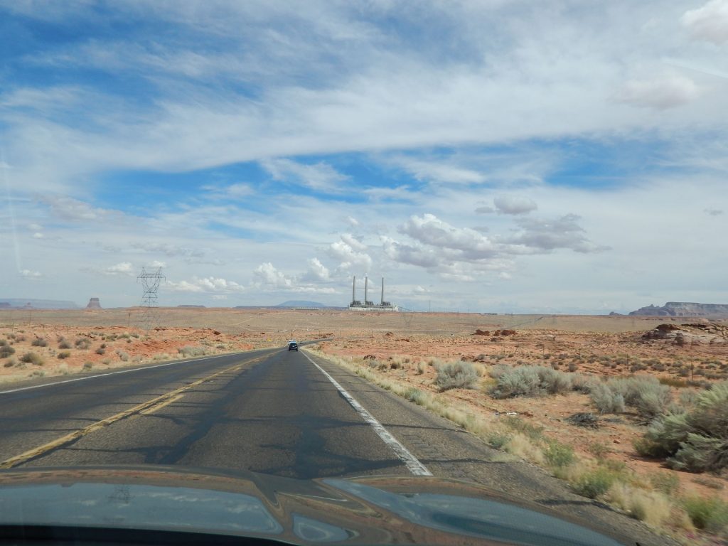
It is one of several coal-fired plants being shut down this year. Its 430 employees will soon be out of work.

Helpful Hint: We have found casinos quite often offer great meals and buffets for low $$.
Tonight, we watched TV and rested as we planned ahead for
tomorrow’s drive through Monument Valley and 4 Corners.
We hope you will join us again tomorrow! See you then!
Mileage Today: 230 Miles
Trip Total: 3,864 Miles