Southwest – Day 18

Southwest USA

Retirement Trip

September 2019

29 Days – 6,500 Miles – 19 States

7 National Parks

Several State Parks – 6,000+ Photos

1 Trillion Insects Squished by Car Windshield

 From 108 Degrees to Snow

From 282 Feet Below Sea Level to 12,000+ Feet

Bison, Elk, Prairie Dogs, Lizards, Wild Horses

Elvis, Aliens, John Wayne Westerns

Walking In The Footsteps of Forrest Gump

And More! 


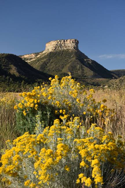
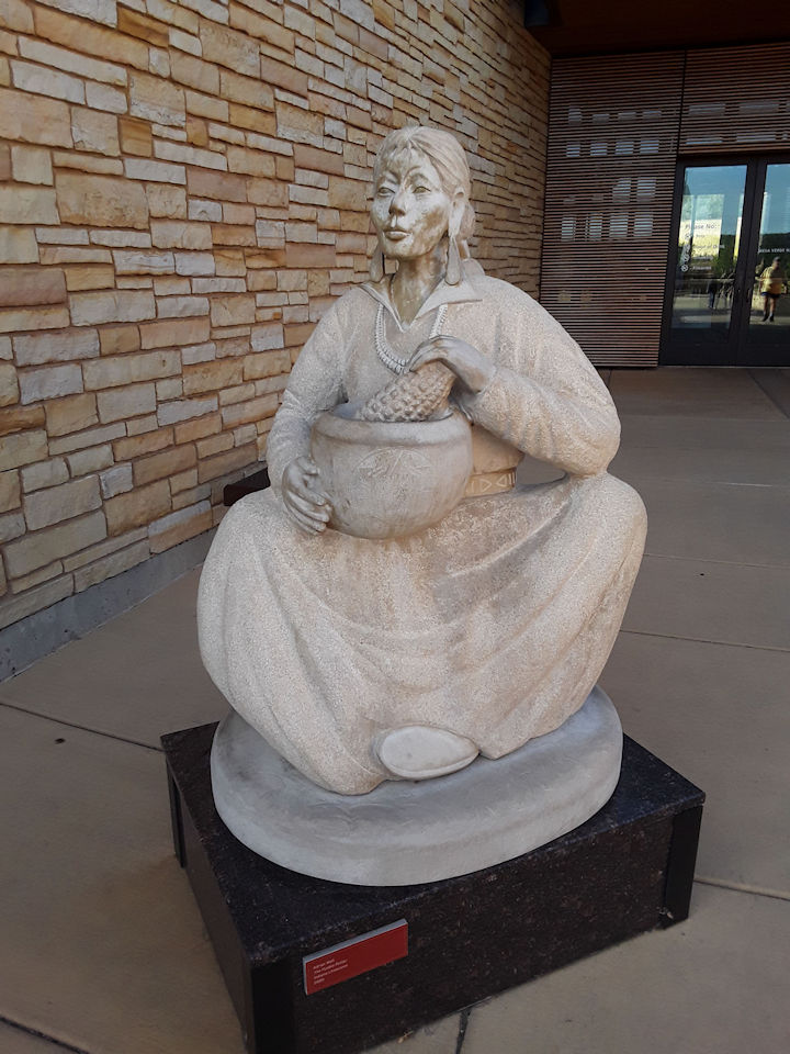
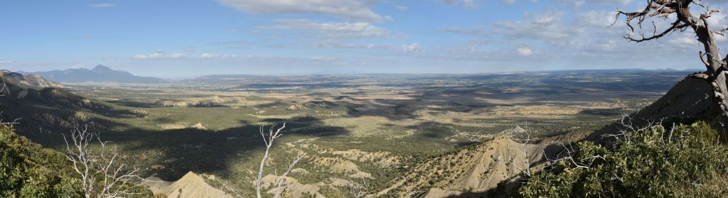
Mesa Verde National Park, Colorado

Today we explored Mesa Verde National Park near our hotel in Cortez, Colorado
 
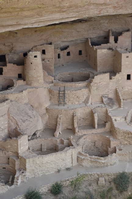
Established by Congress in 1906, Mesa Verde NP occupies over 52,000 acres.   With more than 5,000 sites, including 600 cliff dwellings, it is the largest archaeological preserve in the United States.   Cliff Palace is thought to be the largest cliff dwelling in North America.
This large butte, Point Lookout, greets visitors at the park entrance.
Mesa Verde National Park Visitor Center.
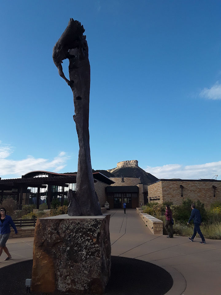
Sculpture “The Ancient Ones” was created by Edward J. Fraughton and gifted to the park. It depicts an ancestral Puebloan climbing up a cliff face using hand and toe holds while carrying a bundle of wood for fuel.
“The Pueblo Potter” by Adrian Wall.   Next to Visitor Center entrance.
The Park Entrance and Visitor Center is at the top of the map.
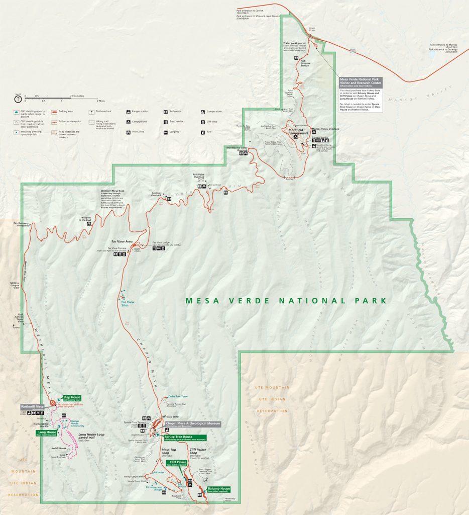
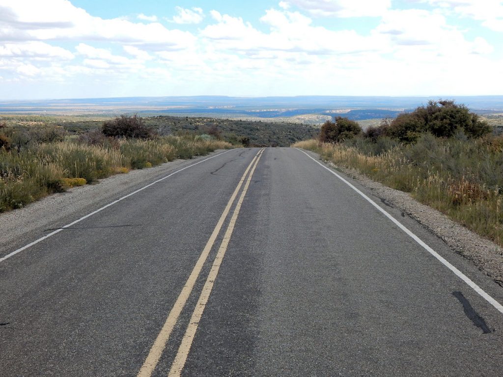
After getting maps and figuring out our plan for the day, we headed out from the Visitor Center.
First, we will head straight to the bottom of the map and visit Mesa Top Loop and Cliff Palace Loop.
It’s about 25-30 miles, so there is plenty to see along the way.
 
Later, we will backtrack to the middle and go down Wetherill Mesa to the Step House on the western edge.
Entering the park, we first climbed up the long hill to the mesa (flat plain at high elevation).
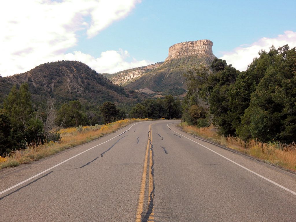
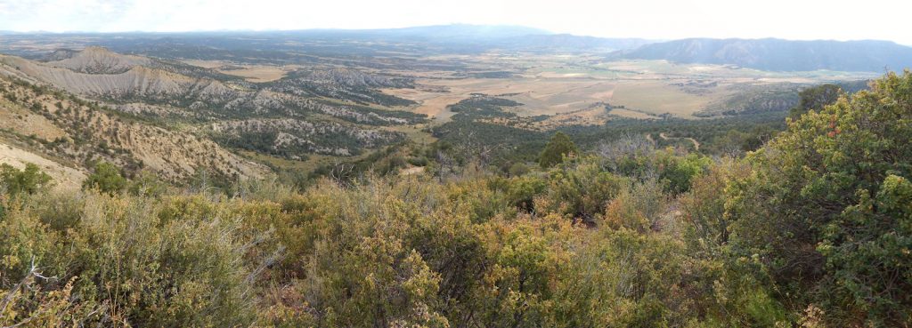
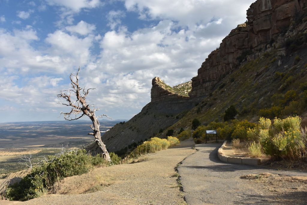
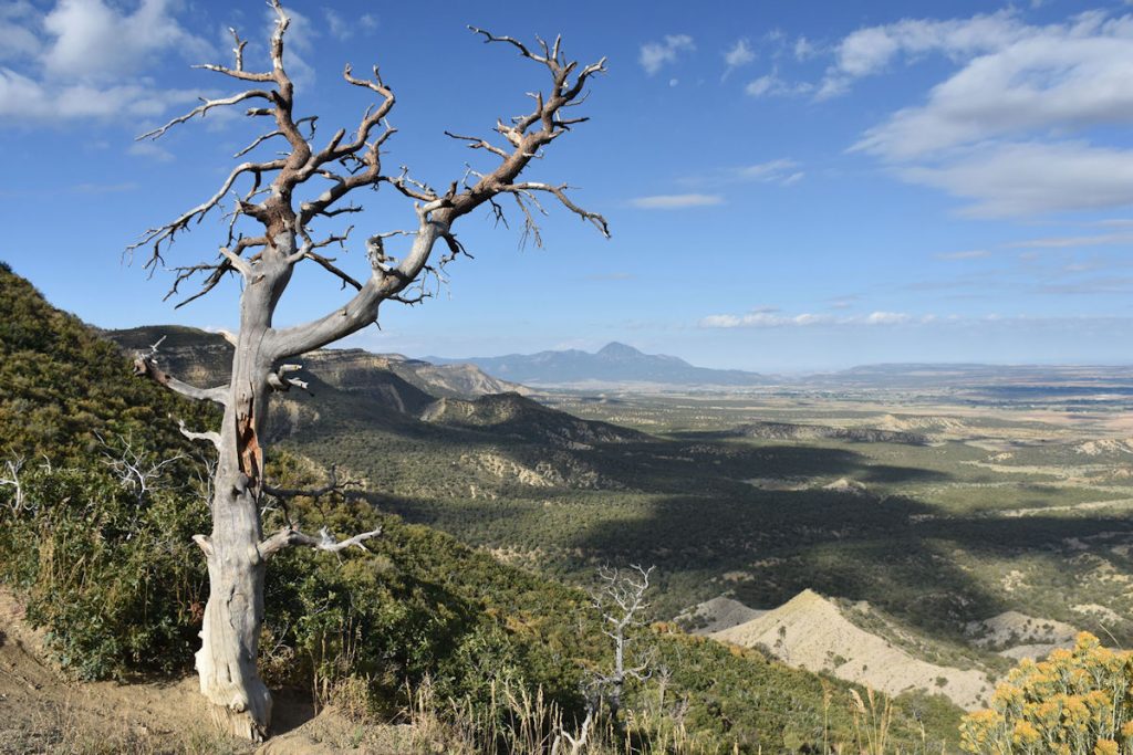
We got to enjoy the view of Point Lookout on the way up. 
Partway up the long climb, we pulled over to the Mancos Valley Overlook to enjoy the view to the east.
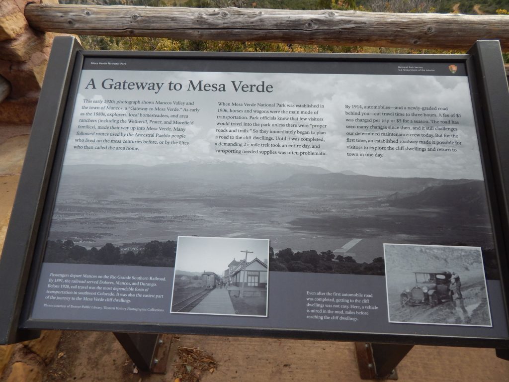
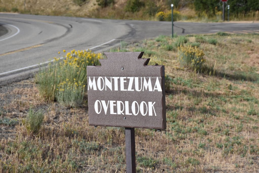
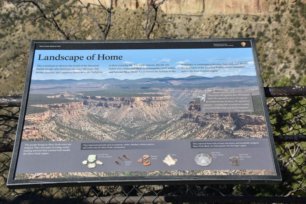
This sign gives some history of the area.
Panorama view of Mancos Valley to the east.
As we neared Montezuma Valley Overlook, we went through this long tunnel.
This sign by Montezuma Valley Overlook tells us we broke our altitude record we set at the Grand Canyon North Rim a few days ago.
Only by about 200 feet, though.   In a few hours, this one will be bumped to second place.
Between Montezuma Valley Overlook and Park Point Overlook, the road levels out at around 8,300 feet elevation.

MONTEZUMA VALLEY OVERLOOK

Our next stop.
Early travel through the park was somewhat perilous. 
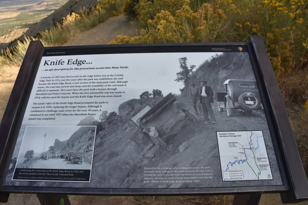
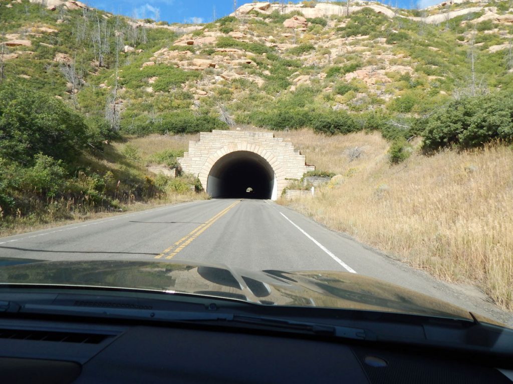
Now, the tunnel offers a more direct route without having to take this narrow road.
View of the old Knife Edge Road from previous photo. 
Informational sign at Montezuma Valley Overlook.
Panorama from Montezuma Valley Overlook.
From Montezuma Valley Overlook, looking west toward Cortez and our hotel. 

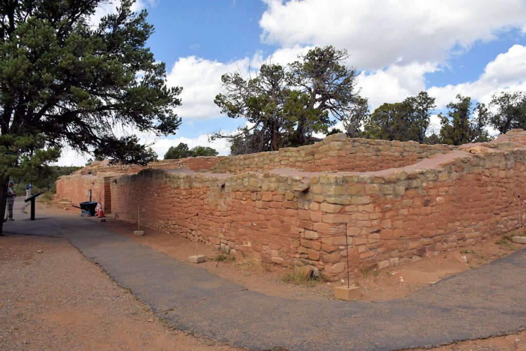
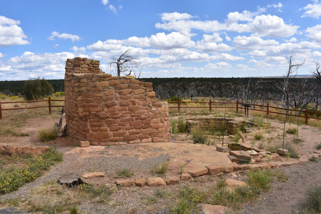
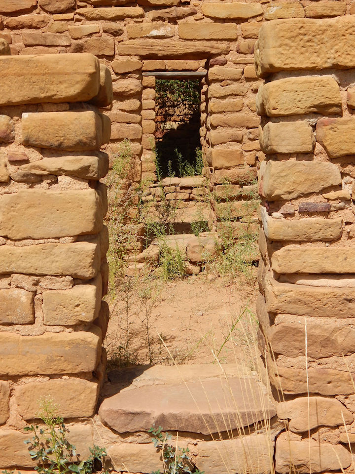
SQUARE TOWER HOUSE (South End of Park)

Our first view of a cliff dwelling was at Square Tower House at the south end of the park.

Just a short hike from the parking lot was the Square Tower House.
This close-up shows how the Square Tower House got its name.
Another close-up of the namesake tower.
The tower is the tallest structure in Mesa Verde NP.
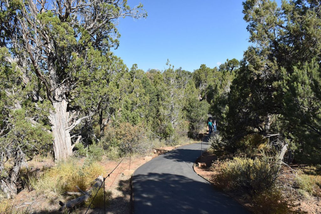
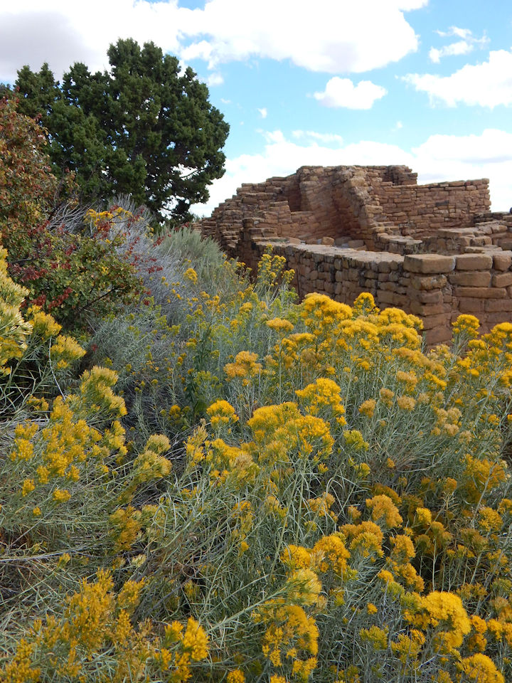
TRAILS

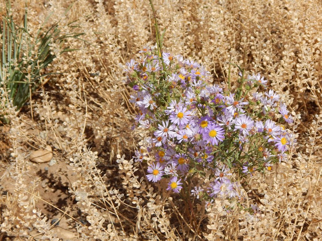
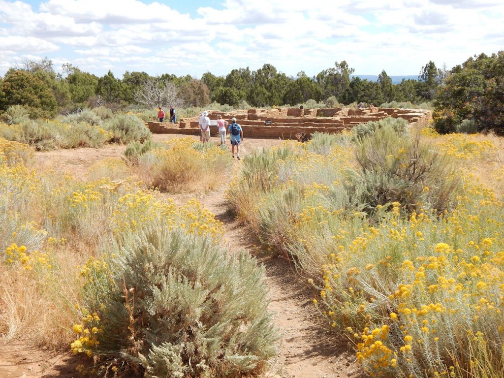
Throughout the park, there are walking trails connecting various sites. 

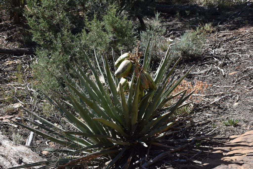
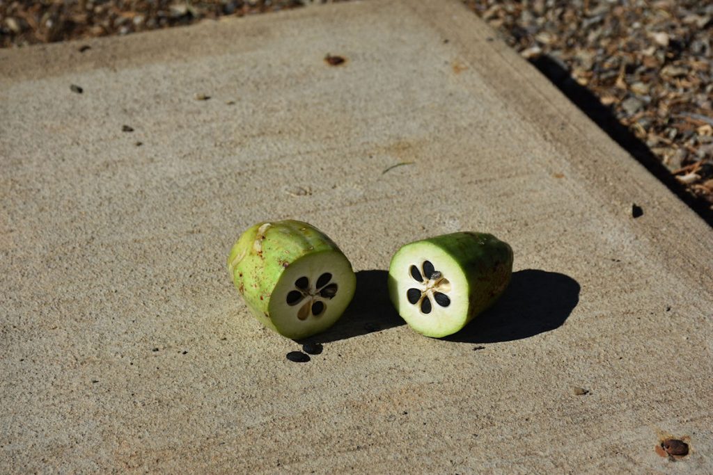
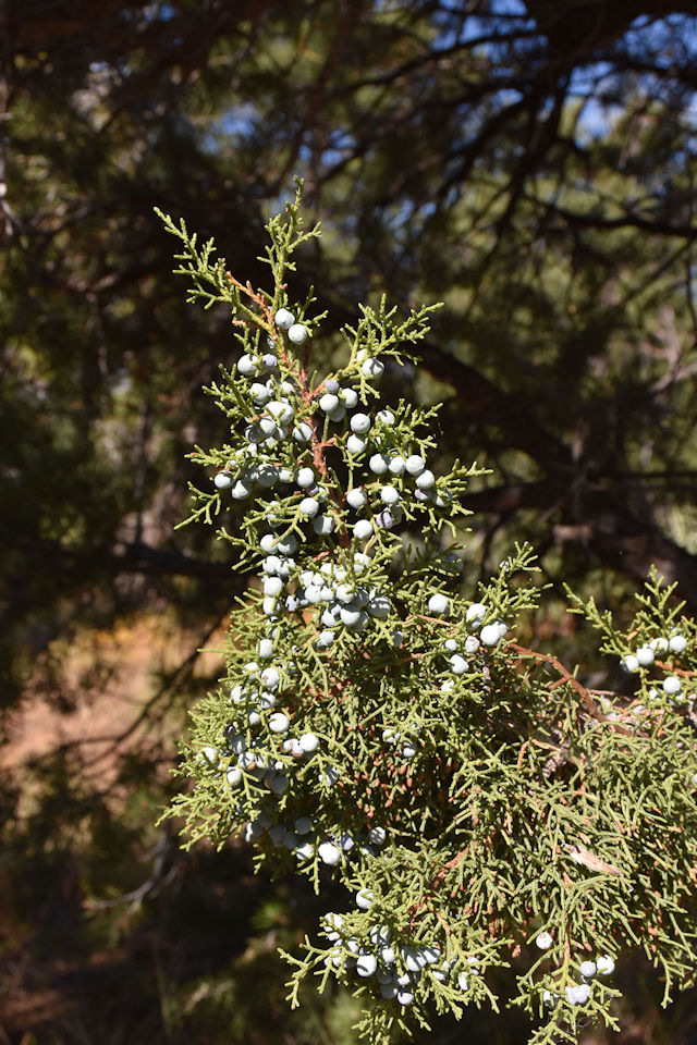
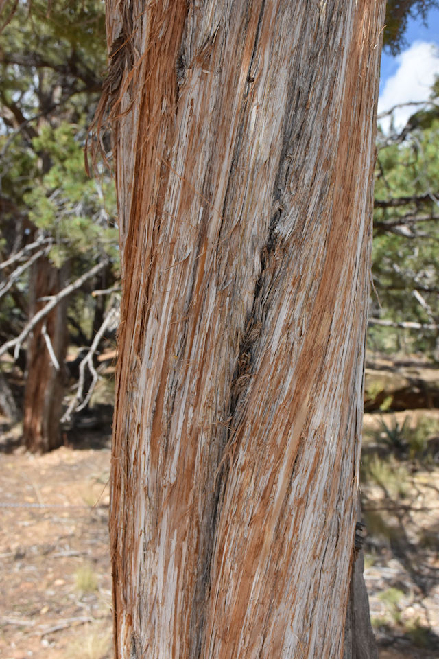
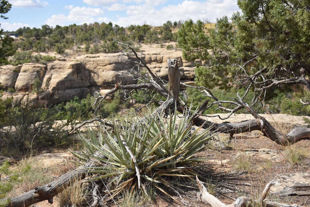
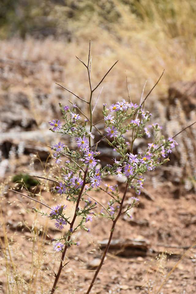
Here are some photos of flowers and interesting things we saw along the trails.

One of many trails connecting various sites.
Yucca plants were very common in this area, and have large fruit.
Yucca fruit cut open. (Park display)
The berries on this pine tree were not quite ripe yet.
Interesting colors in this tree that has shed most of its bark.
Typical scene from this area. 
And lots of pretty flowers.
Colorful daisies. 

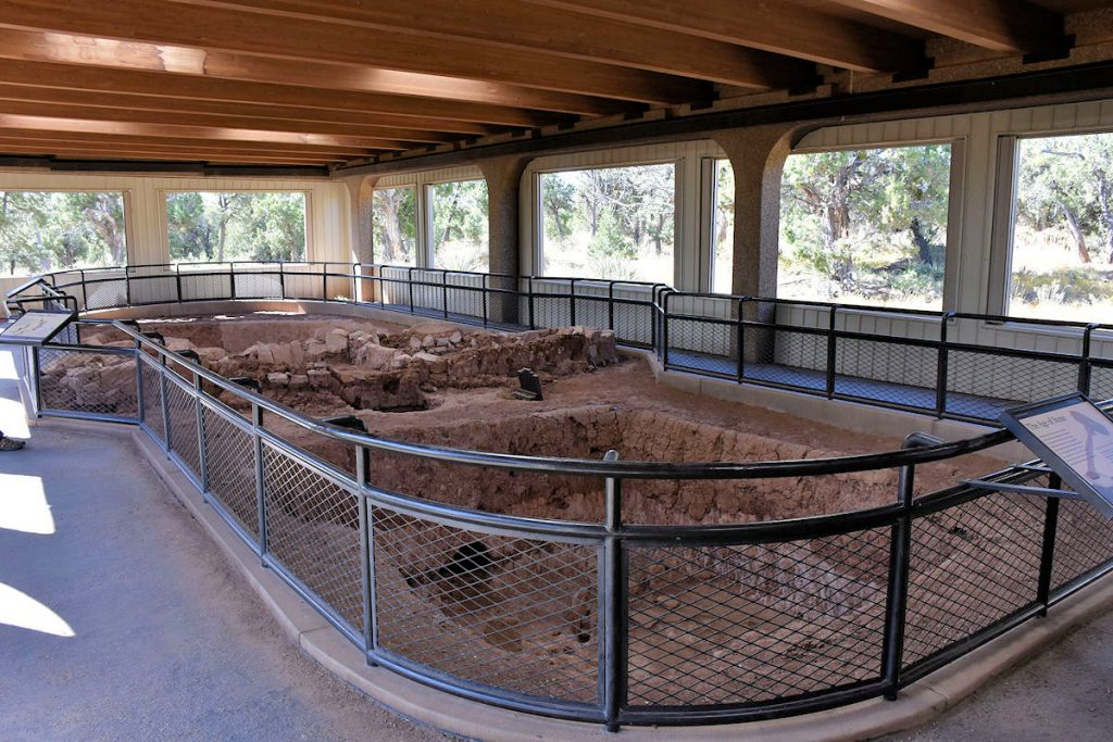
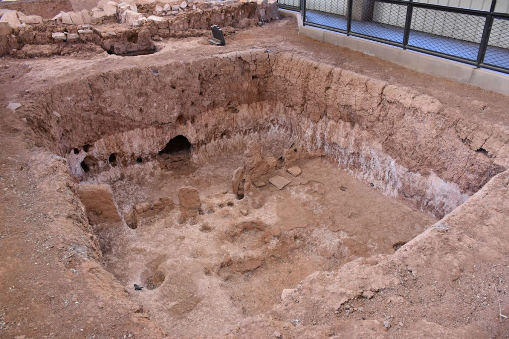
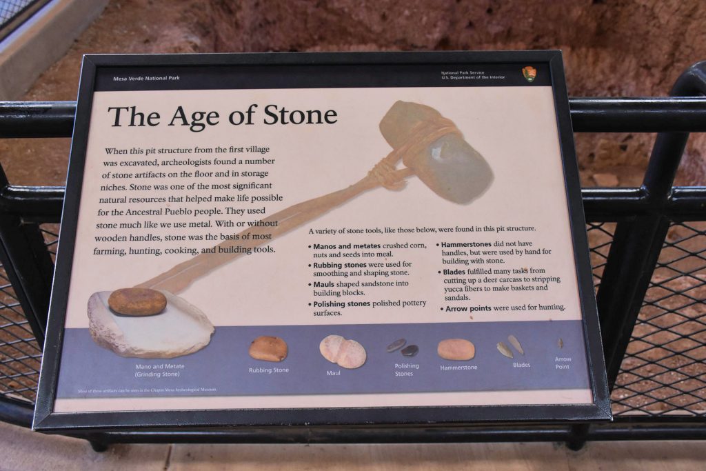
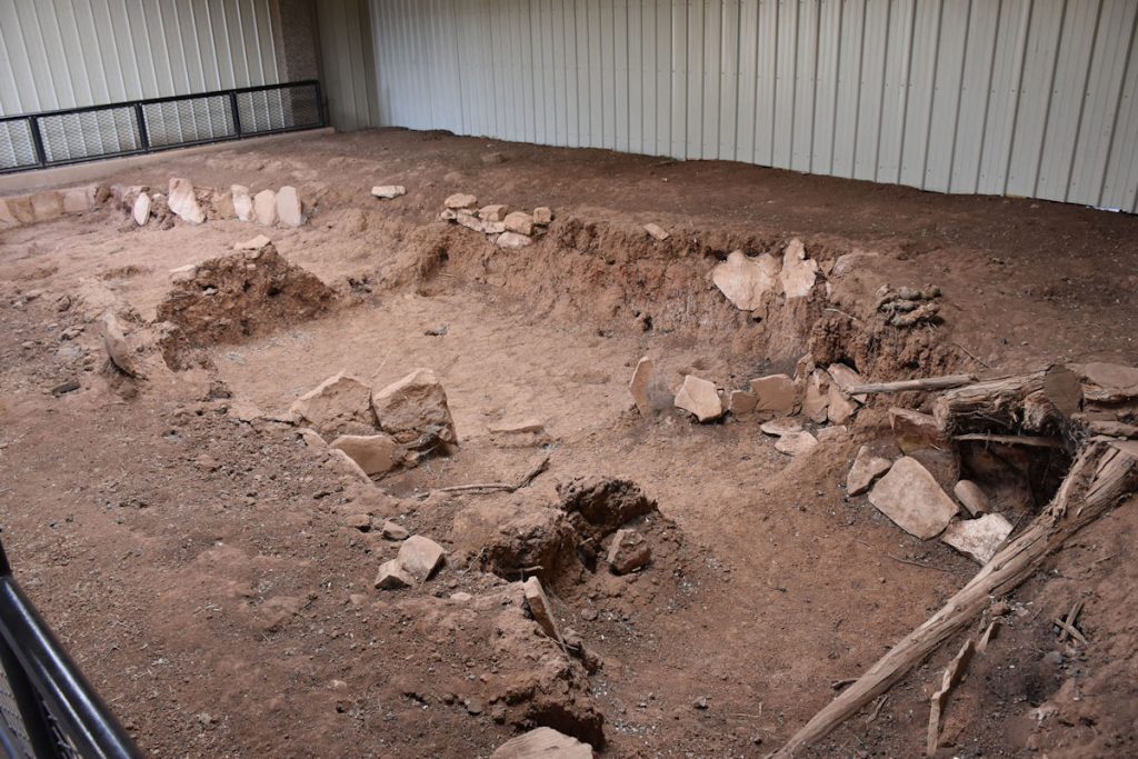
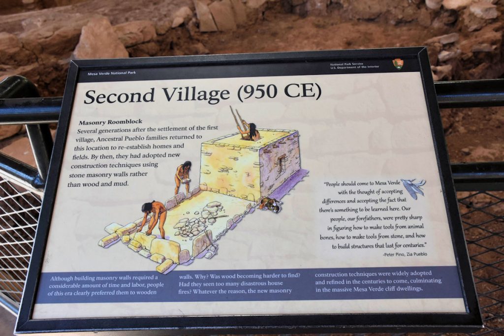
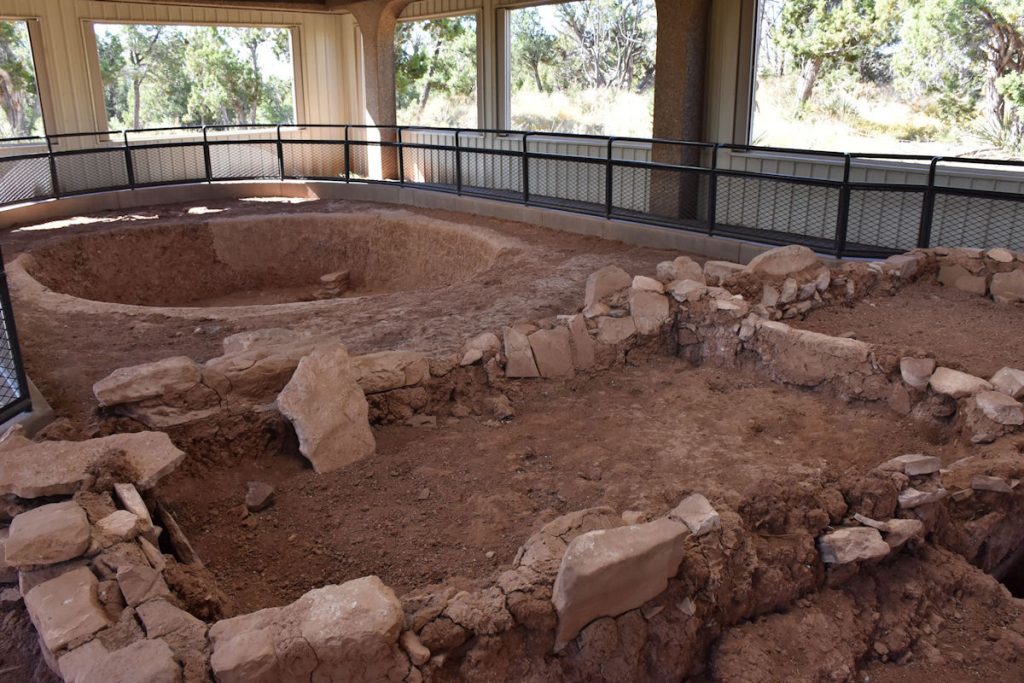
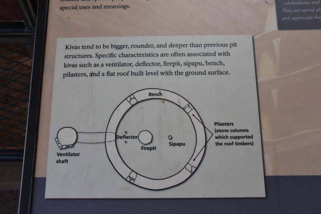
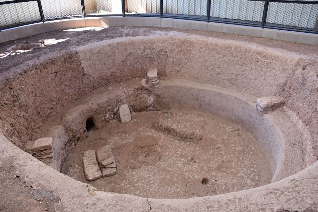
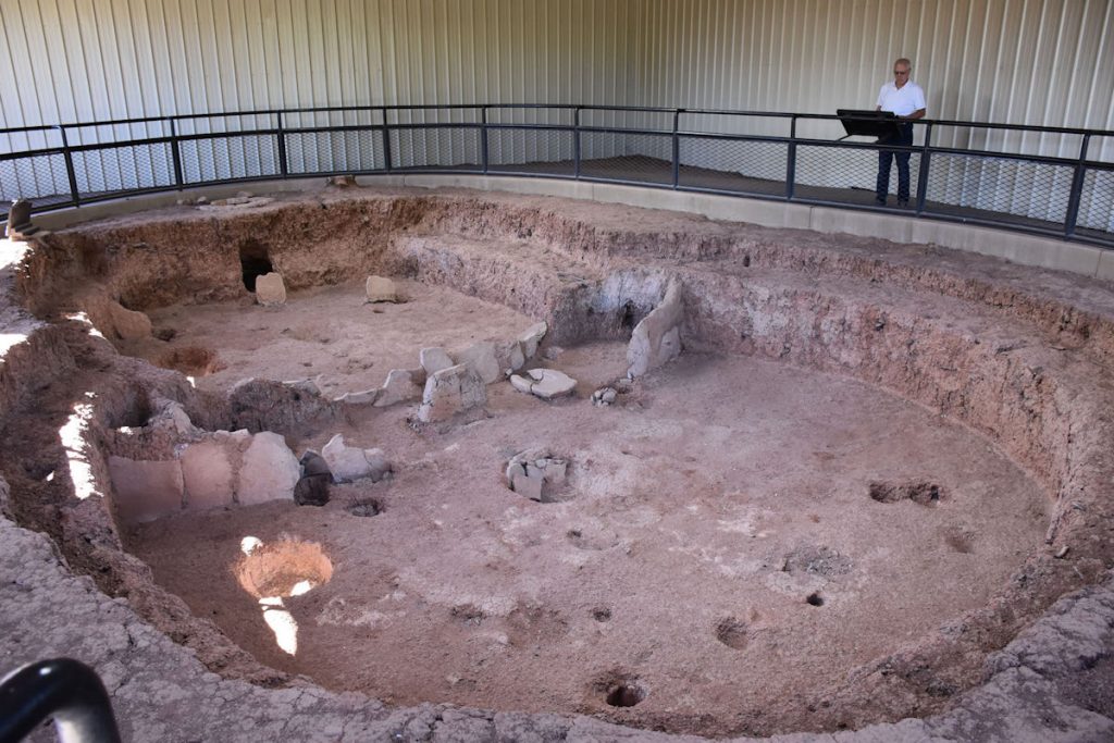
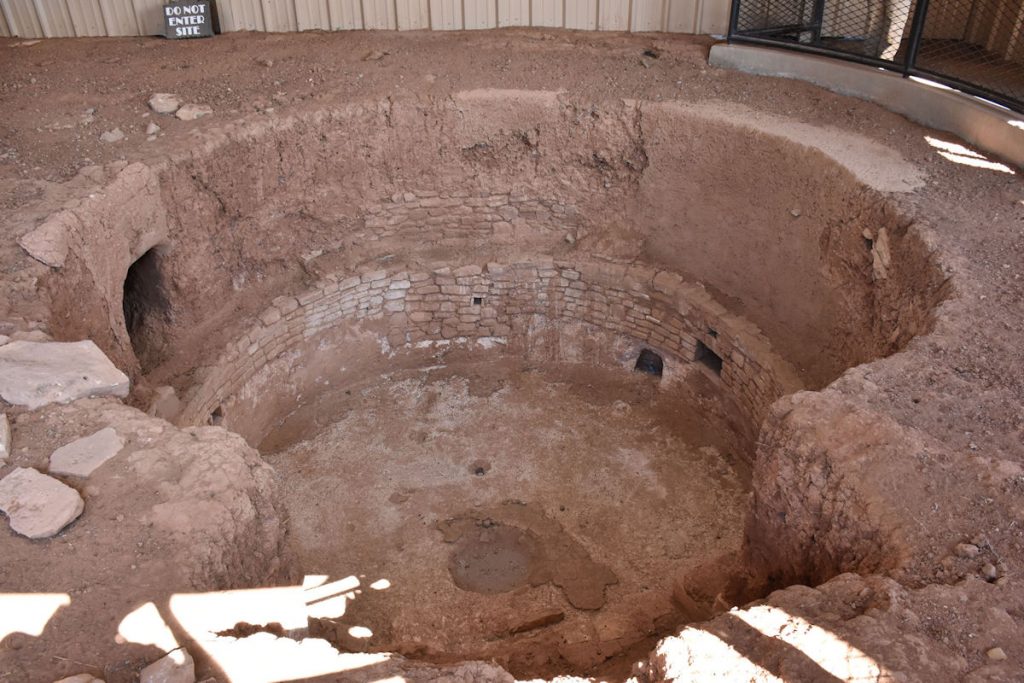
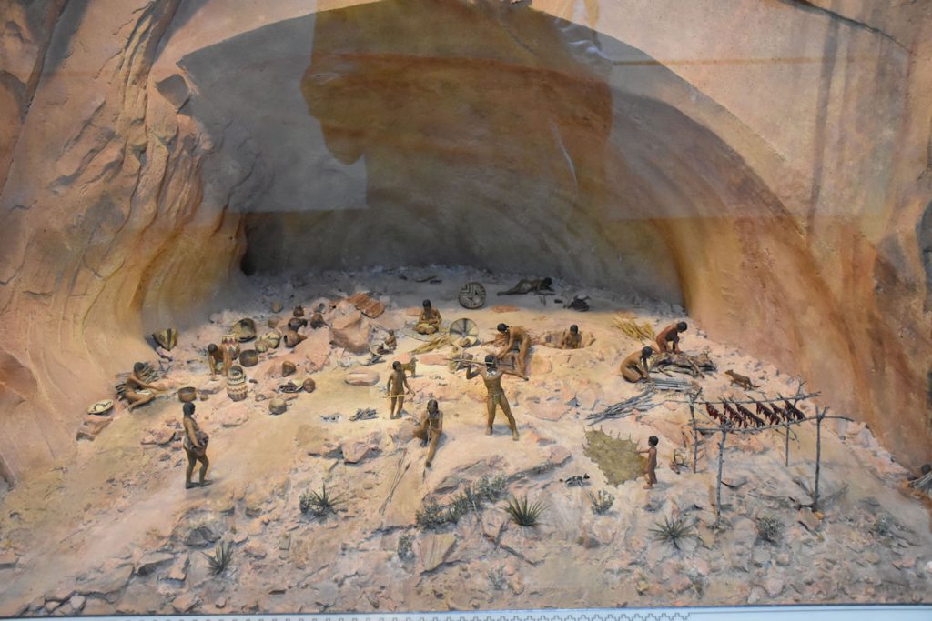
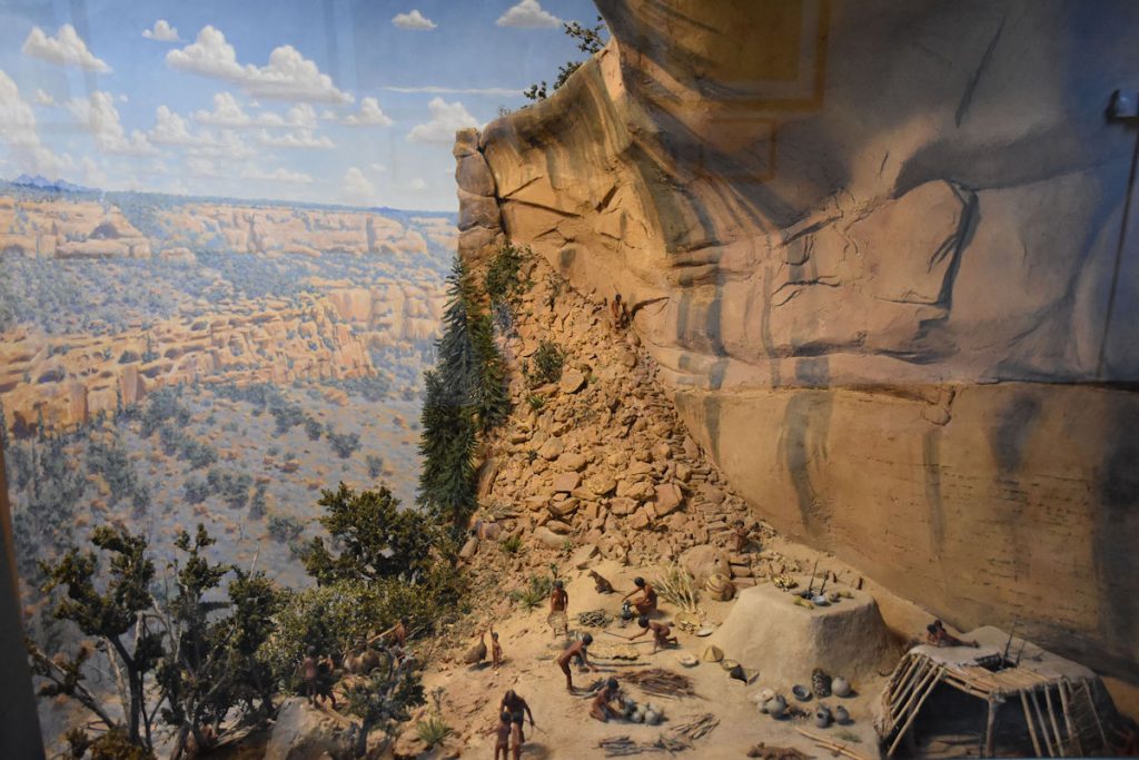
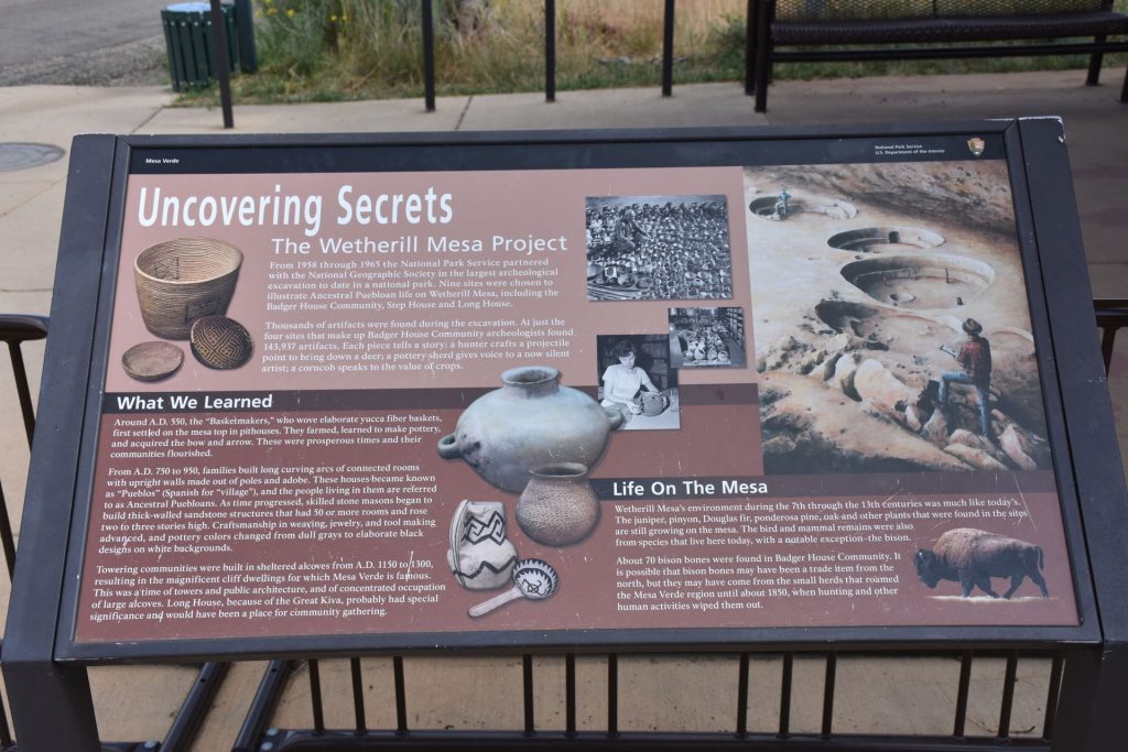
PIT HOUSES AND VILLAGES

This was an interesting exhibit.  The Puebloan residents built homes partially below ground level.
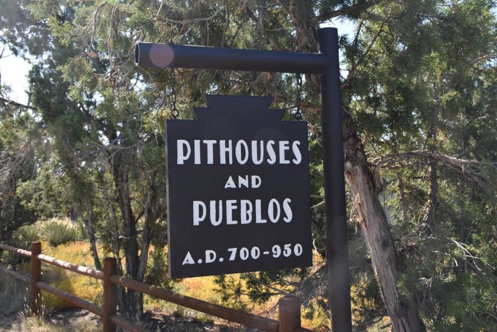
They did this so the homes would be cooler in the summer and warmer in the winter. 
Hard work to build a pit house, and they needed to be replaced every 10-20 years.
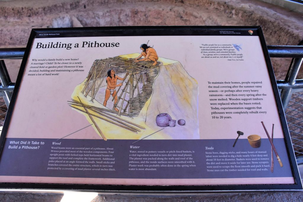
It looks like many were built over the same pit as the previous home.
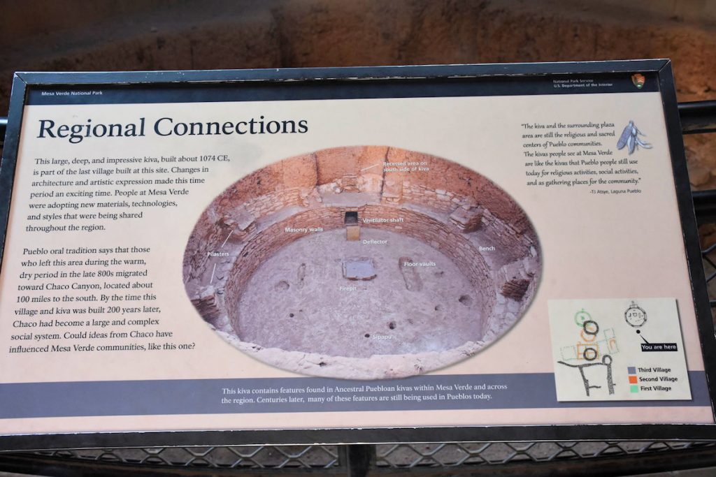
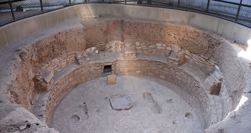
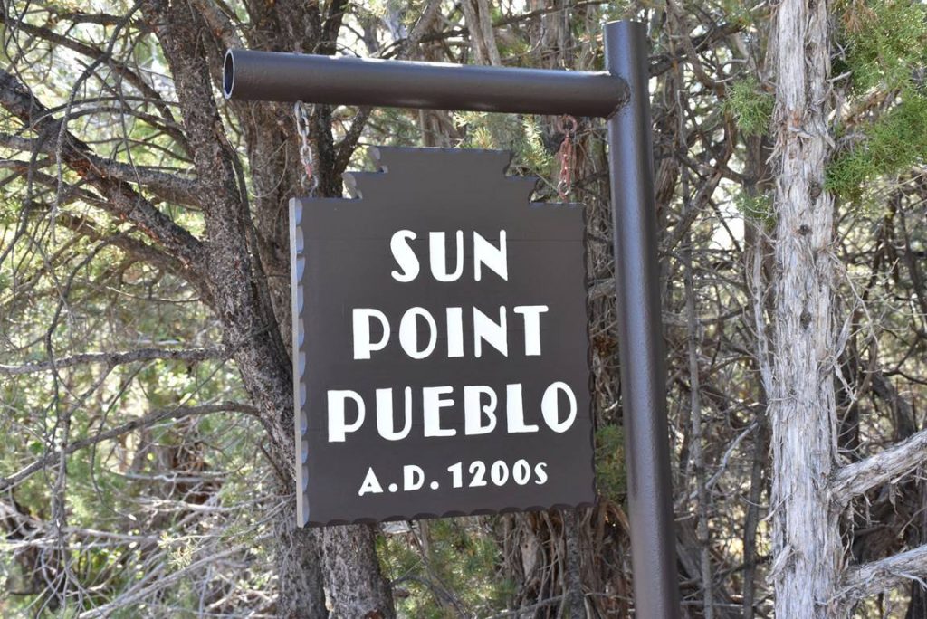
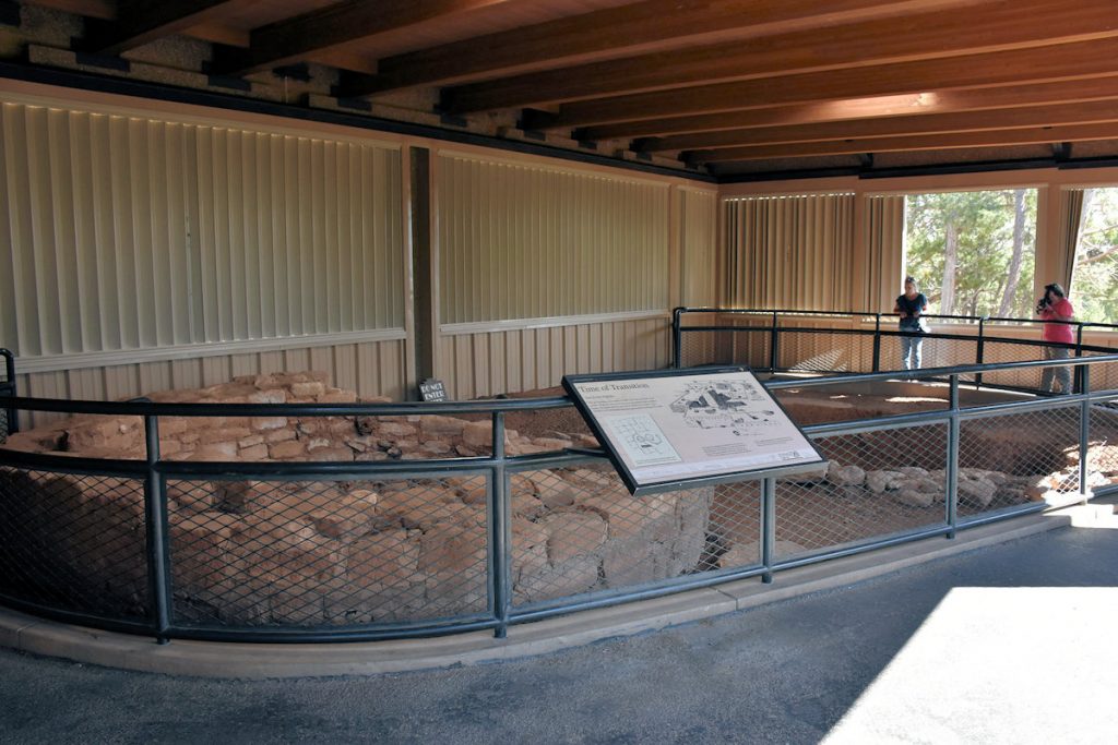
The original pits were protected under roof.
Original pit house remains.
Some of the tools used by the Puebloans at the time.
Another pit house protected from the weather.
Another informative sign.
More pit house remains.
This sign describes the details of the kiva in the next photo.
This is the kiva described in the previous photo.
Some of these pit houses were quite large.
This sign describes in detail the features of the kiva shown in the next photo.
The details of this kiva are described in the previous photo.

SUN POINT PUEBLO

Our next stop on the Mesa Top Loop was the Sun Point Pueblo.

Sign for Sun Point Pueblo.
This sign indicates this was one of the last villages built on the mesa top. 
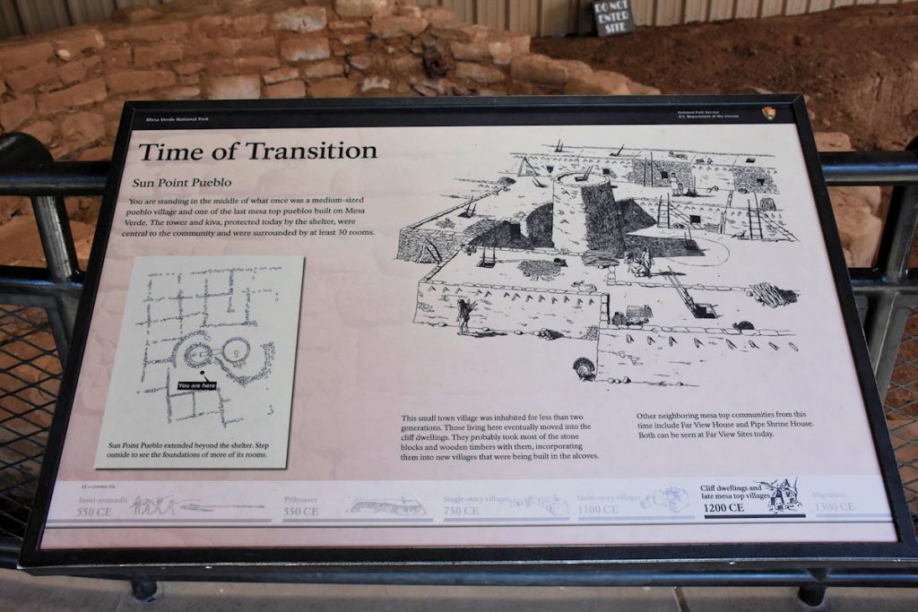
After living here just 2 generations, the next villages were cliff dwellings. 
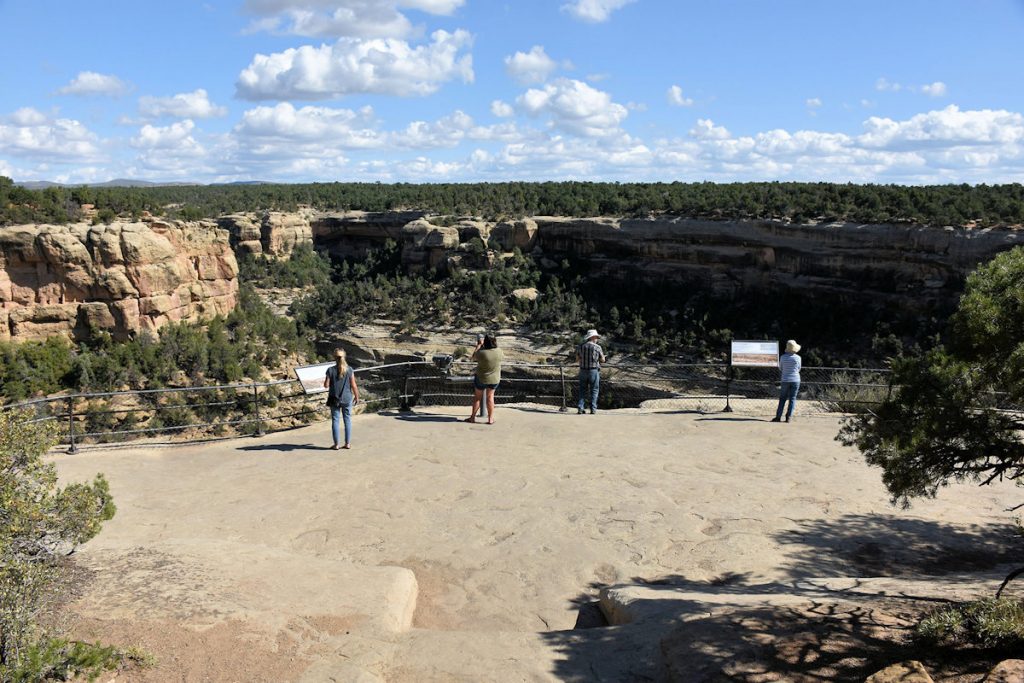
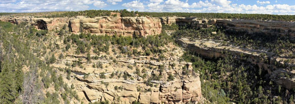
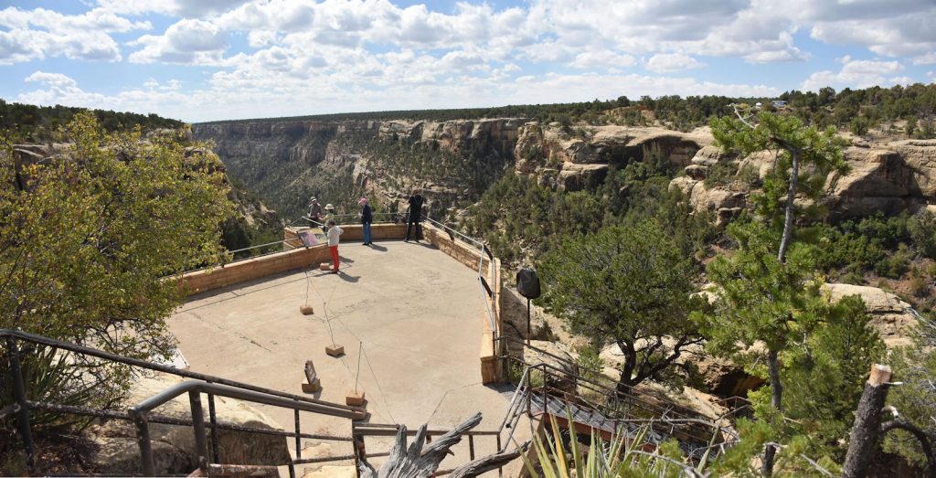
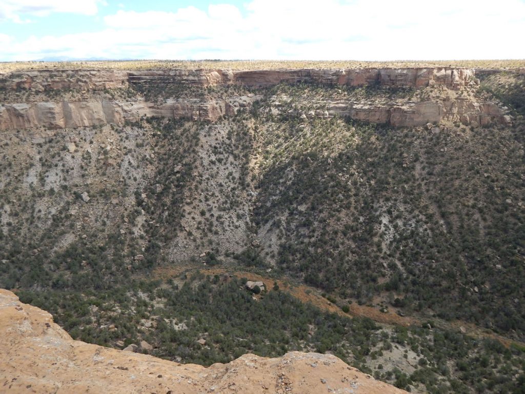
The remains of this village are also protected from the weather.

SUN POINT VIEW

Just around the next corner, we entered an area where there was a
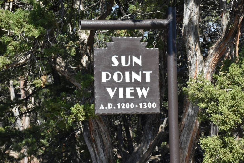
great view up the canyon where there are several cliffside dwellings.
Sun Point View overlook. 
This sign at Sun View Point shows some of the cliffside dwellings we will be visiting.
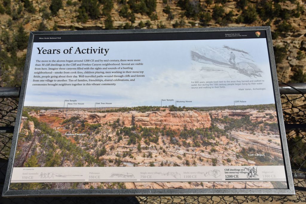
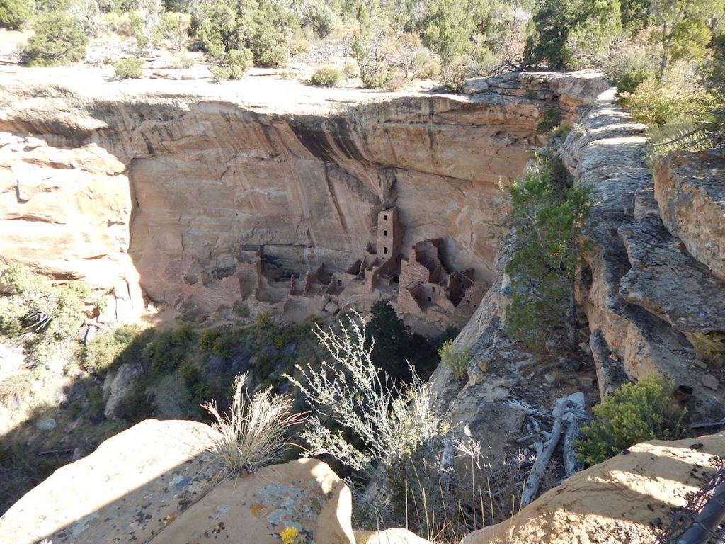
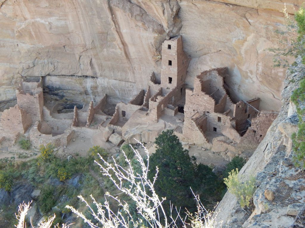
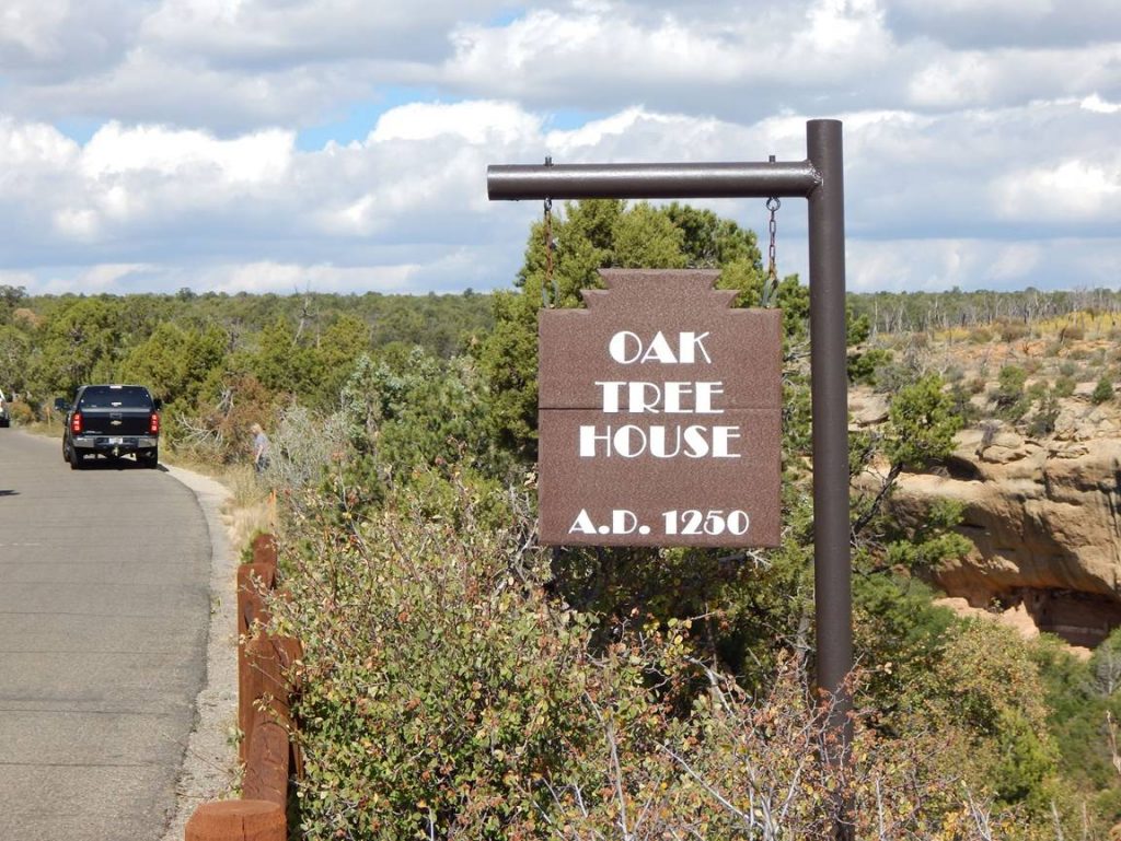
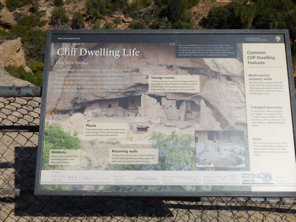
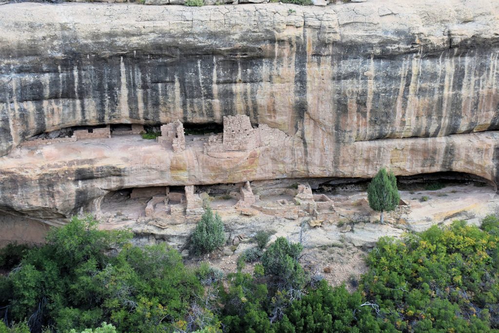
Since the road loops around from the left, we will be seeing Oak Tree House first, then Fire Temple,
and then Sun Temple and Cliff Palace.
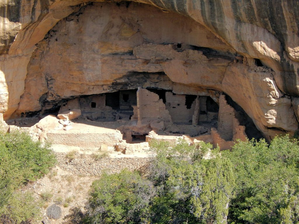
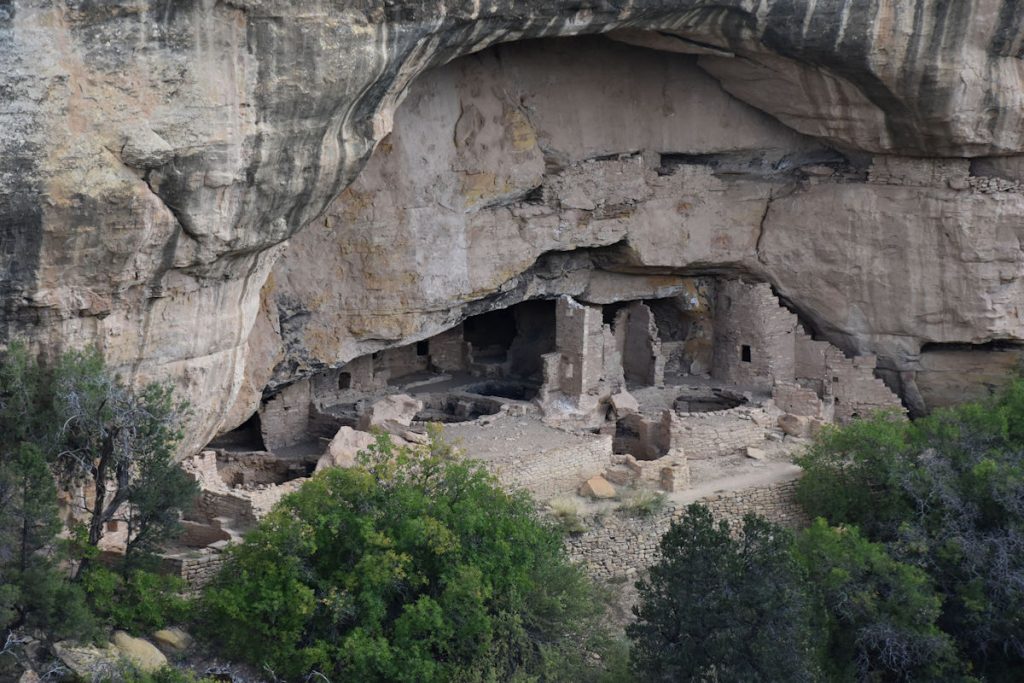
View of the canyon shown on the sign in the previous photo.
Way off in the distance, we could see Cliff Palace.  (We will see it up-close shortly)

OAK TREE HOUSE

From the previous overlook, it is just a 5-minute walk to the Oak Tree House overlook.
This sign describes the Oak Tree House. 
Oak Tree House. 
Better photo of Oak Tree House in the shade.

FIRE TEMPLE

Just to the left (north) of the Oak Tree House is the Fire Temple.

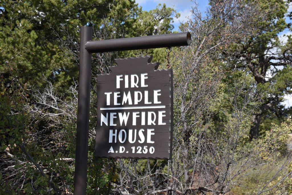
According to the Cultural Preservation site Cy Ark:

“While archaeological evidence points to the construction and primary use of Fire Temple as being late in the chronology of Mesa Verde (1200 CE – 1300 CE), its religious significance likely has far deeper roots in the belief systems of Puebloan peoples.”

“Both Fire Temple and the nearby Sun Temple were linked with sun-fire-serpent worship in the service of fertility and agricultural productivity, as practiced by the inhabitants of Mesa Verde.  Evidence indicates that the inhabitants of nearby New Fire House may have been the tenders of the ‘eternal flame’ of Fire Temple, whose large central fire pit was seemingly kept burning at all times for both religious and practical use.  Fire Temple fell into disuse and abandonment in the late 1200s, as did the surrounding communities at Mesa Verde.”
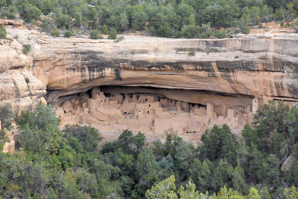
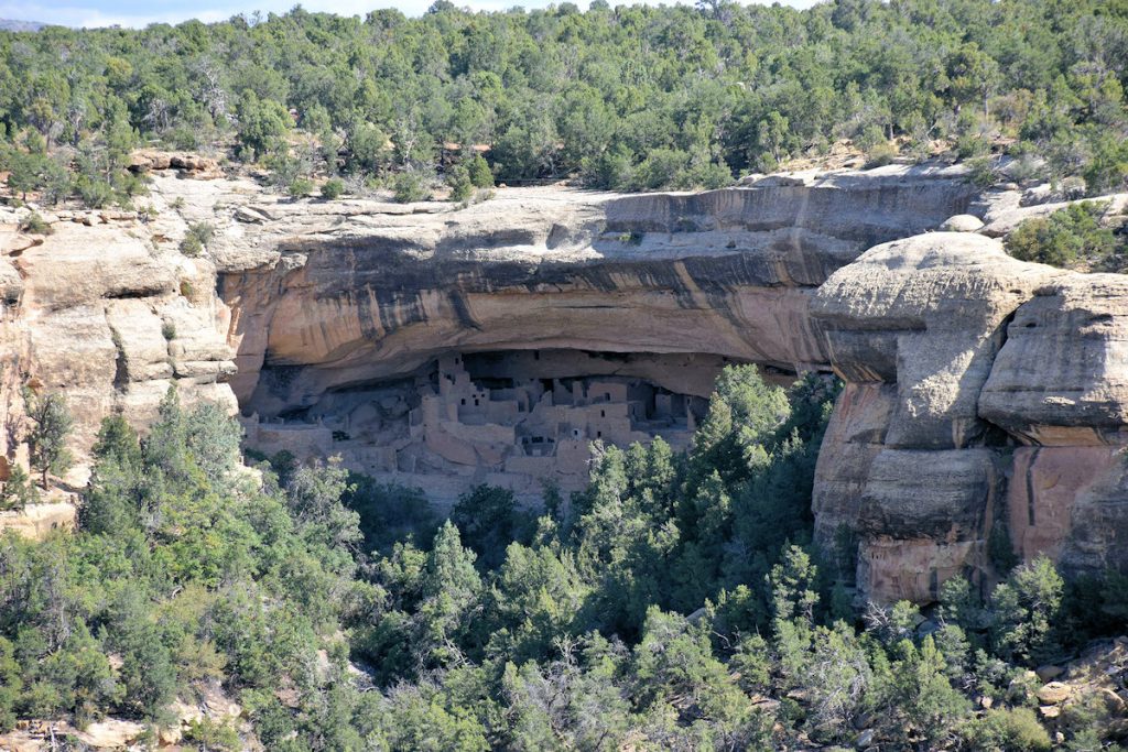
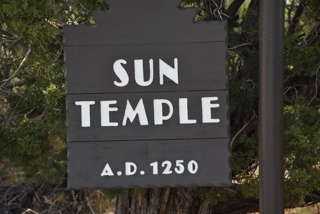
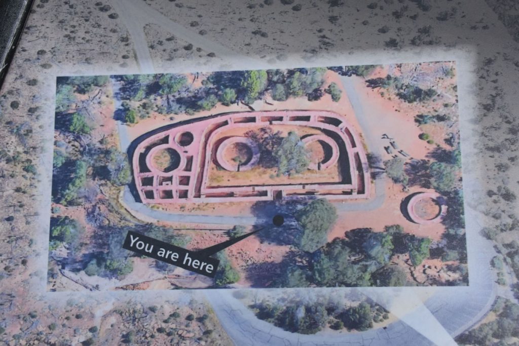
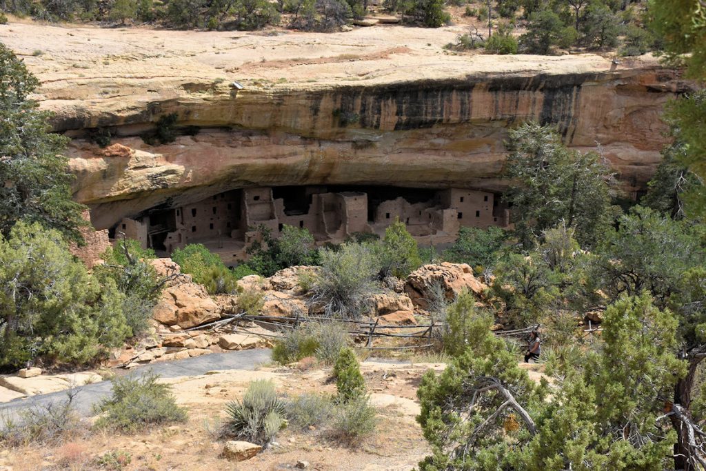
  

Fire Temple.
Just past the Fire Temple, there was an opening in the trees.  We are getting closer to the Cliff Palace.

SUN TEMPLE

As we rounded the next corner, the Sun Temple stop serves two purposes – Sun Temple and a
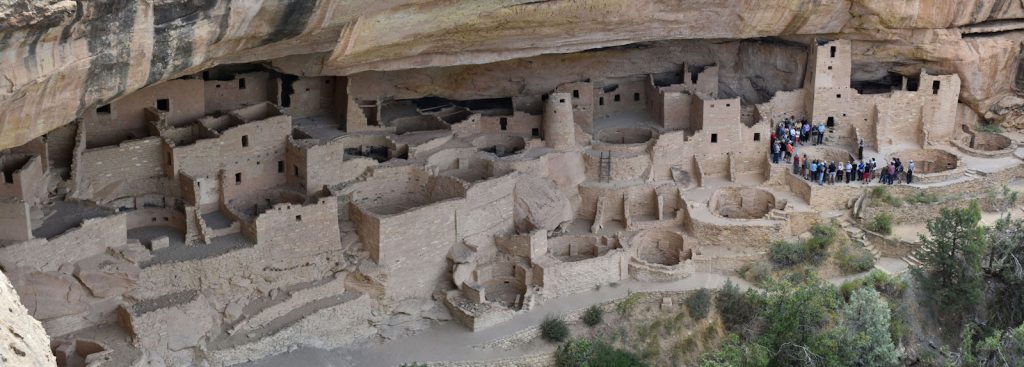
great close-up view of Cliff Palace.  In fact, it’s the closest you can get to Cliff Palace without paying and taking a tour.
Before we walk down to the overlook, we check out the Fire Temple.
Only part of it remains today.
I love these “You Are Here” signs! 
Here is what remains of the Sun Temple today. 
Restoration and research work is in progress. 
After looking around the Sun Temple, we walked down to the overlook.
From the overlook, looking back down the canyon with Sun Point View overlook visible to the right.
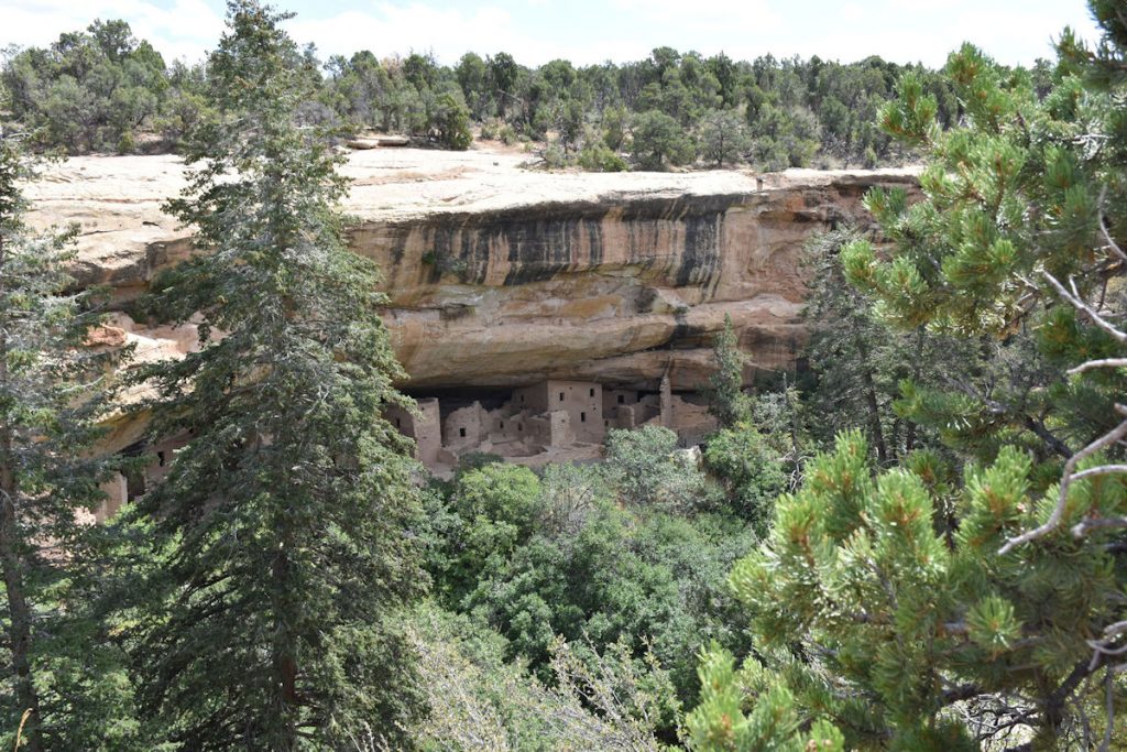
(Remember – we were there just a few minutes ago)
From the overlook, there was a great view of the Cliff Palace dwellings.
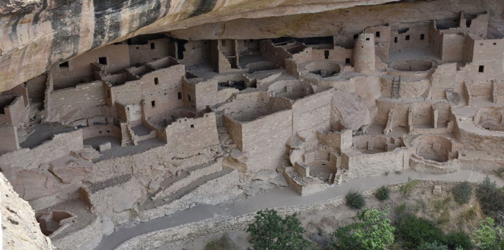
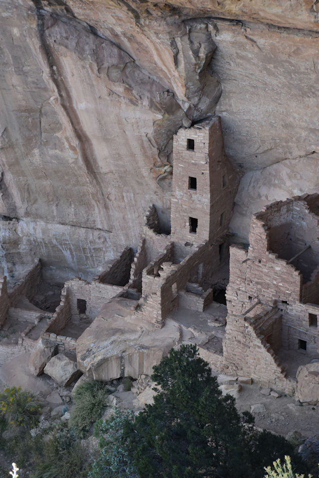
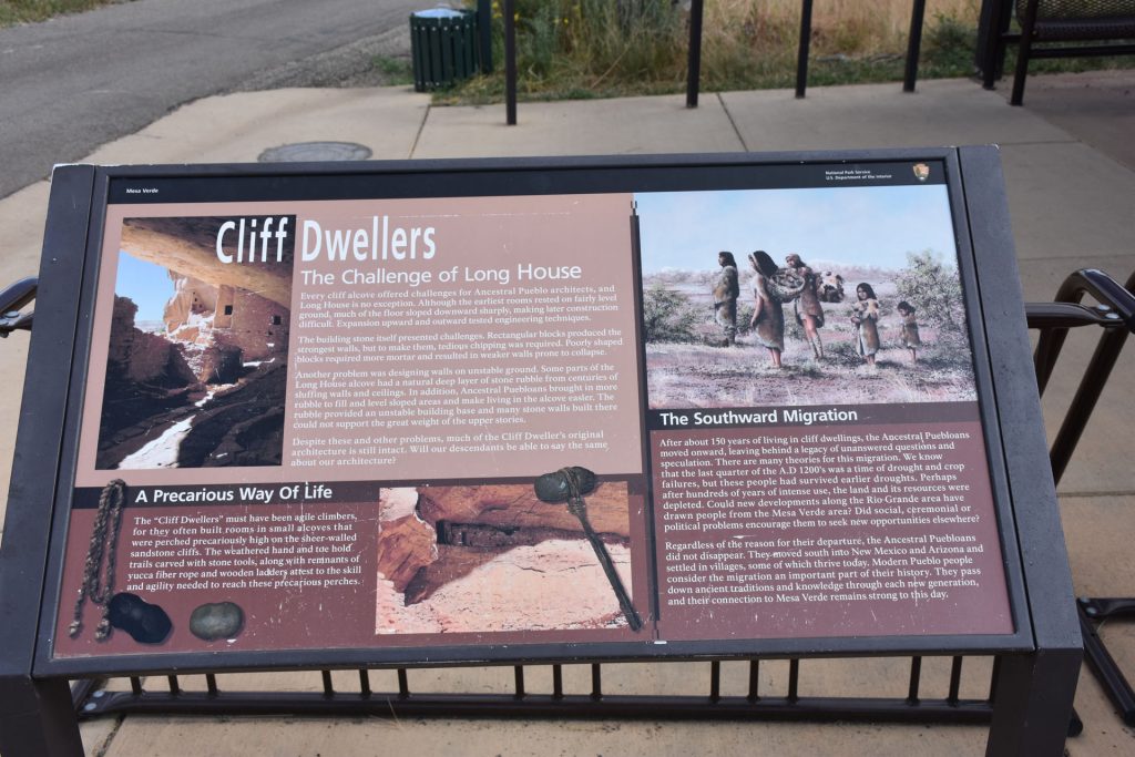
These are perhaps the most-recognized dwellings in the park.
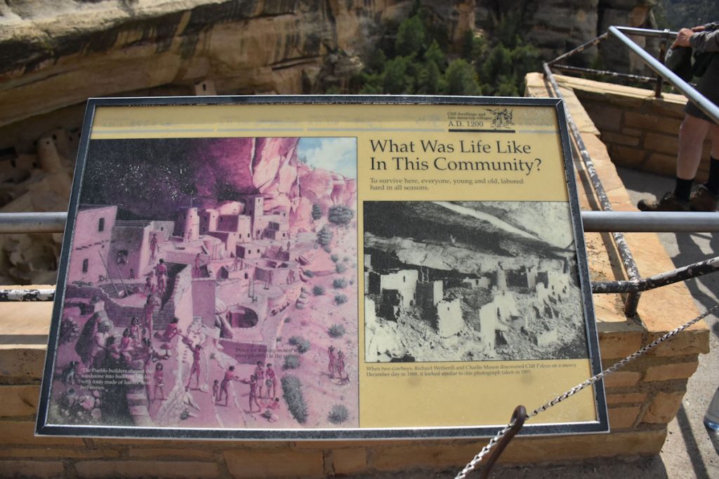
This sign describes the hard work the early residents endured.
 
Some quick facts: 
— The alcove is about 215 feet wide by 90 feet deep by 60 feet high
— It included about 150 rooms, 75 open areas, and 21 kivas
— Construction occurred from AD 1190 through 1280
—  It was inhabited by 100-120 people
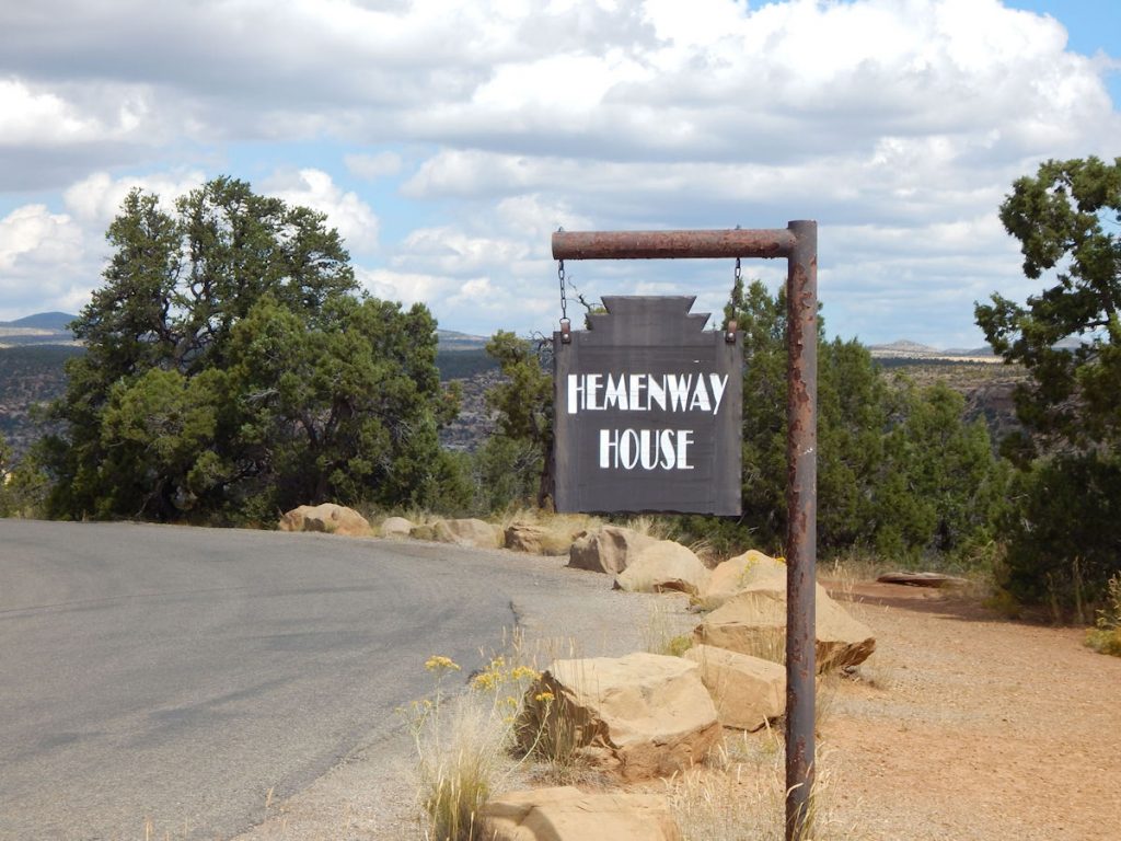
This photo shows a tour group and gives it perspective.
Here is a close-up of the middle section of Cliff Palace.

Hemenway House


OK, I had to look twice because I thought it say Hemingway House.

Named for Mary Tileston Hemenway, who funded the first scientific archeological expedition in the Southwest.
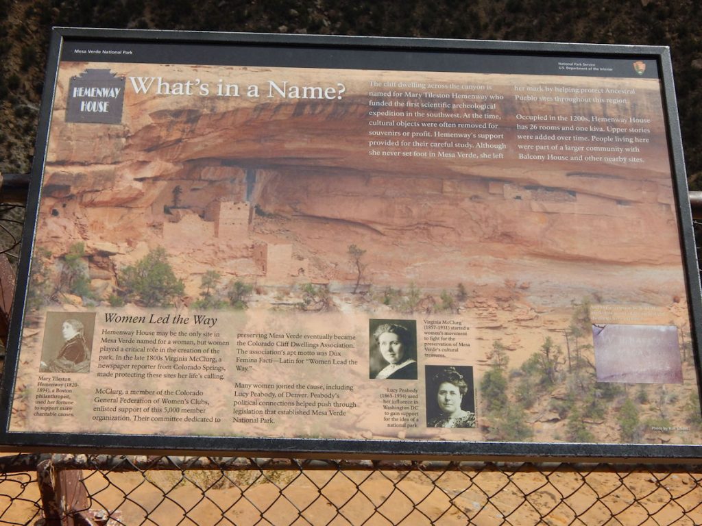
Her support allowed cultural objects to be studied and preserved.
Although she never set foot in Mesa Verde, she helped protect sites throughout this region.
See the Hemenway House?  Don’t feel bad – you need binoculars or a zoom lens.

SPRUCE TREE HOUSE AND MUSEUM

Our next stop was Spruce Tree House and Museum.
The path down to the dwellings was closed due to a rockslide.
Another view of Spruce Tree House.
In the museum, there were several exhibits of life in the cliffside dwellings.
Another depiction of daily life.
This display explains how corn was an important part of their lives.  When this area was first excavated in the early 1900s, archeologists found thousands of small corn cobs, dried squash stems and seeds, and caches of dried corn kernels and dried beans.  They were successful farmers!
 
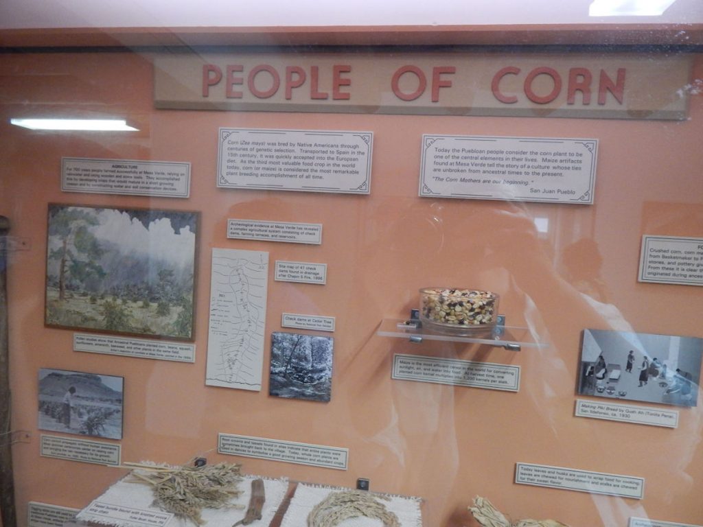
Corn was originally bred by Native Americans through centuries of genetic selection.
It was transported to Spain in the 15th Century, and quickly accepted into European diet.
 
(Side note:  When I was in Germany from 2000-2003, a German friend (Hans, who spoke no English) once referred
to corn as “Schwein Essen” — Pig Food!  Apparently not all Germans have accepted corn into their diet.)
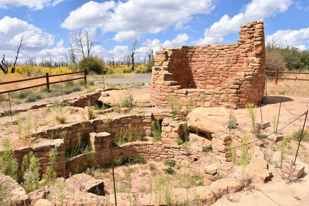
CEDAR TREE TOWER

Just one of several towers found around the area.
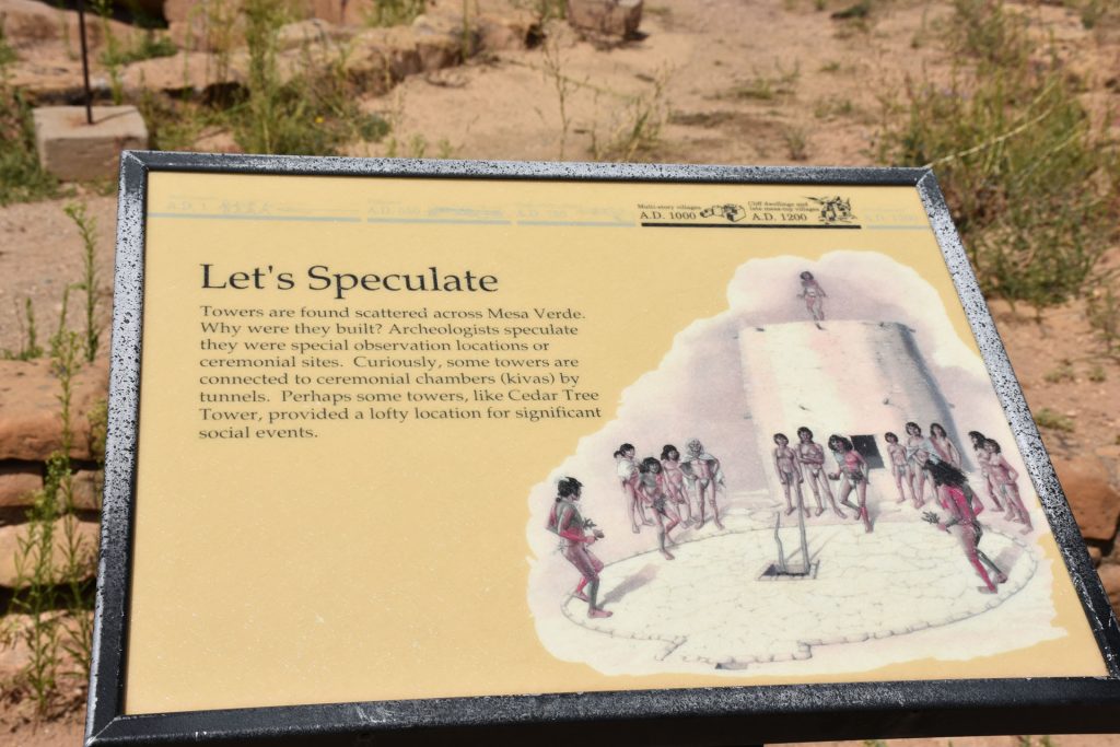
It is still not known for certain what their purpose was.
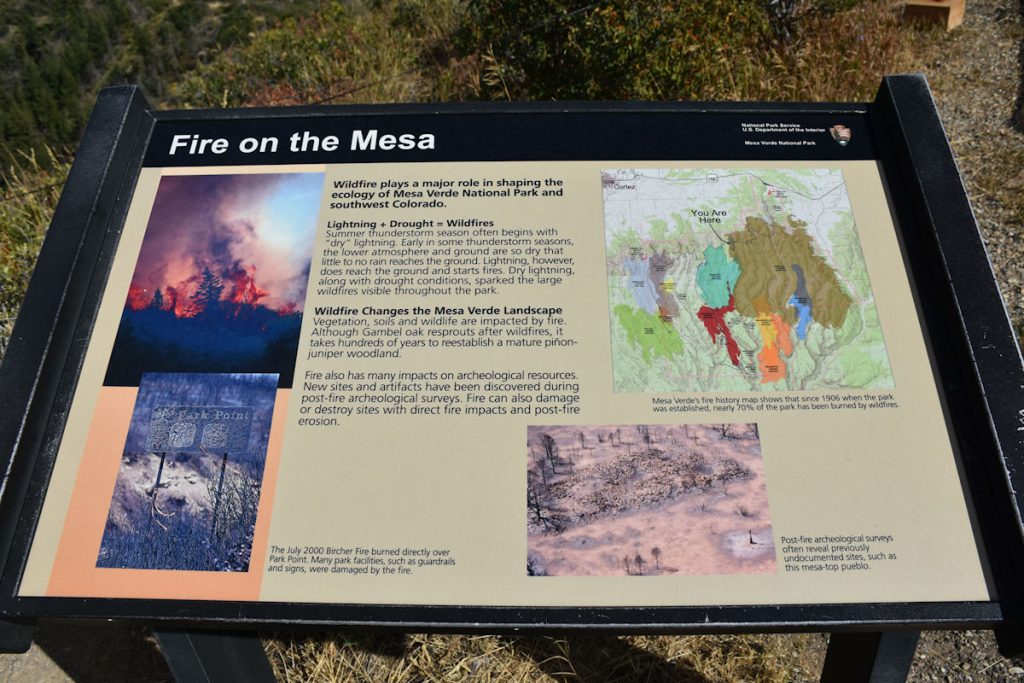
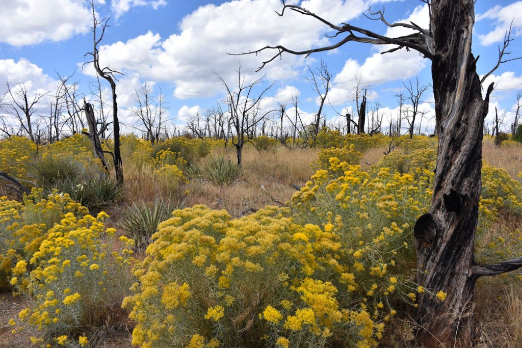
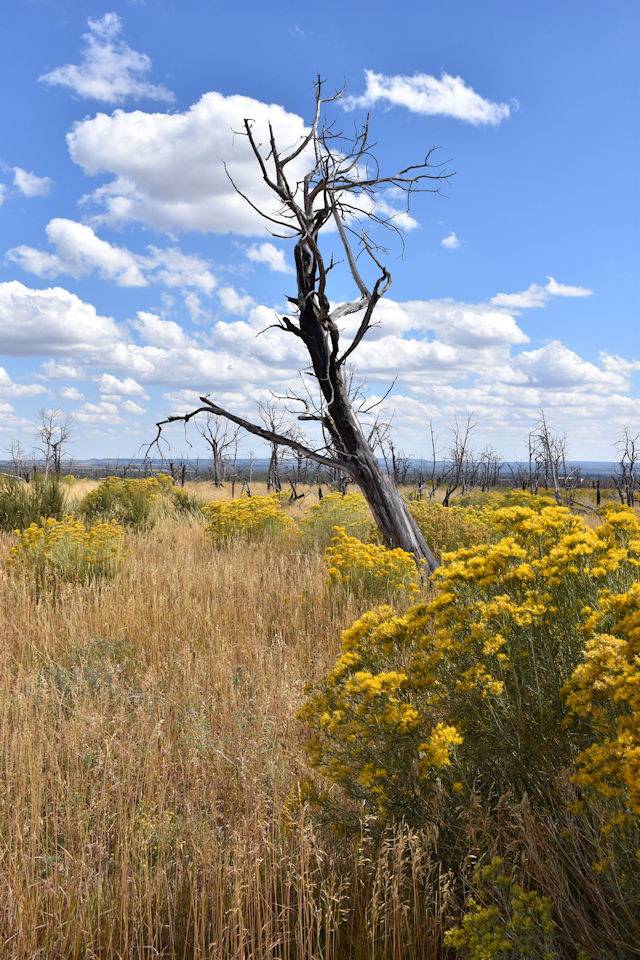
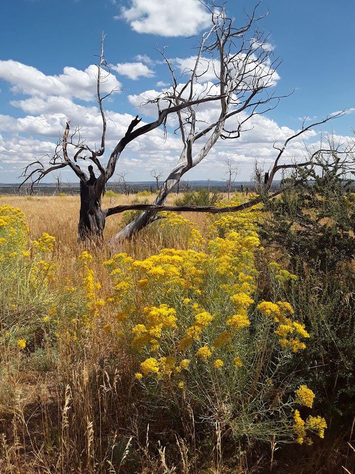
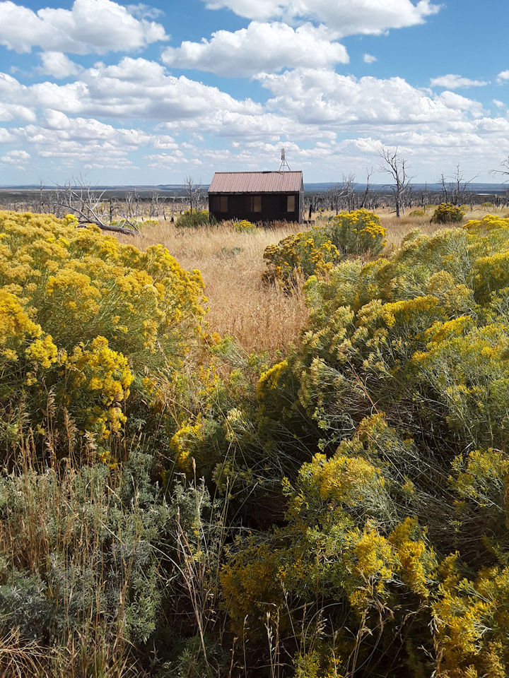
Cedar Tree Tower.
Cedar Tree Tower.
Wildflowers growing near the Cedar Tree Tower.

FOREST FIRES

As we drove around the park, there were several areas where there was

evidence of large fires similar to what we saw in Alaska when we lived there.  

Although burned tree trunks remain, new life is sprouting up from the forest floor.

This roadside sign explains much about the fires.
This scene of an earlier fire is slowly coming back to life.
My idea of a retirement home.  Beth did not agree.  Oh well.

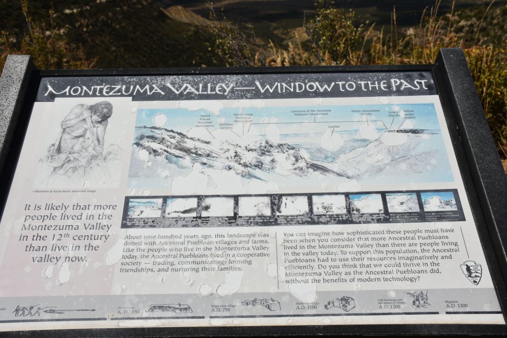
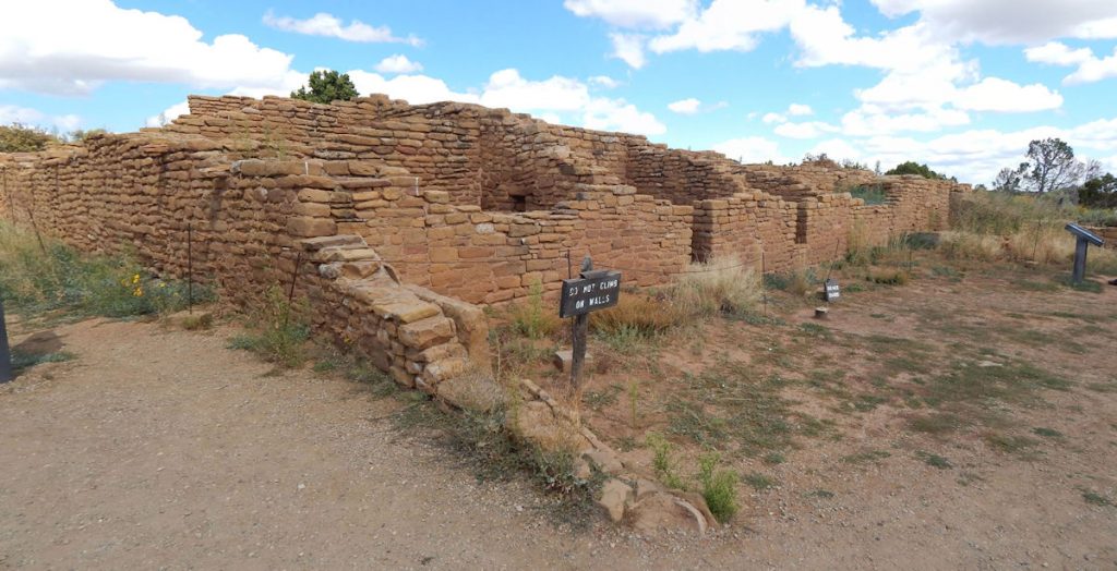
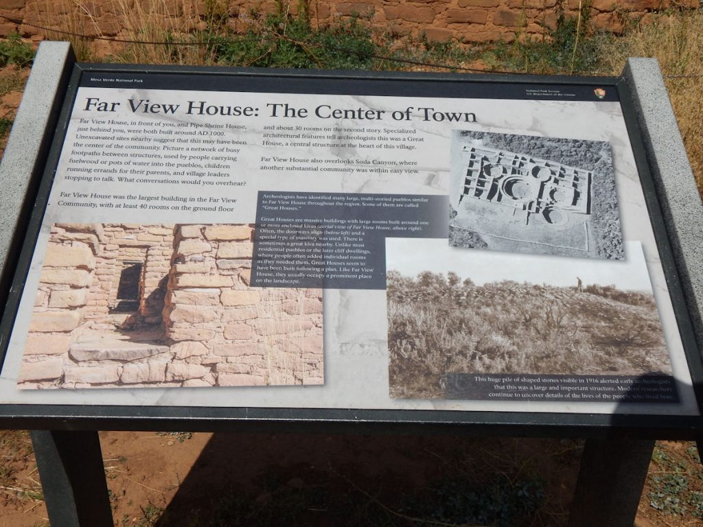
Nearing the center of the park – Far View Area.

This roadside sign tells about the early people living here.

Before the Puebloans moved over to cliff dwellings, they lived and farmed the Mesa Verde plateau.
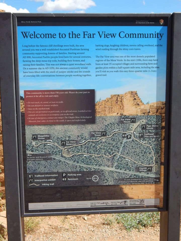
This area was one of the most densely populated areas around.
Far View House – a “Community Center”
Information on the Far View House.
Walking down to the adjacent Pipe Shrine House.
This sign explains the Pipe Shrine House.
The Pipe Shrine House today.
Some of the rocks were intricately decorated.
Portals to the past. 

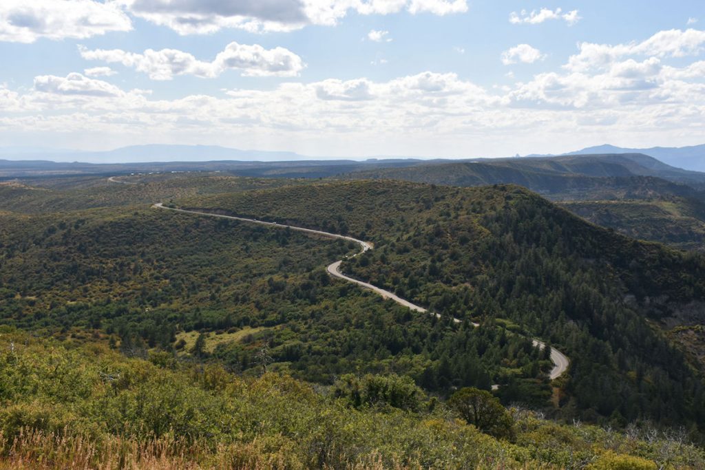
After lunch, we drove down the west side of the park on Wetherill Mesa.
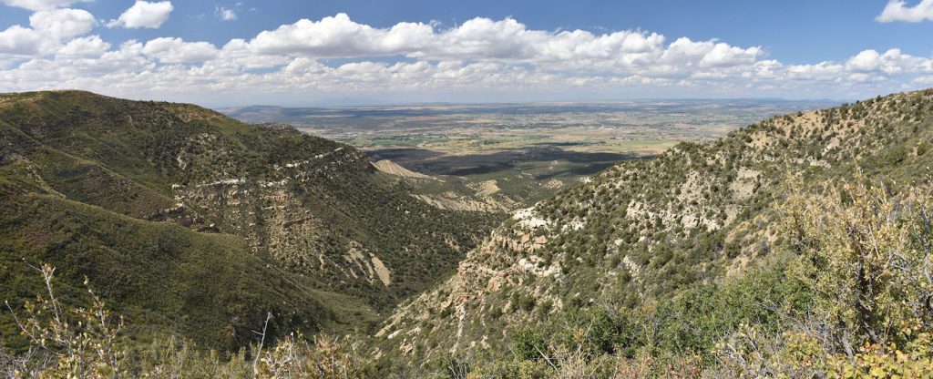
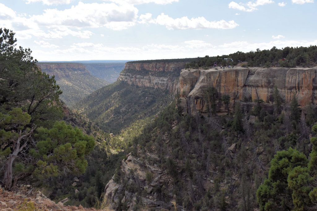
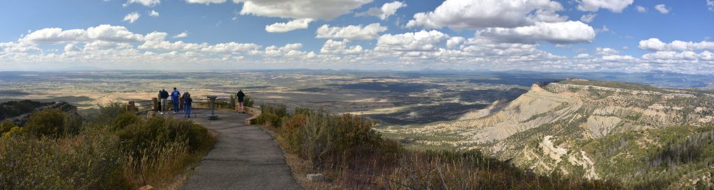
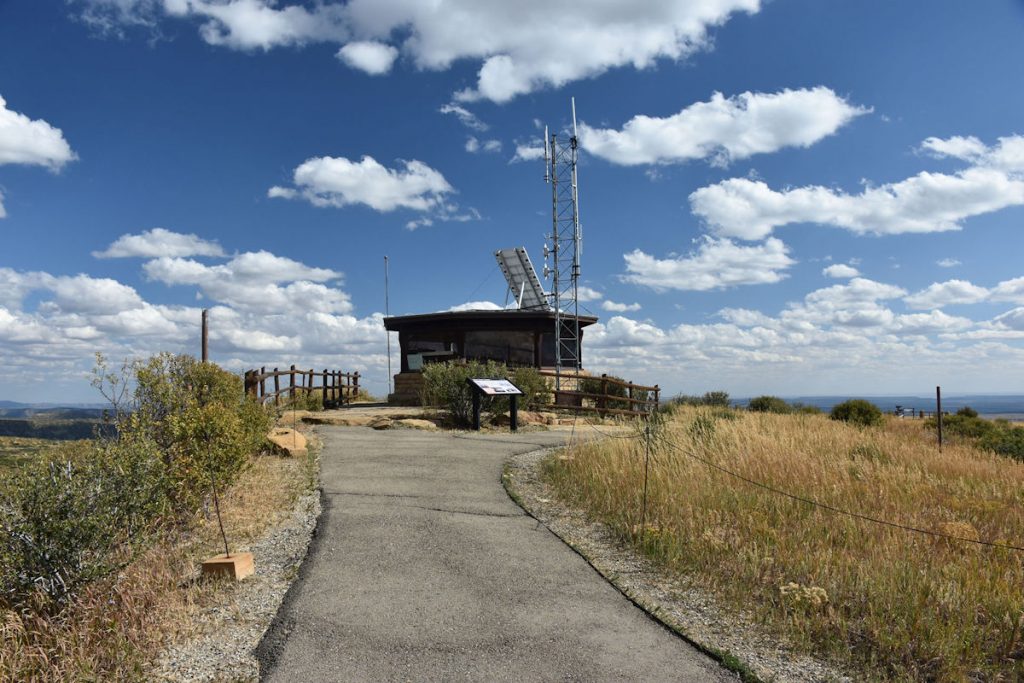
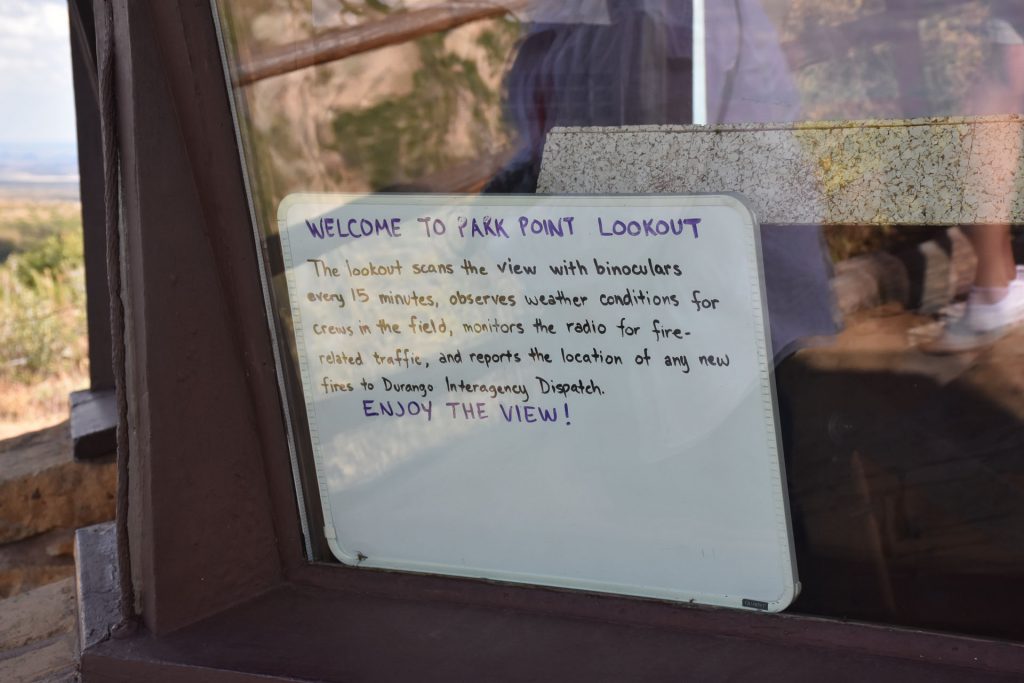
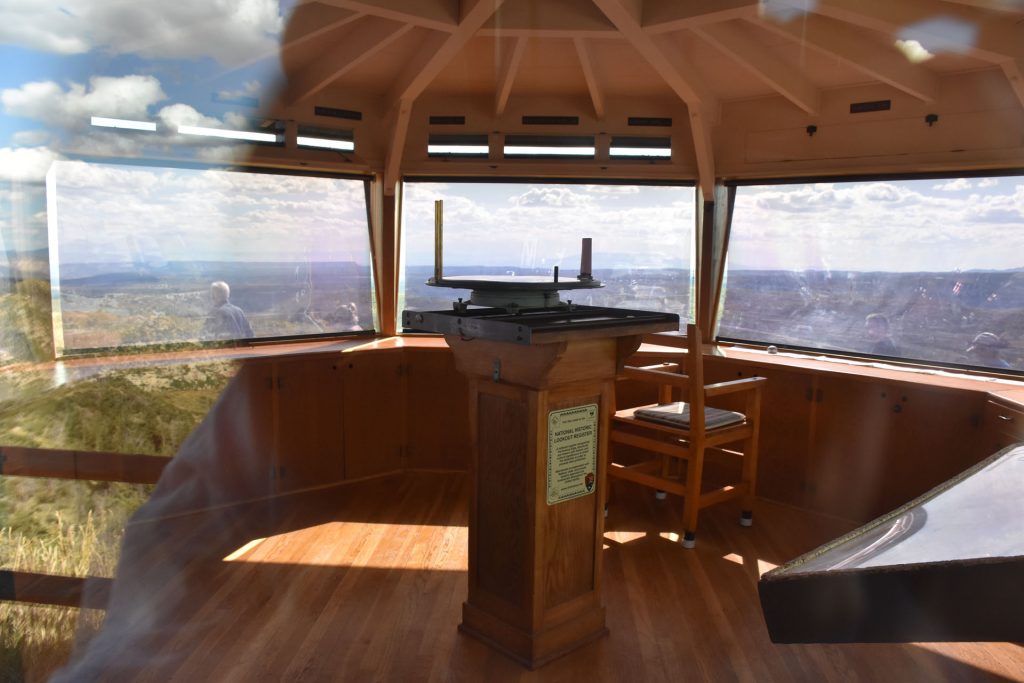
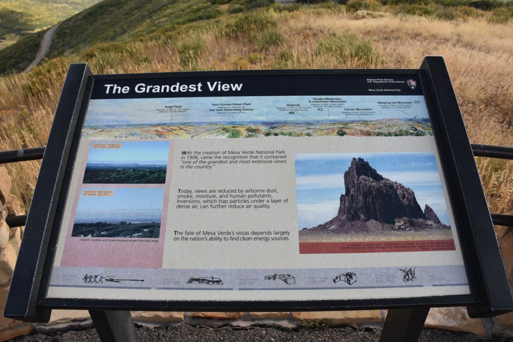
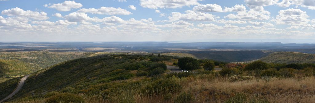
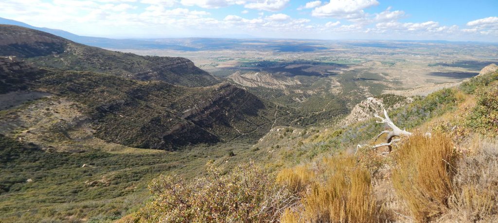
View from Wetherill Mesa to the west, toward Cortez.
At the end of the road were two informative signs.  Sign #1
Sign #2

PARK POINT OVERLOOK

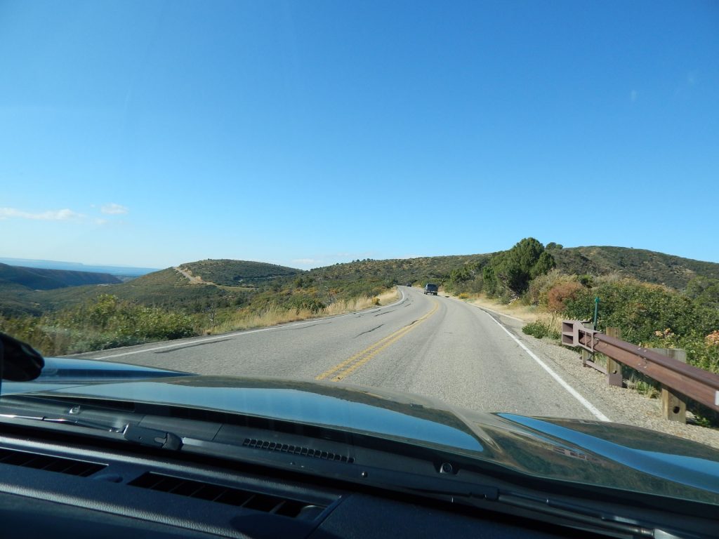
Since we had reached the end of the road, it was time to head back to the entrance. 

But first, we want to stop at the Park Point Overlook, the highest point in the park.

We drove by earlier, but wanted to save it for when we were leaving.

Elevation 8,572 feet – our high point for the trip!  (for now)
View west from the Park Point Overlook.  On a clear day, you can see well over 100 miles.
This is the view of Mesa Verde National Park looking south.
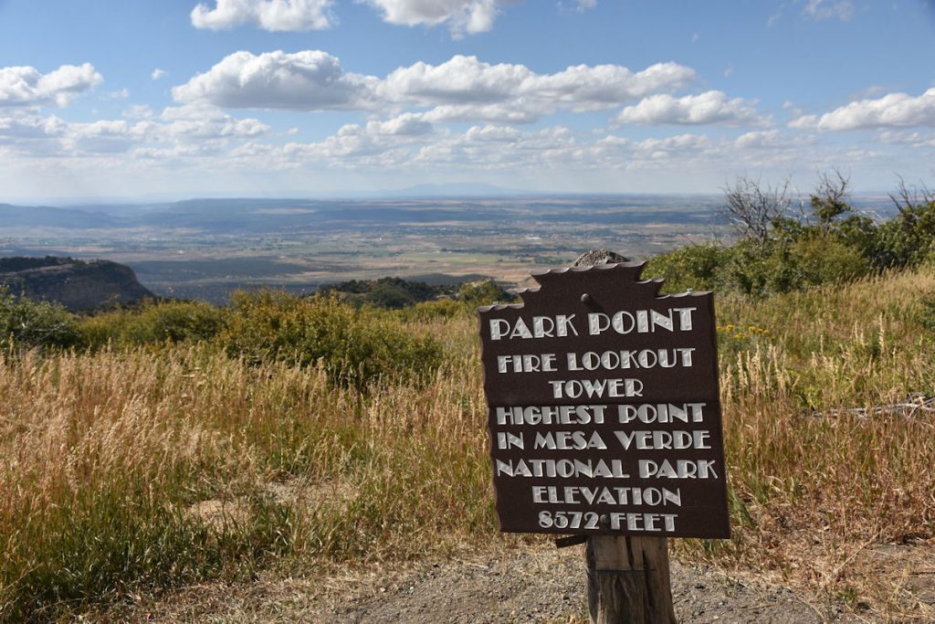
The cliff dwellings are about 10-12 miles straight ahead. 
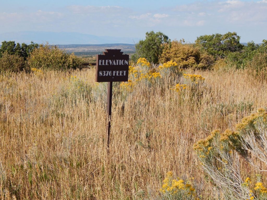
This relatively flat area is still over 8,000 feet elevation. 
This highest point in the park is also the best place for the fire lookout building.
Sign in the fire lookout building.
Peek inside the fire lookout building.  Nobody here at the moment. 
Sign describing the view to the southeast.
View toward the southeast as shown in previous photo.

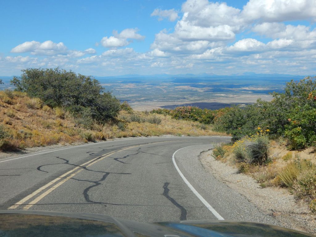
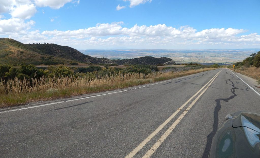
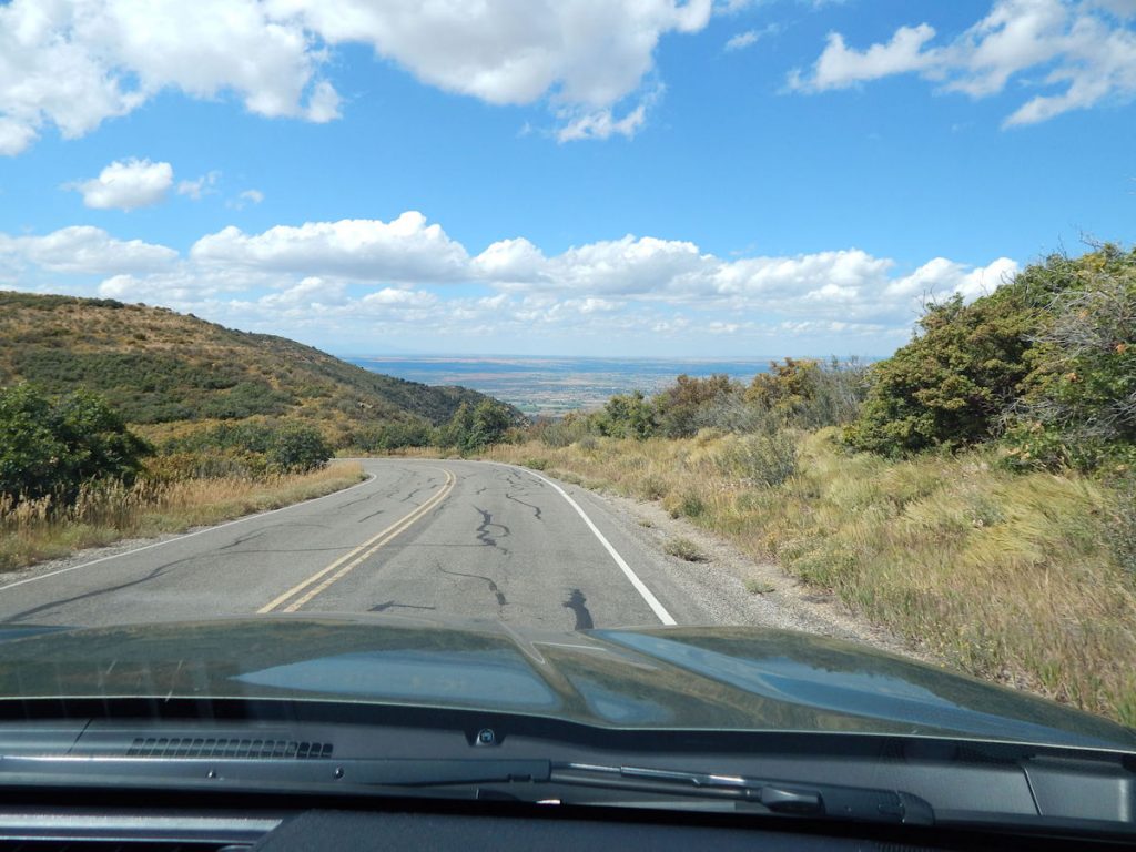
TIME TO HEAD BACK TO THE HOTEL

It’s been a great day exploring Mesa Verde National Park, but we’re tired and ready to call it a day.

Descending from Mesa Verde (Elevation 8,500 feet) to the entrance (Elevation 6,000 feet)
It’s a long way down.
View north down toward the entrance.
Still descending.


Getting closer to the entrance.
That’s all for today.

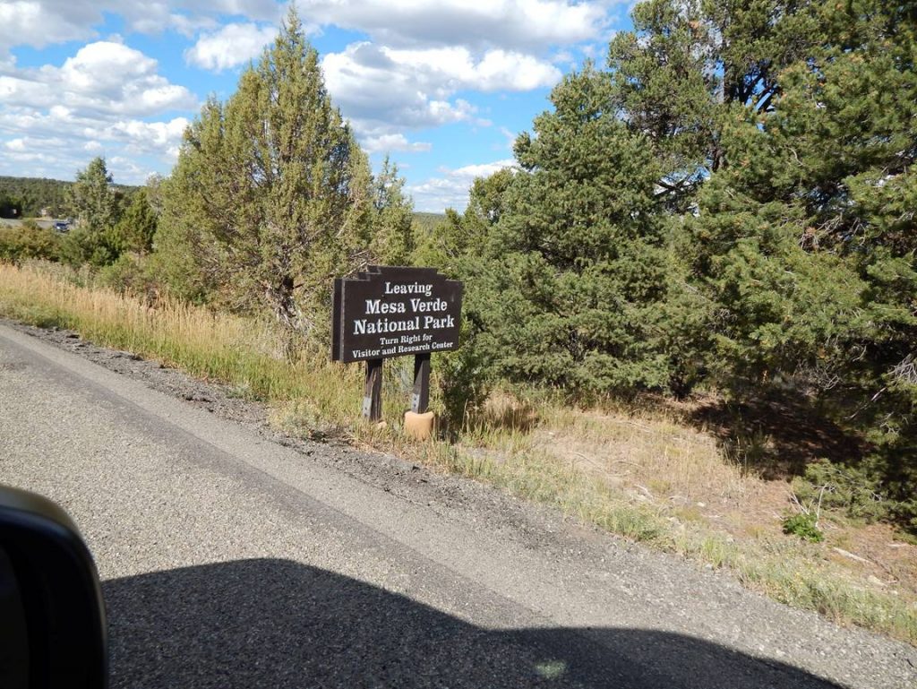
Learn more about Mesa Verde National Park:    https://en.wikipedia.org/wiki/Mesa_Verde_National_Park  

On the way back to the hotel, we stopped at this Mexican restaurant for supper.
We beat the supper crowd by an hour.
Dinner is served. 

We returned to the hotel and relaxed watching TV until bedtime.

Tomorrow, we return to Utah (for the 4th or 5th time this week!) to go to Arches NP.

Hope you will join us!

Mileage Today:  101 Miles

Trip Total:   4,132 Miles

PROCEED TO DAY 19 – MESA VERDE NP TO ARCHES NP, UTAH AND GRAND JUNCTION, COLORADO

RETURN TO SOUTHWEST MASTER INDEX